Cibao Valley
The Cibao Valley is a vital agricultural and economic hub in the northern Dominican Republic. As the country’s most densely settled region, it is divided…
How does the Cibao Valley contribute to the Dominican Republic’s agriculture and economy?
The Cibao Valley is a vital agricultural and economic hub in the northern Dominican Republic. As the country’s most densely settled region, it is divided into two distinct climatic zones that support diverse crop production.1
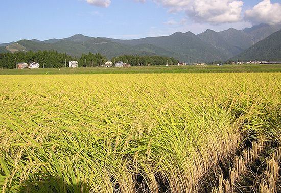
In the drier western section, irrigation supports the cultivation of rice, bananas, and wheat. The eastern region, known as the fertile La Vega Real, produces coffee, tobacco, cacao, corn, and rice. These agricultural interests are significant to the national economy, particularly through the port of Puerto Plata, which maintains commercial importance largely due to the export of tobacco, coffee, and cacao from the region.12
Beyond its agricultural output, the valley is noted for its relative prosperity compared to other rural areas, reflected in the solid construction of its homes. Transportation infrastructure, including highways and a government-owned freight railroad, connects the valley to market centers, facilitating the movement of goods.32
What are the notable geographical features of the Cibao Valley, such as rivers or mountains?
The Cibao Valley is a prominent geographical feature in the northern Dominican Republic, extending approximately 145 miles (235 km) from Manzanillo Bay in the west to Samaná Bay in the east.15
Mountain Ranges
The valley is defined by two major mountain systems that serve as its northern and southern boundaries:
- Cordillera Septentrional: This range forms the northern boundary of the valley.16
- Cordillera Central: Located to the south, this is the island’s most rugged and imposing mountain range, featuring Duarte Peak, the highest point in the Caribbean.15
River Systems
The valley’s fertile landscape is sustained by two primary river systems:
- Yaque del Norte River: As the country’s largest river, it flows generally northwestward through the western portion of the valley before emptying into Manzanillo Bay.65
- Yuna River: This river, along with the Camú-Yuna system, waters the eastern portion of the valley, known as the fertile La Vega Real region.15
How does the climate of the Cibao Valley affect its agricultural productivity?
The Cibao Valley features two distinct climatic zones that dictate its agricultural productivity.1
- The Western Section: This area is characterized by a drier climate and savanna vegetation. Because of these arid conditions, agricultural success relies heavily on modern irrigation systems. With this water management, the region is able to produce rice, bananas, and wheat.1
- The Eastern Section (La Vega Real): This region is significantly more humid and fertile, a quality noted since the time of Christopher Columbus. The abundant moisture provided by the Yuna River supports a diverse range of crops, including coffee, tobacco, cacao, corn, and rice.1
By leveraging these varying climatic conditions, the valley serves as the most densely settled and agriculturally productive region in the Dominican Republic.1
What is the geographical location and extent of the Cibao Valley in the Dominican Republic?
The Cibao Valley is a major valley located in the northern region of the Dominican Republic. It spans approximately 145 miles (235 km) in length, stretching from Manzanillo Bay in the west to Samaná Bay in the east.1
The valley is geographically defined by two significant mountain ranges: the Cordillera Central to the south and the Cordillera Septentrional to the north. Due to its fertile soil and favorable conditions, it remains the most densely populated area in the country.1
Sources
- Cibao Valley — Encyclopædia Britannica
- Dominican Republic - Transportation — Encyclopædia Britannica
- Dominican Republic - Agriculture, fisheries, and forestry — Encyclopædia Britannica
- Dominican Republic - Daily life — Encyclopædia Britannica
- Yaque del Norte River — Encyclopædia Britannica
- Dominican Republic - Relief, drainage, and soils — Encyclopædia Britannica
Published on · 3 min read