Albany River
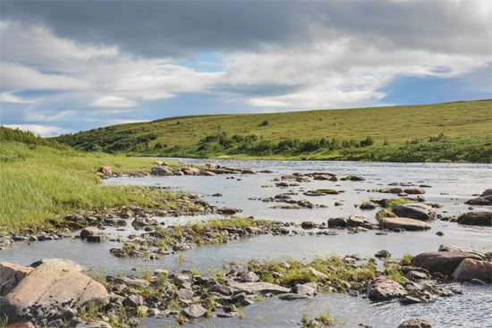
The Albany River is a river located in north-central Ontario, Canada. It originates in Lake St. Joseph at an elevation of 1,218 feet (371 meters) and flows…
What is Albany River?
The Albany River is a river located in north-central Ontario, Canada. It originates in Lake St. Joseph at an elevation of 1,218 feet (371 meters) and flows eastward into James Bay.1
Spanning a course of 610 miles (982 km), the river is navigable for 250 miles (400 km). Historically, it served as a vital transportation route during the fur-trading era, connecting inland regions to the Hudson’s Bay Company post at Ft. Albany, which was established at the river’s mouth in 1684.1
The river’s largest tributary is the 200-mile-long Kenogami River. Additionally, the flow of the Ogoki River—formerly a tributary—has been diverted into Lake Nipigon to support hydroelectric power generation.1
What was the role of the Hudson’s Bay Company in the fur trade?
Incorporated in 1670, the Hudson’s Bay Company played a central role in the North American fur trade for over two centuries. Granted a monopoly over Rupert’s Land, the company initially established trading posts along the shores of Hudson and James bays.34
Following the British conquest of Canada, the company faced intense competition, particularly from the North West Company, which utilized overland routes and deep relationships with Indigenous peoples and the Métis to dominate inland trade. This rivalry led to decades of conflict, including the Seven Oaks Massacre, until the British government mandated a merger of the two firms in 1821.345
Operating under the Hudson’s Bay Company name, the unified entity held exclusive trading licenses across vast territories, including the Northwest Territories and the Oregon Country. By the mid-19th century, its monopoly waned as independent traders increased, and in 1870, the company sold its remaining territories to the Canadian government. It remained a major fur-marketing agency until exiting the trade in 1991.3
How does the geography of James Bay influence the surrounding region?
The geography of James Bay profoundly shapes the surrounding region through its physical characteristics, climate, and resource potential. As a shallow southern extension of Hudson Bay, the bay is less than 200 feet deep, and its low salinity is maintained by the numerous rivers that flow into it, including the Albany, Moose, and Rupert.6
The surrounding landscape is dominated by the Hudson Bay Lowland, a vast wetland area characterized by permafrost, peat plateaus, and muskeg. This marsh-ridden terrain is a direct result of the region’s geological history, where retreating glaciers left behind marine sediments and sedimentary basins.78
The region’s geography also drives significant economic and human activity:
- Hydroelectric Development: The abundance of water and river systems has enabled massive projects, such as the James Bay Hydroelectric project, which harnesses the region’s water resources to produce electricity for export.9
- Settlement and Trade: The bay’s forested shores have historically supported trading posts and communities, such as Moose Factory, which served as vital hubs for the fur trade.78
- Climate and Ecology: The severe continental climate, marked by long, cold winters and short summers, supports unique ecosystems, including coniferous forests and habitats for diverse wildlife like seals, polar bears, and migratory birds.8
What is the environmental impact of diverting river water for hydroelectric power?
Diverting river water for hydroelectric power generation involves significant environmental trade-offs. While hydropower is a renewable energy source that avoids thermal pollution, the construction of dams and reservoirs fundamentally alters riverine ecosystems13.10
Ecological and Physical Impacts
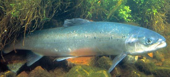
- Habitat Disruption: Dams act as physical barriers that block the migration of spawning fish, such as salmon. While fish passes like ladders and locks are sometimes used to mitigate these effects, they are not always successful in preventing population declines.1112
- Sedimentation and Erosion: Reservoirs trap sediment that would otherwise flow downstream, which can reduce the reservoir’s capacity over time. Conversely, the water released from dams often lacks its natural sediment load, giving it renewed erosive power that can damage downstream stream channels.1314
- Landscape and Biodiversity Loss: Large-scale projects can inundate vast areas, destroying ecosystems, flooding bird breeding grounds, and submerging cultural or natural treasures. Additionally, the decomposition of vegetation submerged in reservoirs can release methane, a greenhouse gas.15141312
Social and Human Impacts
Large-scale hydroelectric projects frequently require the displacement of human communities, sometimes involving millions of people, as seen with the Three Gorges Dam. These projects often spark intense debate between the need for renewable energy and the preservation of natural and cultural heritage.151312
Sources
- Albany River — Encyclopædia Britannica
- Albany — Encyclopædia Britannica
- Hudson’s Bay Company — Encyclopædia Britannica
- North West Company — Encyclopædia Britannica
- Manitoba - The fur trade era — Encyclopædia Britannica
- Hudson Bay Lowland — Encyclopædia Britannica
- James Bay — Encyclopædia Britannica
- Hudson Bay — Encyclopædia Britannica
- Quebec - Resources and power — Encyclopædia Britannica
- dam - Rise of environmental and economic concerns — Encyclopædia Britannica
- dam - Fish passes — Encyclopædia Britannica
- river - Environments of deposition — Encyclopædia Britannica
- hydroelectric power — Encyclopædia Britannica
- lake - The water budget — Encyclopædia Britannica
- river - Effects of climatic change — Encyclopædia Britannica
- Did you know? — Merriam-Webster
- reservoir — Encyclopædia Britannica
Published on · 3 min read