Allier River
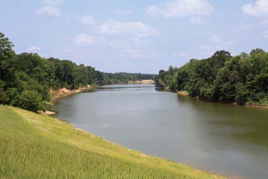
The Allier River is a river located in central France that flows for 255 miles (410 km) before joining the Loire River west of Nevers.
What is Allier River?
The Allier River is a river located in central France that flows for 255 miles (410 km) before joining the Loire River west of Nevers.1
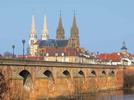
Rising in the Lozère département, the river carves through deep gorges between the Margeride and Velay mountains. As it continues its course, it traverses the basins of Langeac and Brioude, receives water from the mountains of Dore and Puy-de-Dôme, and flows across the agricultural region of Grande Limagne, north of Clermont-Ferrand. The river is joined by the Sioule above Moulins, which is the second-largest town situated along its banks. The Allier’s total drainage basin encompasses 5,573 square miles (14,434 square km).1
How does the Loire River compare to the Allier River?
The Loire River and the Allier River are distinct in scale and role within the French river system. The Loire is the longest river in France, stretching 634 miles (1,020 km), whereas the Allier serves as its major tributary, spanning 255 miles (410 km) before joining the Loire near Nevers.12
Feature
Loire River
Allier River
Length
634 miles (1,020 km)
255 miles (410 km)
Drainage Basin
~45,000 sq miles (117,000 sq km)
5,573 sq miles (14,434 sq km)
Primary Role
Main artery to the
Atlantic Ocean
Major tributary of the Loire
While both rivers originate in the Massif Central, the Loire follows a long, complex path through the Paris Basin to the sea, while the Allier is characterized by its course through deep gorges and agricultural basins before feeding into the larger Loire stream.123
What are the main characteristics of the Massif Central region?
The Massif Central is a vast upland region in south-central France that covers approximately 33,000 square miles (86,000 square km), accounting for about one-sixth of the country’s total area.45
Geological and Physical Features
The region is primarily composed of crystalline rocks like granite, gneiss, and schist, dating back to the Hercynian orogeny. Its landscape was significantly shaped by later Alpine mountain-building movements, which caused uplifting, tilting, and intense volcanic activity. This history resulted in:45
- Volcanic Landscapes: The region features numerous volcanic cones and plateaus, including the Chaîne des Puys and the massifs of Cantal and Monts Dore, where Sancy Hill reaches the highest elevation of 6,184 feet (1,885 meters).45
- Diverse Terrain: The area includes the Causses, a permeable limestone region characterized by deep, dramatic river gorges, and various plateaus dissected by glacial valleys.45
Economy and Demographics
The Massif Central maintains a strong rural character, though it faces demographic challenges such as an aging population and the closure of local services.4
- Agriculture: The economy is heavily rooted in cattle rearing for meat and dairy, as well as the production of distinctive regional cheeses like Cantal, Bleu Saint-Nectaire, and Roquefort.4
- Industry and Services: While historical coal mining and metallurgy have declined, the region now hosts diverse small-to-medium industries and a growing service sector centered in cities like Clermont-Ferrand, Saint-Étienne, and Limoges.4
- Tourism: The region is a popular destination, featuring national and regional parks, as well as mineral springs in towns like Vichy.45
How do rivers shape the landscape through erosion?
Rivers are the most significant agents in molding the Earth’s surface, transforming geologic settings into distinct topographic forms through the continuous interaction of flowing water and sediment. This process, known as fluvial erosion, involves several key mechanisms:78
- Scouring and Abrasion: Moving water scours riverbanks, particularly during floods. The sediment entrained by the river acts as a tool for erosion; as these particles are dragged along the riverbed or suspended in the flow, they abrade the bedrock and each other, progressively deepening and widening the channel.89
- Vertical Entrenchment: In the early stages of valley development, rivers expend most of their energy in vertical downcutting, creating narrow, deep valleys or canyons. As the river smooths its longitudinal profile and approaches its baselevel, it shifts from vertical incision to lateral erosion, which broadens the valley floor.10
- Energy and Slope: The power of a river to erode and transport material is governed by its velocity, which is influenced by the channel’s slope and roughness. A river’s longitudinal profile typically assumes a concave upward shape, as it must decrease its slope downstream to maintain a balance of energy as its discharge increases.911
Ultimately, the resulting landforms reflect a balance between the river’s energy, the resistance of the underlying bedrock, and the time allowed for these processes to operate.710
Sources
- Allier River — Encyclopædia Britannica
- Loire River — Encyclopædia Britannica
- France - The Loire system — Encyclopædia Britannica
- Massif Central — Encyclopædia Britannica
- France - Drainage of France — Encyclopædia Britannica
- France - The Massif Central — Encyclopædia Britannica
- river - Rivers as agents of landscape evolution — Encyclopædia Britannica
- fluvial process — Encyclopædia Britannica
- erosion — Encyclopædia Britannica
- river - Valley evolution — Encyclopædia Britannica
- river - Valleys and canyons — Encyclopædia Britannica
- valley - Valley longitudinal profiles — Encyclopædia Britannica
Published on · 4 min read