Almendares River
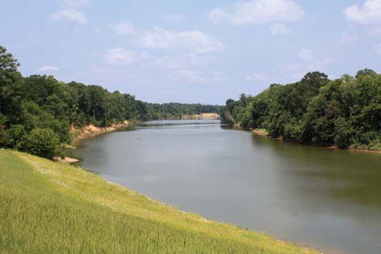
The Almendares River is a 29-mile (47-km) river located in western Cuba.
What is Almendares River?
The Almendares River is a 29-mile (47-km) river located in western Cuba.1
Rising at an elevation of approximately 740 feet (225 meters) in the Alturas de Bejucal, the river flows in a semicircular path to the north and west. It eventually crosses the Cuban coastal plain and passes through the city of Havana, where it serves as the boundary between the Vedado and Miramar neighborhoods before emptying into the Straits of Florida.1
Beyond its geographical significance, the river is a vital water supply source for Havana, and its banks host the popular Parque Almendares.1
What is the significance of Parque Almendares?
Parque Almendares is a significant green space located along the banks of the Almendares River in Havana, Cuba. It is a much-frequented destination that serves as a natural retreat within the urban landscape of the city.1
While Havana is historically noted for its numerous parks and plazas—which have long served as essential gathering places for residents—Parque Almendares is distinguished by its riverside setting. It provides a lush, forested environment that contrasts with the city’s dense architectural centers, such as Old Havana and the commercial districts of Vedado. By offering a space for recreation and leisure, the park contributes to the city’s tradition of utilizing green areas as vital social hubs for Habaneros.12
How does the river impact Havana’s water supply?
The Almendares River serves as a critical water supply source for the city of Havana, Cuba. As the river flows northward across the coastal plain and through the urban landscape, it provides a portion of the water necessary to sustain the city’s population and infrastructure.1
What are some other major rivers in Cuba?
Cuba’s river systems are generally characterized by their short length and limited flow. While there are nearly 600 rivers and streams across the island, the most significant ones are concentrated in the southeast, where precipitation is heaviest.3
The Cauto River is the country’s longest, stretching 230 miles (370 km) from the Sierra Maestra to the Golfo de Guacanayabo. Other notable rivers in the southeastern region include the Guantánamo, Sagua de Tánamo, Toa, and Mayarí.43
Rivers flowing southward in the western and central regions include:
- Sevilla
- Najasa
- Jatibonico del Sur
- Zaza
- Cuyaguateje
Northward-flowing rivers of note include the Saramaguacán, Caonao, Sagua la Grande, and La Palma.3
Sources
- Almendares River — Encyclopædia Britannica
- Havana - City layout — Encyclopædia Britannica
- Cauto River — Encyclopædia Britannica
- Cuba - Drainage — Encyclopædia Britannica
- Cuba - Resources and power — Encyclopædia Britannica
Published on · 2 min read