Alpenrhein River
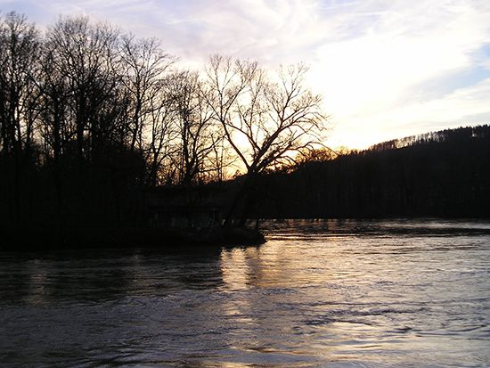
The Alpenrhein River (or Alpine Rhine) is a 63-mile (102-km) stretch of the Rhine River that extends from the confluence of the Vorderrhein and Hinterrhein…
What is Alpenrhein River?
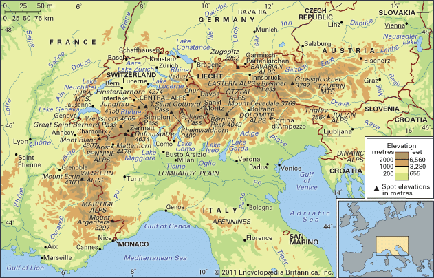
The Alpenrhein River (or Alpine Rhine) is a 63-mile (102-km) stretch of the Rhine River that extends from the confluence of the Vorderrhein and Hinterrhein rivers to its entry into Lake Constance.1
The river’s course is defined by its international borders:
- From Reichenau to Sargans, it flows entirely within Switzerland.1
- For the next 19 miles (30 km), it serves as the boundary between Switzerland and Liechtenstein.1
- The final section separates Switzerland from Austria.1
Characterized by a steep gradient and high runoff, the river exhibits a distinct Alpine hydrological regime, with water levels influenced by snowmelt and summer rains. In this flat-floored section, the river has been straightened and its banks reinforced to mitigate flooding. Its waters are notably thick with mud.231
How does Lake Constance influence the flow of the Rhine?
Lake Constance plays a significant role in regulating the hydrology of the Rhine River. Its primary influences on the river’s flow include:
- Flow Stabilization: The lake acts as a natural reservoir that evens out the variations in the river’s flow. By storing water, it helps moderate the extreme fluctuations characteristic of the Alpine Rhine, which is otherwise subject to significant seasonal changes due to snowmelt and heavy summer rains.4
- Filtration: In addition to its regulatory capacity, the lake functions as a filter for the river, which enters the lake in the southeast near Bregenz and exits via the Untersee arm in the west.24
- Hydrological Regime: While the lake helps smooth out the flow, the Rhine’s overall discharge remains influenced by its various tributaries. Downstream, the confluence with the Aare River—which carries a high volume of water—can increase flow variations again before they are further moderated by other upland tributaries.4
What are the main differences between the Alpine Rhine and the High Rhine?
The Alpine Rhine and the High Rhine (Hochrhein) represent distinct segments of the Rhine River, differing primarily in their geography, hydrology, and physical characteristics.
The Alpine Rhine
- Location: This section extends from the confluence of the Vorderrhein and Hinterrhein rivers to its entry into Lake Constance.32
- Hydrology: It exhibits a characteristic Alpine regime with a steep gradient and high runoff. It experiences high water levels in the spring due to snowmelt and early summer maximums from heavy rains.3
- Physical Features: The river flows through a flat-floored section where it has been straightened and its banks reinforced to prevent flooding.2
The High Rhine (Hochrhein)
- Location: This stretch begins where the river leaves Lake Constance via the Untersee arm and continues to the bend at Basel.2
- Hydrology: While it receives water from Alpine tributaries like the Aare River, its flow is influenced by the moderating effect of Lake Constance.32
- Physical Features: The river flows swiftly between the Alpine foreland and the Black Forest. Its course is interrupted by rapids, leading to the construction of barrages (dams) for navigation and power, and it includes the Rhine Falls at Schaffhausen.2
Why is flood control necessary for rivers originating in the Alps?
Flood control is essential for rivers originating in the Alps because of their complex and volatile hydrological regimes. These rivers are characterized by steep gradients and high runoff, which create significant risks of flooding during specific seasonal events.36
The primary drivers of these flood risks include:
- Snowmelt and Precipitation: Alpine rivers experience high water levels in spring due to the melting of winter snowpack. This is often compounded by heavy rainfall in early summer.36
- Foehn Winds: A specific threat arises from the warm foehn wind, which can cause rapid, large-scale melting of snow, leading to sudden and dangerous surges in water volume.6
- Glacial Dynamics: While glaciers can act as natural reservoirs, they also contribute to high discharge rates. In summer, as snowpack thins and lower-albedo ice is exposed, meltwater is transmitted rapidly through the system.7
- Sediment Load: Alpine streams carry high concentrations of sediment, including rock flour, which can lead to the continual readjustment of stream channels and further complicate flood management.7
While embanking measures have reduced the frequency of disasters, flooding remains a persistent threat that requires ongoing management.6
Sources
- Alpenrhein River — Encyclopædia Britannica
- Rhine River - Physiography — Encyclopædia Britannica
- Rhine River - Hydrology of the Rhine River — Encyclopædia Britannica
- Lake Constance — Encyclopædia Britannica
- Germany - Drainage of Germany — Encyclopædia Britannica
- Europe - Hydrology — Encyclopædia Britannica
- glacier - Glacier hydrology — Encyclopædia Britannica
Published on · 3 min read