Andreanof Islands
The Andreanof Islands, part of the Aleutian Islands chain, have historically served as a critical strategic location for military operations rather than as a…
What impact have the Andreanof Islands had on maritime navigation in the region?
The Andreanof Islands, part of the Aleutian Islands chain, have historically served as a critical strategic location for military operations rather than as a primary facilitator of commercial maritime navigation. During World War II, the island of Adak functioned as a vital staging point for U.S. forces to reclaim the Japanese-held islands of Attu and Kiska. Following the war, Adak hosted extensive U.S. naval facilities until their closure in 1997.12
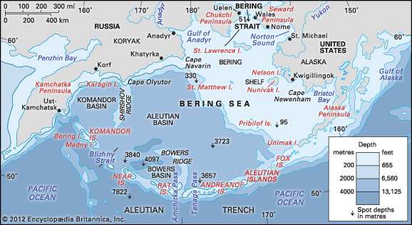
While the broader Aleutian archipelago features dangerous approaches and rocky shores that challenge mariners, the primary navigational lanes through the chain are located at the Unimak, Umnak, Amukta, and Seguam passes. The region is characterized by severe weather, including high winds, persistent fog, and heavy precipitation, which, combined with the challenging geography of the Bering Sea, makes it one of the most difficult areas for maritime transit.23
What role did the Andreanof Islands play during World War II?
During World War II, the Andreanof Islands held significant strategic importance for the United States military. Specifically, the island of Adak—which hosted a naval station from 1942 to 1997—served as a vital staging point for U.S. forces.
This base was instrumental in mounting the campaign to reclaim the islands of Attu and Kiska, which had been invaded and occupied by Japanese troops in June 1942. The military installations on Adak provided the necessary infrastructure to support these operations, which ultimately led to the expulsion of Japanese forces from the Aleutian Islands by August 1943.13
What is the climate like in the Andreanof Islands?
The climate of the Andreanof Islands, as part of the Aleutian Islands, is classified as a maritime zone. This environment is defined by several consistent characteristics:1
- Temperature: The islands experience fairly uniform temperatures throughout the year, with relatively small seasonal variations. In the broader southern coastal and Aleutian region, summer temperatures typically range from 40 to 60 °F (4 to 16 °C), while winter temperatures generally fall between 20 and 40 °F (−7 to 4 °C).513
- Precipitation and Cloudiness: The region is noted for heavy precipitation, which occurs primarily as rainfall, and persistent fog. The area is also characterized by significant cloudiness.51
- Wind: High winds are a frequent feature of the climate. The islands are particularly known for sudden, intense gusts of wind known as williwaws.53
- Atmospheric Influences: The climate is heavily influenced by the Aleutian low, an atmospheric low-pressure center that frequently forms in the region during the winter due to the mixing of warm Pacific waters with the colder waters of the Bering Sea5.6
How many islands make up the Andreanof Islands group?
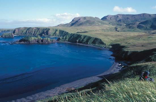
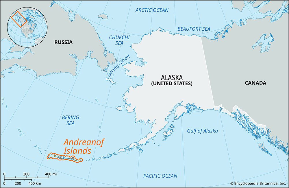
The Andreanof Islands are a group within the Aleutian Islands that consist of numerous islands, though the provided sources do not specify an exact total count. The group spans approximately 270 miles (430 km) and includes several major islands, most notably:
- Adak
- Amlia
- Atka
- Kanaga
- Tanaga
These islands are situated between the Pacific Ocean and the Bering Sea and are part of the Alaska Maritime National Wildlife Refuge.1
Sources
- Andreanof Islands — Encyclopædia Britannica
- Andreanof Islands — Merriam-Webster
- Aleutian Islands — Encyclopædia Britannica
- Bering Sea and Strait - Navigation — Encyclopædia Britannica
- Alaska - Climate of Alaska — Encyclopædia Britannica
- Aleutian low — Encyclopædia Britannica
- Alaskan mountains - Climate of the Alaskan mountains — Encyclopædia Britannica
Published on · 2 min read