Angara River
The Angara River is a major waterway located in southeast central Russia. Serving as the sole outlet for Lake Baikal, it flows for 1,105 miles (1,779 km)…
What is Angara River?
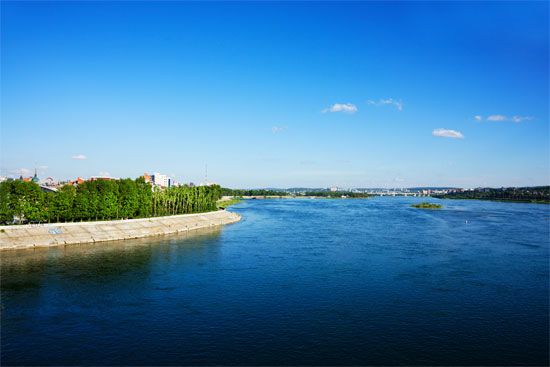
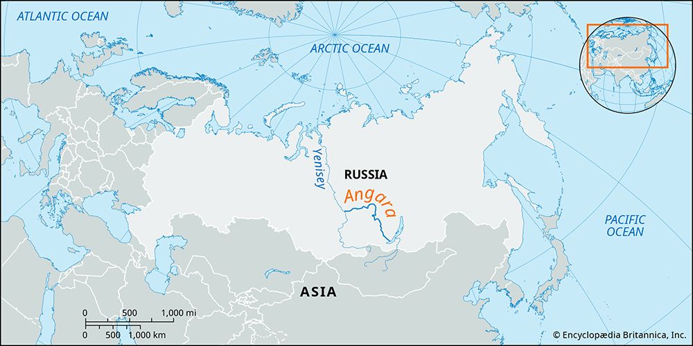
The Angara River is a major waterway located in southeast central Russia. Serving as the sole outlet for Lake Baikal, it flows for 1,105 miles (1,779 km) across the Central Siberian Plateau before joining the Yenisey River near Yeniseysk1.1
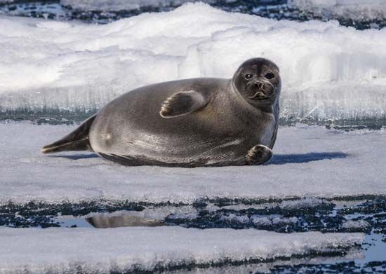
The river’s path across basalt formations creates numerous rapids, which have been harnessed for significant hydroelectric power generation. Major power stations and dams are located at Irkutsk, Bratsk, and Ust-Ilimsk, supporting the regional industrial economy. Additionally, the river serves as a habitat for the Baikal seal, the world’s only exclusively freshwater seal species.2
Some geographers consider the Selenga River—which flows into Lake Baikal—to be the ultimate source of the entire Yenisey system, making the Angara a critical link in one of the world’s largest river basins.3
What makes Lake Baikal unique among the world’s lakes?
Lake Baikal, located in Siberia, is distinguished by several remarkable records and biological features that make it unique among the world’s lakes:
- Depth and Volume: It is the deepest lake in the world, reaching a maximum depth of 5,315 feet (1,620 meters). It also holds the title of the world’s largest freshwater lake by volume, containing approximately 20% of Earth’s unfrozen surface fresh water.45
- Age: Baikal is the oldest existing freshwater lake on Earth, with an estimated age of 20 million to 25 million years.45
- Biodiversity and Endemism: The lake hosts a vast array of plant and animal species, the majority of which are endemic, meaning they are found nowhere else on the planet. A notable example is the Baikal seal (nerpa), which is the only seal species in the world that lives exclusively in a freshwater habitat.45
- Water Clarity: The lake is renowned for its exceptional water clarity, allowing visibility up to 130 feet (40 meters) below the surface.5
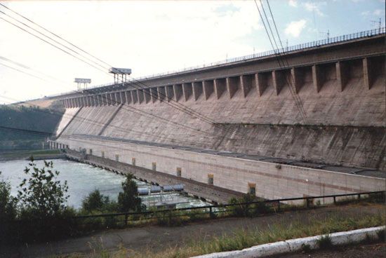
How do hydroelectric dams impact the river’s ecosystem?
Hydroelectric dams significantly alter river ecosystems by transforming natural environments to serve human needs, often resulting in profound ecological and social consequences.1
Impact on Aquatic Life
Dams frequently obstruct the migration routes of spawning fish, leading to dramatic population declines. While technologies like fish passes—such as fish ladders and locks—are designed to help fish navigate these barriers, they have proven difficult to sustain as more dams are built. Furthermore, turbines can pose risks to migrating fish, and the alteration of river regimes threatens endangered species by destroying their natural habitats.615
Sediment and Landscape Changes
Dams act as traps for sediment, holding back the load that rivers naturally transport. This process reduces the effective storage capacity of reservoirs over time as they fill with silt. Downstream, the water released from dams is often depleted of its natural sediment burden, which can lead to increased erosion of riverbanks and land degradation rather than the natural building of landforms.785
Broader Environmental and Social Effects
Beyond aquatic impacts, dams can inundate vast areas, destroying picturesque landscapes, flora, and fauna. These projects often force the relocation of human populations and submerge cultural homelands, making them a subject of ongoing, contentious debate regarding their role in modern society.15
What are some other major rivers in the Siberian region?
Siberia is home to some of the world’s longest and most significant river systems, most of which drain northward into the Arctic Ocean. These rivers serve as vital transport arteries, though they are typically blocked by ice for long periods each year.1112
Major Arctic-Draining Rivers
The vast majority of Siberia’s drainage is handled by three “gigantic” rivers:11
- Ob River: Stretching 2,268 miles (3,650 km), it reaches a total length of 3,362 miles (5,410 km) when combined with its main tributary, the Irtysh River.11
- Yenisey River: A massive waterway spanning 2,540 miles (4,090 km). It is often associated with the Angara River12.11
- Lena River: Extending 2,734 miles (4,400 km), this river system also incorporates the waters of the Aldan and Vilyuy rivers.1112
Other notable rivers flowing into the Arctic include the Yana, Indigirka, and Kolyma rivers.1112
Pacific-Draining Rivers
Southeastern Siberia is primarily drained by the Amur River system. Spanning 1,755 miles (2,824 km), the Amur forms a significant portion of the border between Russia and China. Its major tributaries include the Ussuri and the Sungari (Songhua) rivers. Additionally, the Anadyr River is a key waterway in the northern Pacific drainage region.1112
Sources
- Angara River — Encyclopædia Britannica
- Angara — Merriam-Webster
- Yenisey River - Physical features — Encyclopædia Britannica
- 9 of the World’s Deepest Lakes — Encyclopædia Britannica
- Lake Baikal — Encyclopædia Britannica
- dam - Fish passes — Encyclopædia Britannica
- river - Environments of deposition — Encyclopædia Britannica
- dam - Rise of environmental and economic concerns — Encyclopædia Britannica
- dam - Reservoirs — Encyclopædia Britannica
- Yangtze River - Human impact on the environment — Encyclopædia Britannica
- Russia - Rivers — Encyclopædia Britannica
- Asia - Rivers — Encyclopædia Britannica
- Ob River - Climate and hydrology — Encyclopædia Britannica
Published on · 3 min read