Apennine Range
The Apennine Range has profoundly shaped Italy's agricultural landscape through its rugged topography and varying climatic zones. Because of the mountainous…
How have the Apennines impacted Italy’s agriculture and farming practices?
The Apennine Range has profoundly shaped Italy’s agricultural landscape through its rugged topography and varying climatic zones. Because of the mountainous terrain, cultivation is largely concentrated in wide river valleys—such as those of the Arno and Tiber—and internal basins, which provide rich alluvial soil.1
Agricultural practices are dictated by altitude and latitude:
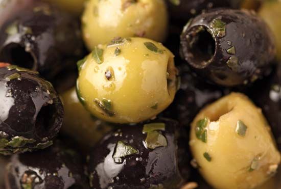
- Lower Elevations: Farming is dominated by Mediterranean crops, including olive trees (up to 1,300 feet), grapes, citrus fruits, and various vegetables.2
- Highlands: Due to the steep relief, these areas are primarily utilized for pastureland, similar to the Alps402), similar to the Alps.2
- Infrastructure: While the rugged landscape presents challenges, the development of over 200 artificial lakes has been critical for supporting irrigation needs.3
Historically, the range supported significant hill farming, though rural depopulation has led to a decline in certain crops like corn (maize). Efforts to develop the local economy continue to influence land use in these mountainous regions.21
What natural resources are found in the Apennine Mountains?
The Apennine Mountains possess a variety of natural resources that have been utilized for centuries, ranging from industrial minerals to energy sources.
Mineral Resources
The region is well-known for its extraction industries, which include:
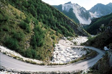
- Marble: The quarries of the Apennines, particularly those near Carrara, have been famous for centuries for their high-quality stone.1
- Industrial Minerals: Significant deposits of mercury, sulfur, boron, and potassic salts are found within the range.1
- Metallic Ores: In the southern Apennines, certain areas—such as the Metallifere Mountains—are noted for being abundant in various minerals.5
Energy Resources
The Apennine region also contributes to Italy’s energy supply:
- Natural Gas: Important discoveries of natural gas have been made in the adjacent coastal plains, where extraction industries are actively developed.1
- Hydroelectric Potential: While not a raw material in the traditional sense, the range’s topography has been utilized to create more than 200 artificial lakes, which are critical for generating power and supporting irrigation.6
Ongoing research and environmental evaluations continue to monitor the geologic evolution and potential resources of the range.7
Where exactly is the Apennine Range located in Italy?
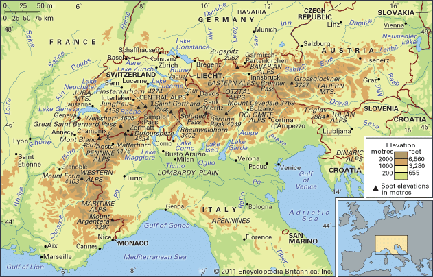
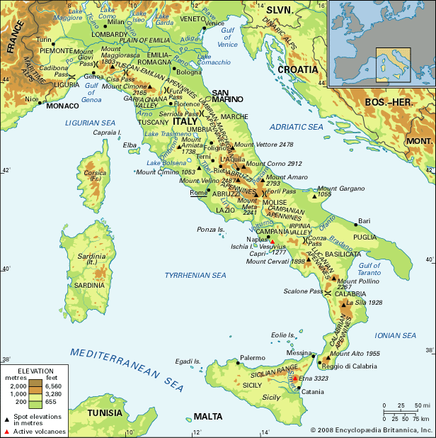
The Apennine Range serves as the physical backbone of the Italian peninsula. The system begins in the northwest at the Cadibona Pass, near the Maritime Alps, and forms a great arc that extends down the length of Italy to the tip of Calabria.98
From Calabria, the range continues onto the island of Sicily, reaching as far as the Egadi Islands to the west. Throughout its approximately 870- to 1,245-mile length, the range varies significantly in width—from about 20 miles at its ends to roughly 120 miles in the Central Apennines, located east of Rome9. The orientation of the mountains generally follows a northwest–southeast path until reaching the southern tip of the peninsula, where the trend shifts toward the south and finally westward.98
What are some of the most notable peaks or regions within the Apennine Range?
The Apennine Range is divided into several major regional subdivisions, each characterized by distinct elevations and geological features. Notable peaks and regions include:
- Tuscan-Emilian Apennines: Located in the north, this region reaches a maximum height of 7,103 feet at Mount Cimone.10
- Umbrian-Marchigian Apennines: This central section features Mount Vettore, which stands at an elevation of 8,130 feet.10
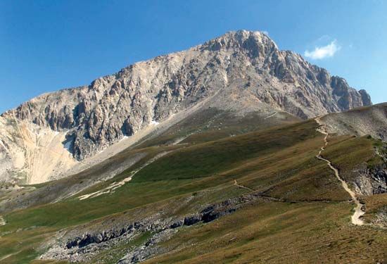
- Abruzzi Apennines: Home to the highest point of the entire range, the Gran Sasso d’Italia mountain group contains Mount Corno (9,554 feet). This area is also notable for the Calderone glacier, which is the southernmost glacier in Europe.11103
- Campanian Apennines: This region reaches a maximum elevation of 7,352 feet at Mount Meta.10
- Lucanian Apennines: This southern section features Mount Pollino, which rises to 7,438 feet.10
- Calabrian Apennines: Located at the southern tip of the peninsula, this region reaches 6,414 feet at Mount Alto.10
- Sicilian Range: The range continues onto the island of Sicily, where it reaches its highest overall elevation at Mount Etna (10,902 feet).10
Beyond these primary peaks, the range includes various volcanic and limestone formations, such as the Apuane Alps (famous for marble), the Metallifere Mountains, and the volcanic group of Vesuvius.3
Sources
- Apennine Range - People and economy — Encyclopædia Britannica
- Italy - Plant life — Encyclopædia Britannica
- Apennine Range - Physiography — Encyclopædia Britannica
- Apennine Range - Plant and animal life — Encyclopædia Britannica
- Europe - Mesozoic and Cenozoic eras — Encyclopædia Britannica
- Apennine Range - Geology — Encyclopædia Britannica
- Apennine Range - Study and exploration — Encyclopædia Britannica
- Italy - Mountain ranges — Encyclopædia Britannica
- Apennine Range — Encyclopædia Britannica
- Apennine Range - Climate of the Apennine Range — Encyclopædia Britannica
- Gran Sasso d’Italia — Encyclopædia Britannica
- Corno, Monte — Merriam-Webster
Published on · 3 min read