Araguaia River
The Araguaia River has a total length of 1,632 miles (2,627 km). It rises in the Brazilian Highlands and flows north-northeast until it joins the Tocantins…
What is the length of the Araguaia River and how does it compare to other major rivers in Brazil?
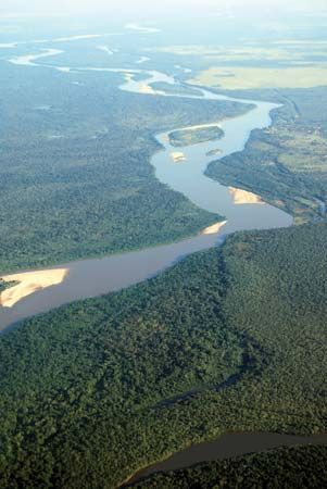
The Araguaia River has a total length of 1,632 miles (2,627 km). It rises in the Brazilian Highlands and flows north-northeast until it joins the Tocantins River.1
When compared to other major Brazilian river systems, the Araguaia is part of the Tocantins-Araguaia system, which is technically a separate entity from the Amazon River despite being popularly associated with it. While the Amazon is the centerpiece of the world’s most extensive river system—stretching some 4,000 miles (6,400 km)—the Tocantins-Araguaia system drains nearly one-tenth of Brazil’s national territory.23
Like the São Francisco River, which flows over 1,000 miles (1,600 km), the Araguaia and its partner, the Tocantins (1,677 miles/2,699 km), are significant waterways that face navigation challenges due to frequent falls and rapids. Unlike the Amazon, which supports large-scale shipping, the Araguaia is primarily utilized for its hydroelectric potential.213
How does the Araguaia River contribute to Brazil’s economy, particularly in terms of agriculture and transportation?
The Araguaia River contributes to Brazil’s economy primarily through its hydroelectric power potential and the presence of valuable natural resources in its upper basin.2
Hydroelectric Power and Resources
During the late 20th century, hydroelectric projects were developed along the river to provide essential energy. While the river holds significant hydroelectric potential, much of it remains underutilized because it is located far from major industrial and urban centers. Additionally, the area surrounding the river’s upper course contains unexploited mineral deposits, including uranium, copper, cobalt, zinc, and diamonds.21
Transportation Challenges
The Araguaia River plays a limited role in Brazil’s transportation network. It is frequently interrupted by falls and rapids, which hinder large-scale waterborne traffic. While the smaller eastern channel around Bananal Island can be navigated by small boats, the river is generally considered to offer poor transportation options. In the late 1990s, the government initiated efforts to improve navigation on the river, though it remains less significant for shipping compared to other major Brazilian waterways.24
Where is the Araguaia River located in Brazil, and what are its main geographical features?
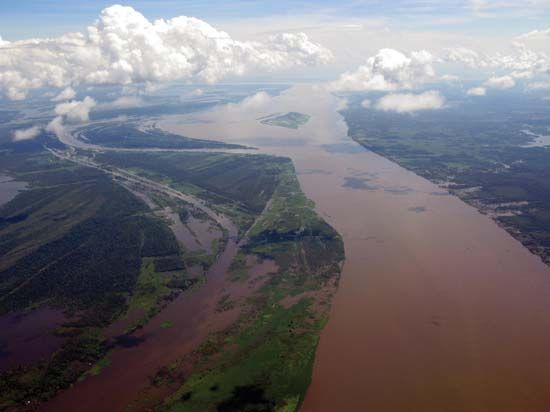
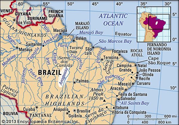
The Araguaia River is located in central Brazil. It originates in the Brazilian Highlands near the town of Alto Araguaia in the state of Mato Grosso and flows north-northeast for 1,632 miles (2,627 km) until it meets the Tocantins River at São João do Araguaia.2
Geographical Features
- State Boundaries: The river serves as a natural border, separating Mato Grosso from Goiás and Tocantins states in its upper course, and Pará from northern Tocantins in its lower course.2
- Bananal Island: In its midcourse, the river splits into two channels, forming Bananal Island. Stretching approximately 200 miles (320 km), it is the largest known inland river island in the world and serves as the site of the Araguaia National Park.26
- Navigation and Terrain: The river is frequently interrupted by falls and rapids, which limit its utility for large-scale transportation, though small boats can navigate the eastern channel around Bananal Island.2
How does the Araguaia River impact the local communities and indigenous populations in the region?
The Araguaia River region is home to various Indigenous peoples, including the Suyá who reside on Bananal Island. This area, which became the Araguaia National Park in 1959, serves as a significant site for both ecological preservation and the traditional livelihoods of these communities.26
Historically, Indigenous groups in Brazil have faced significant challenges, including displacement, the introduction of diseases, and encroachment on their lands by settlers and transient miners known as garimpeiros. While Brazil’s 1988 constitution entitles Indigenous communities to their historically occupied territories, these rights are not always respected, leading to ongoing conflicts over land and resources.78
In response to these pressures, many Indigenous groups have organized to advocate for their rights, political recognition, and the preservation of their cultural heritage. Movements such as those led by the Kayapó have utilized modern technology and social media to document their history and communicate the challenges they face, striving to protect their lands and promote sustainable development that incorporates indigenous knowledge.78
Sources
- Brazil - Rivers of Brazil — Encyclopædia Britannica
- Araguaia River — Encyclopædia Britannica
- Tocantins River — Encyclopædia Britannica
- Brazil - Hydroelectric resources — Encyclopædia Britannica
- Brazil - Shipping of Brazil — Encyclopædia Britannica
- Bananal Island — Encyclopædia Britannica
- Araguaia — Merriam-Webster
- Brazil - Indigenous people — Encyclopædia Britannica
- South America - Sociological changes — Encyclopædia Britannica
Published on · 3 min read