Aral Sea
The Aral Sea basin, located in the heart of Central Asia, is defined by several distinct geological and physiographic characteristics:
What unique geological features characterized the Aral Sea basin?
The Aral Sea basin, located in the heart of Central Asia, is defined by several distinct geological and physiographic characteristics:
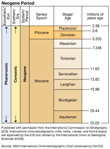
- Formation: The depression was formed toward the end of the Neogene Period (approximately 23 to 2.6 million years ago).1
- Topography: The basin is bordered to the west by the Ustyurt Plateau, which rises 820 feet (250 meters) above the lake. The northern shore features a mix of high and low terrain indented by large bays, while the eastern shore is characterized by low-lying, irregular land.1
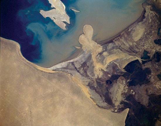
- River Deltas: The basin is shaped by the massive deltas of the Syr Darya in the north and the Amu Darya in the south, which historically served as the primary water sources.1
- Bathymetry: The sea was relatively shallow, with an average depth of about 53 feet (16 meters), though it reached a maximum depth of 226 feet (69 meters) near its western shore.213
- Islands: Historically known as the “Sea of Islands,” the basin contained over 1,000 islands, many of which merged with the mainland as water levels receded.1
Where is the Aral Sea located, and what countries border it?
The Aral Sea is located in the heart of Central Asia, situated to the east of the Caspian Sea.14
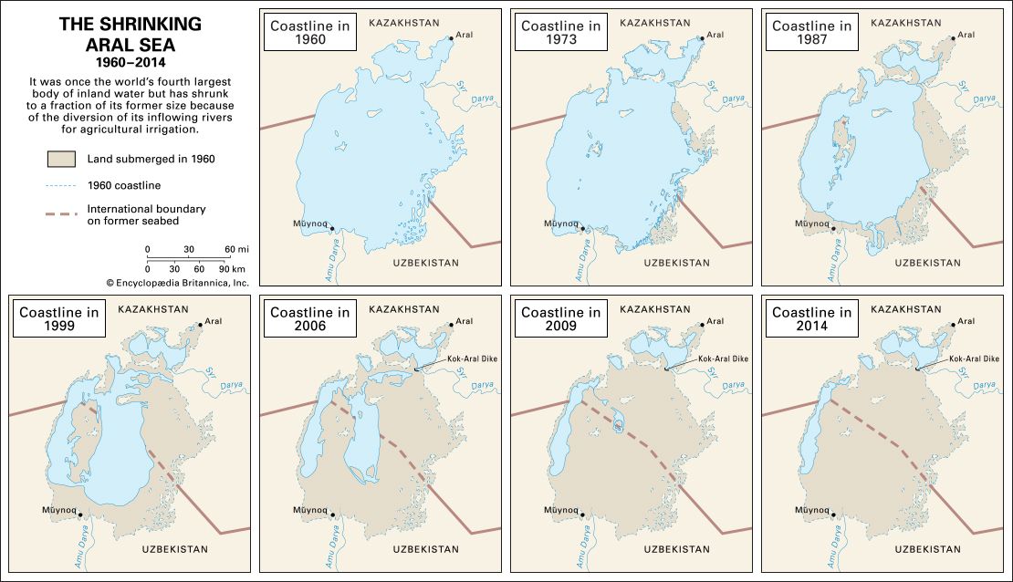
Historically, the lake straddled the boundary between Kazakhstan to the north and Uzbekistan to the south. Due to significant shrinkage that began in the second half of the 20th century, the sea has fragmented into smaller, separate bodies of water. Today, the remnants of the Aral Sea continue to cover parts of both Kazakhstan and Uzbekistan.4213
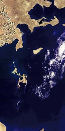
How has the shrinking of the Aral Sea affected local communities and economies?
The shrinking of the Aral Sea, driven by the diversion of the Amu Darya and Syr Darya rivers for irrigation, has had devastating consequences for local communities and economies.21
Economic Impact
- Collapse of the Fishing Industry: Once a thriving sector, the fishing industry was virtually destroyed as rising salinity and receding water levels killed off native fish populations like sturgeon and carp.215
- Port Abandonment: Major ports such as Aral and Muynaq were left stranded far from the shoreline, effectively ending their roles as maritime hubs and leading to the grounding of commercial vessels.25
- Depopulation: The loss of traditional livelihoods forced a partial depopulation of communities along the former shoreline.2
Health and Environmental Impact
- Toxic Dust Storms: As the seabed dried, winds began carrying toxic dust—contaminated with salt, pesticides, and fertilizers—across the region.25
- Public Health Crisis: Local populations, particularly the Karakalpaks, have faced severe health issues, including high rates of throat cancer, anemia, and kidney disease, alongside some of the world’s highest infant mortality rates.2
- Contamination: The toxic environment has poisoned local drinking water and food supplies.25
What are the environmental consequences of the Aral Sea’s shrinkage?
The rapid shrinkage of the Aral Sea has triggered severe environmental degradation across Central Asia. The primary consequences include:
- Increased Salinity and Pollution: As water levels plummeted due to the diversion of the Amu Darya and Syr Darya rivers, the concentration of salts and minerals rose drastically. Furthermore, the water became heavily contaminated with agricultural chemicals, including insecticides and fertilizers, rendering it unfit for consumption.251
- Loss of Biodiversity: The extreme salinity and loss of habitat decimated native fish populations, including sturgeon, carp, barbel, and roach, leading to the total collapse of the local fishing industry.251
- Toxic Dust Storms: The receding shoreline exposed vast areas of the former seabed. Winds now carry toxic dust—laden with salt, pesticides, and fertilizers—across the region, poisoning local food supplies and drinking water.25
- Climate Alteration: The contraction of the sea has resulted in a harsher, more extreme local climate with more pronounced temperature fluctuations between summer and winter.2
- Biological Hazards: The exposure of former islands, such as Vozrozhdenya, created new environmental risks. Once a secret Soviet Union testing ground for biological weapons, the island’s connection to the mainland raised concerns regarding the potential spread of buried pathogens like anthrax.2
Sources
- 6 Lakes That Are Drying Up - Aral Sea — Encyclopædia Britannica
- Aral Sea — Encyclopædia Britannica
- Aral Sea: Top Questions — Encyclopædia Britannica
- Aral Sea — Merriam-Webster
- Uzbekistan - Drainage — Encyclopædia Britannica
Published on · 3 min read