Bering Strait
The Bering Strait itself did not serve as a migration route; rather, it is the modern body of water that separates Asia and North America. During the…
What role did the Bering Strait play in human migration to the Americas?
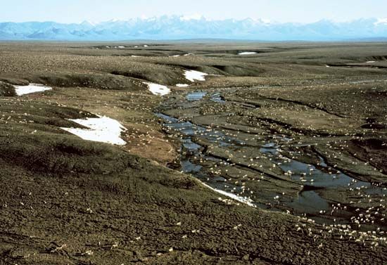
The Bering Strait itself did not serve as a migration route; rather, it is the modern body of water that separates Asia and North America. During the Pleistocene Epoch, specifically when worldwide glaciation caused sea levels to drop by as much as 400 feet, the area now occupied by the strait became part of a vast, dry landmass known as Beringia.
This land bridge, which reached its greatest extent roughly 20,000 years ago, connected northeastern Siberia with northwestern North America. Because much of this region remained unglaciated and supported cold-hardy tundra vegetation, it provided a viable path for animals and humans to move between the continents. While some theories suggest humans followed this overland route in pursuit of game, others propose that ancient peoples may have traveled via boats or along the coast. As glaciers melted and sea levels rose, this connection was eventually submerged, forming the present-day Bering Strait.12
What is the geographical location and significance of the Bering Strait?
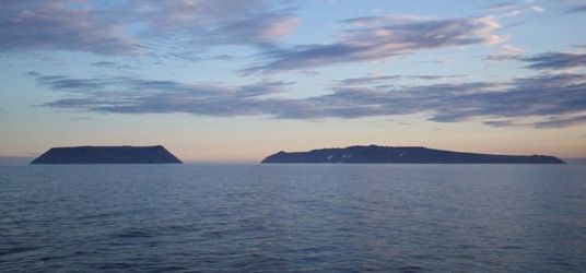
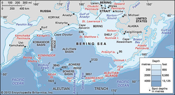
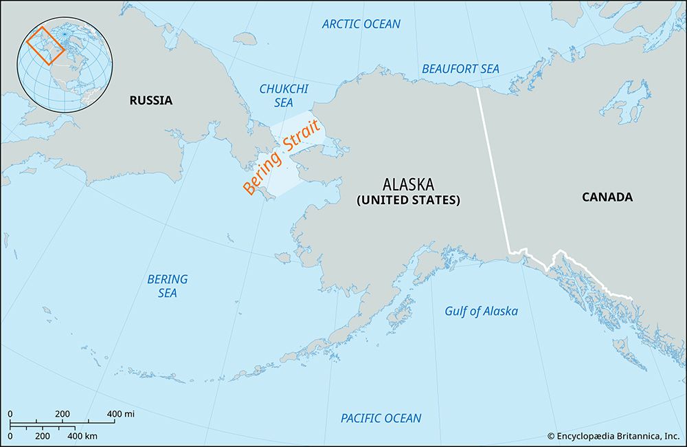
The Bering Strait is a vital waterway that links the Arctic Ocean with the Bering Sea, serving as the boundary between Asia and North America. At its narrowest point, the strait is approximately 53 miles (85 km) wide and averages between 98 and 164 feet (30 to 50 meters) in depth. The international boundary between the United States and Russia passes through this region.2
The significance of the strait is deeply rooted in prehistoric migration. During the Pleistocene Epoch, global glaciation caused sea levels to drop by as much as 400 feet, exposing a vast landmass known as Beringiaeringia](https://www.britannica.com/place/Beringia/Introduction#ref1). This land bridge connected Siberia to North America, providing a pathway for the migration of plants, animals, and humans between 20,000 and 35,000 years ago. As glaciers melted, the land bridge was submerged, creating the modern strait. Today, the region remains a challenging environment for navigation due to severe winter storms, thick ice fields, and powerful currents.213
How deep is the Bering Strait, and how does this affect maritime activities?
The Bering Strait is a relatively shallow passage, averaging between 98 and 165 feet (30 to 50 meters) in depth.42
This limited depth, combined with the region’s harsh climate, significantly impacts maritime activities. The strait is considered part of one of the most difficult bodies of water to navigate, characterized by severe winter storms and powerful tidal currents. During the winter, the area is covered by ice fields that can reach 4 to 5 feet in thickness, with some hummocks exceeding 100 feet in height. Even in midsummer, drift ice remains a persistent hazard for vessels.54
Despite these challenges, the region remains important for shipping, serving as a route for the Russian Far East and providing a connection between the Bering Sea and the Arctic Ocean. The combination of shallow waters, floating ice, and extreme weather conditions necessitates careful navigation for any maritime traffic passing between the continents of Asia and North America.542
How wide is the Bering Strait, and what countries does it separate?
The Bering Strait is approximately 53 miles (85 km) wide at its narrowest point. It serves as the geographical boundary that separates the continents of Asia—specifically Russia—and North America, with the United States (Alaska) located on the eastern side. The international boundary between these two nations passes directly through the strait.267
Sources
- Beringia — Encyclopædia Britannica
- Bering Strait — Encyclopædia Britannica
- Bering Sea and Strait - Navigation — Encyclopædia Britannica
- Bering Sea and Strait - Hydrology — Encyclopædia Britannica
- List of Important Straits — Encyclopædia Britannica
- Bering Sea and Strait — Encyclopædia Britannica
- Bering Strait — Merriam-Webster
Published on · 3 min read