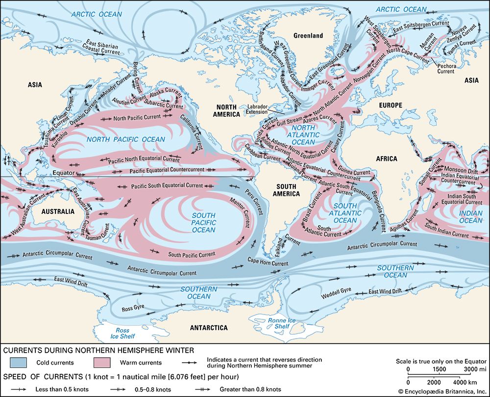
Benguela Current
The Benguela Current is a major oceanic current in the Southern Hemisphere and a branch of the West Wind Drift. It flows northward through the South Atlantic…
What is Benguela Current?
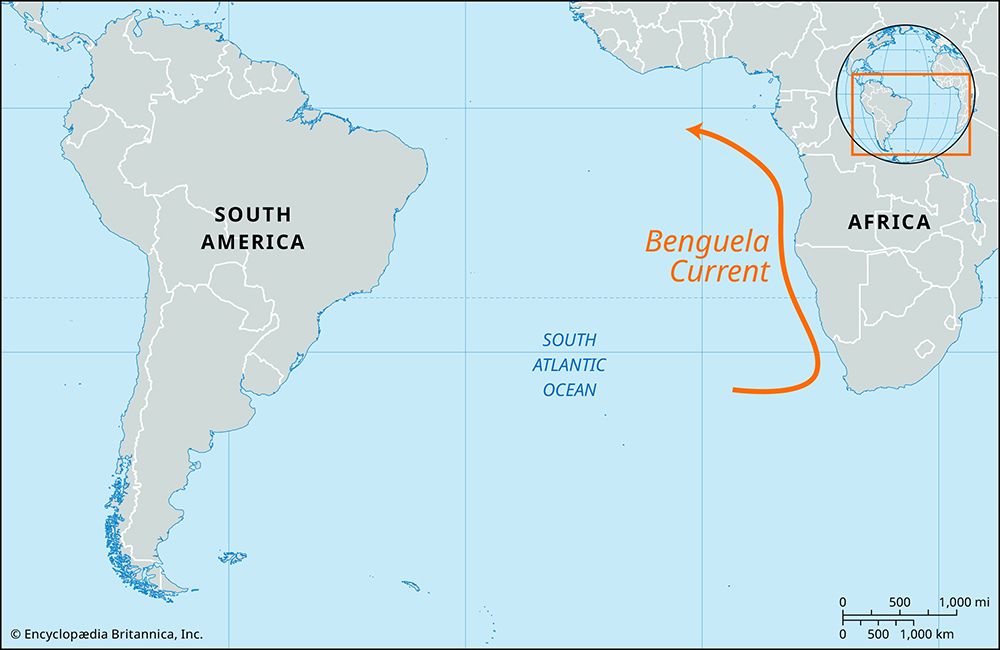
The Benguela Current is a major oceanic current in the Southern Hemisphere and a branch of the West Wind Drift. It flows northward through the South Atlantic Ocean along the western coast of southern Africa, eventually merging with the Atlantic South Equatorial Current near the Equator.1
Driven by prevailing southerly and southwesterly winds, the current triggers the upwelling of cool, nutrient-rich water. This process results in high concentrations of plankton, which support highly productive fishing grounds. The current also significantly influences the regional climate; coastal areas adjacent to it experience extreme aridity, as the cool, low-moisture air prevents the formation of typical sea-breeze precipitation. Additionally, the Walvis Ridge acts as a submarine barrier, restricting the northward flow of cold Antarctic bottom water.1
What is the process of ocean upwelling?
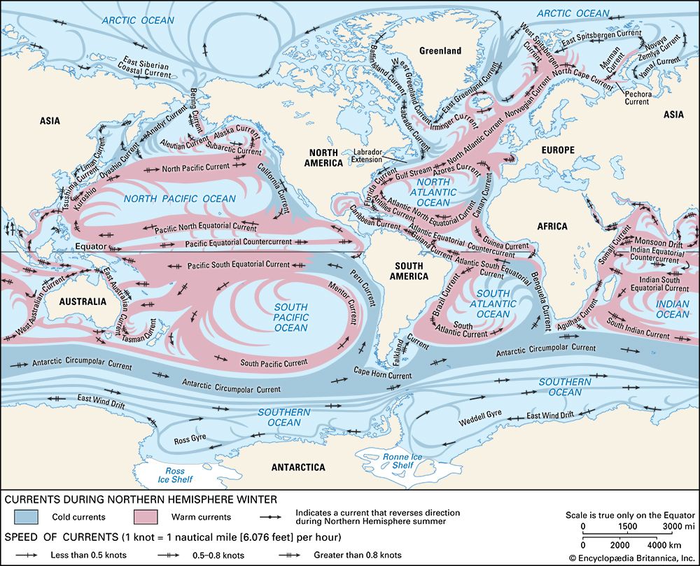
Ocean upwelling is the physical process by which deeper, colder, and typically nutrient-rich water rises to the ocean surface. This phenomenon is primarily driven by wind-induced surface water movement and the Coriolis force.23
Mechanisms of Upwelling
- Ekman Transport: When wind blows across the ocean surface, it creates stress that sets the water in motion. Due to the Coriolis force, this surface water is deflected at an angle—to the right in the Northern Hemisphere and to the left in the Southern Hemisphere. When this Ekman transport causes surface waters to diverge, it creates a deficit that draws deeper water upward to replace them.24
- Coastal Upwelling: This occurs when winds blow parallel to a coastline. The resulting Ekman transport pushes surface water away from the shore, forcing deeper, colder subsurface water to rise to the surface.25
- Equatorial and Polar Divergence: Upwelling also occurs at divergence zones, such as along the Equator, where trade winds displace surface waters, and around Antarctica, where deep water is lifted to the surface.246
Ecological and Climatic Impact
Upwelling is vital for marine life because it brings essential nutrients and oxygen from the depths into the sunlit layer of the ocean, fueling the rapid reproduction of phytoplankton. Consequently, these regions are among the most biologically productive in the world, supporting massive fisheries the most biologically productive in the world, supporting massive fisheries. Climatically, the cold surface waters produced by upwelling can stabilize the lower atmosphere, often reducing precipitation and contributing to arid conditions along adjacent coastlines.27534
How does the Walvis Ridge influence ocean currents?
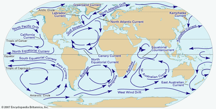
The Walvis Ridge acts as a significant submarine barrier that influences ocean circulation in the South Atlantic. Its primary impact on ocean currents is the restriction of deep-water movement; specifically, it prevents very cold Antarctic bottom water from flowing far to the north along the ocean floor.1
By serving as a physical obstruction on the basin floor, the ridge helps regulate the distribution of deep, cold water masses within the region. This geological feature, which extends southwestward from off the coast of Namibia toward Gough Island, is an aseismic ridge formed by volcanic activity.18
Why does the Benguela Current cause desert conditions in Namibia?
The Benguela Current contributes to the extreme aridity of the Namibian coast primarily by chilling the air above it, which inhibits the formation of rain.111
As this cold current flows northward along the coast, it cools the overlying air, creating a stable maritime air mass that resists rising and producing precipitation. This process generates a temperature inversion about 1,000 feet thick, characterized by cool, fog-laden air near the surface trapped beneath a layer of warmer, dry air. Because the air is stable and lacks the moisture-carrying capacity to produce significant rainfall, the coastal region remains almost entirely rainless, often receiving less than 2 inches of precipitation annually. While the current is responsible for this desertlike aridity, it also produces frequent fog, which serves as a vital source of moisture for local vegetation.111213
Sources
- Benguela Current — Encyclopædia Britannica
- Ekman layer — Encyclopædia Britannica
- Marine ecosystem - Upwelling — Encyclopædia Britannica
- ocean current - Ekman layer — Encyclopædia Britannica
- upwelling — Merriam-Webster
- Atmosphere - Effect of oceans on air movement — Encyclopædia Britannica
- ocean current - Thermohaline circulation — Encyclopædia Britannica
- aseismic ridge — Encyclopædia Britannica
- Mid-Atlantic Ridge — Encyclopædia Britannica
- ocean basin - General features — Encyclopædia Britannica
- Namib - Climate — Encyclopædia Britannica
- Namibia - Climate of Namibia — Encyclopædia Britannica
- Africa - Factors influencing the African climate — Encyclopædia Britannica
Published on · 3 min read