Banda Sea
The Banda Sea is characterized by a complex and deep seafloor topography. It is divided into two primary basins by a ridge, which is punctuated in several…
What are the unique geological features of the Banda Sea?
The Banda Sea is characterized by a complex and deep seafloor topography. It is divided into two primary basins by a ridge, which is punctuated in several locations by coral reefs.1
The sea’s depth profile includes:
- North Banda Basin: Reaches depths of 19,000 feet (5,800 meters).1
- South Banda Basin: Reaches depths of 17,700 feet (5,400 meters).1
- Weber Basin: Separated from the southern basin by a volcanic ridge, this is the deepest part of the sea, plunging to approximately 24,409 feet (7,440 meters).1
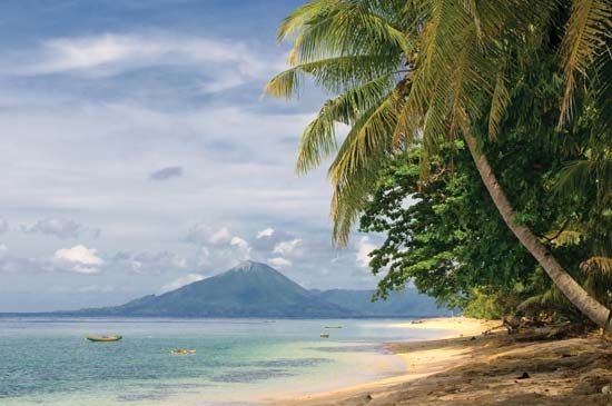
Additionally, the region is geologically active. The volcano Mount Api rises from the floor of the southern basin, extending from a depth of 14,800 feet (4,500 meters) to 2,200 feet (670 meters) above sea level.1
Which major islands are found within or bordering the Banda Sea?
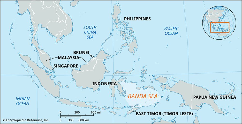
The Banda Sea is bordered by numerous islands belonging to the southern Moluccas group in Indonesia. These islands form a natural boundary around the sea, categorized by their position relative to the basin:
Northern Boundary
- Ceram
- Buru
- Sula
Southern and Eastern Boundaries
- Alor
- Timor
- Wetar
- Babar
- Tanimbar
- Kai
Additionally, the Banda Islands are located within the sea itself, serving as a prominent part of the volcanic arc that characterizes the region’s complex geology.12
How does the Banda Sea contribute to Indonesia’s marine biodiversity?
The Banda Sea significantly contributes to Indonesia’s marine biodiversity primarily through its extensive and pristine coral reefs. The clear waters surrounding the many islands within the sea provide an ideal environment for these ecosystems to flourish.1
Specifically, the Banda Islands are noted for having coral gardens that are described as virtually unrivaled in their beauty and complexity. These reefs serve as vital habitats for a wide array of marine life, supporting the region’s rich aquatic environment. The combination of deep-sea basins and volcanic ridges creates a diverse underwater topography that sustains these thriving biological communities.51
What is the average depth of the Banda Sea, and how does it compare to other seas in the region?
The Banda Sea is characterized by significant depth, featuring multiple basins that reach extreme measurements. While an “average” depth is not explicitly defined, the sea contains three primary basins with varying maximum depths: the North Banda Basin (19,000 feet or 5,800 meters), the South Banda Basin (17,700 feet or 5,400 meters), and the Weber Basin, which is the deepest point at approximately 24,409 feet (7,440 meters).1
When compared to neighboring seas in the region, the Banda Sea is notably deeper:
- Flores Sea: Its greatest depth is 16,860 feet (5,140 meters), with other areas of the basin being significantly shallower, such as a western plateau at 1,650 feet (500 meters).6
- Savu Sea: This sea features a northward-tilting abyssal plain with a maximum depth of 11,385 feet (3,470 meters).3
The complex topography of the Banda Sea, shaped by volcanic ridges and deep-sea basins, distinguishes it as one of the most profound marine environments in the Indonesian archipelago.1
Sources
- Banda Sea — Encyclopædia Britannica
- Maluku — Encyclopædia Britannica
- Savu Sea — Encyclopædia Britannica
- Indonesia - Islands of the Sunda Shelf — Encyclopædia Britannica
- Banda Islands — Encyclopædia Britannica
- Flores Sea — Encyclopædia Britannica
Published on · 2 min read