Belarusian Ridge
The Belarusian Ridge is an upland region spanning approximately 320 miles (520 km), extending from northeastern Poland southeast into western Belarus before…
What is Belarusian Ridge?
The Belarusian Ridge is an upland region spanning approximately 320 miles (520 km), extending from northeastern Poland southeast into western Belarus before turning northeast.1
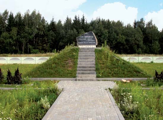
Formed by glacial morainic material during the Pleistocene Epoch, the ridge is a series of separate uplands rather than a single continuous formation. It includes the Minsk Upland, which contains the country’s highest point, Dzyarzhynskaya Hill, at an elevation of 1,135 feet (346 metres). The ridge eventually links eastward with the Smolensk-Moscow Upland.12
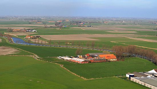
The terrain is characterized by flat or gently rolling surfaces covered in sandy podzolic soils. To the south of this ridge lies the expansive, waterlogged region known as the Pripet Marshes.21
How did the Pleistocene glaciation shape the landscape of Belarus?
The landscape of Belarus was fundamentally shaped by glaciation during the Pleistocene Epoch, which occurred approximately 2,600,000 to 11,700 years ago. The terrain is defined by a contrast between elevated morainic ridges and wide, poorly drained lowlands, both of which are legacies of glacial activity.2
Glacial Deposits and Uplands
The higher regions of the country consist of ridges formed by glacial morainic material, particularly from the Valday glaciation, the final advance of Pleistocene ice in eastern Europe. These formations include:2
- The Belarusian Ridge: The largest of these features, which extends from the Polish border to the Minsk Upland and links eastward to the Smolensk-Moscow Upland.2
- The Ashmyany Upland: A series of terminal moraines running transverse to the main ridge.2
Lowlands and Drainage
Between these ridges lie expansive, marshy lowlands, such as the Polatsk and Neman lowlands in the north. To the south, the Central Byarezina Plain slopes toward the Pripet Marshes, a vast wetland area occupying a structural trough filled with outwash sands and gravels deposited by glacial meltwaters.2
What are the Pripet Marshes and why are they significant?
The Pripet Marshes are a vast, waterlogged region covering approximately 104,000 square miles (270,000 square km) across southern Belarus and northern Ukraine. They are among the largest wetlands in Europe, characterized by saturated sandy lowlands, dense river networks, and extensive pine forests.5
Significance
The region is significant for both its ecological diversity and its historical impact on military strategy:
- Ecological and Economic Value: The marshes support a diverse range of wildlife, including elk, lynx, and various bird species. While historically difficult to traverse, parts of the region have been transformed through land reclamation projects into agricultural land for crops such as rye, barley, and potatoes.5
- Military Obstacle: During the 20th century, the Pripet Marshes served as a formidable strategic barrier. Because the area lacked developed infrastructure, it made large-scale military maneuvers extremely difficult. During World War I, the marshes acted as a natural divider that influenced the movement and logistics of opposing armies across the Eastern Front.6
What is the significance of Dzyarzhynskaya Hill in Belarusian geography?
Dzyarzhynskaya Hill is geographically significant as the highest point in Belarus, reaching an elevation of 1,135 feet (346 metres) above sea level6 metres) above sea level.1
Located within the Minsk Upland, the hill is a prominent feature of the Belarusian Ridge, a 320-mile-long series of uplands formed by glacial morainic material during the Pleistocene Epoch. Its existence highlights the varied topography of the country, which is otherwise characterized by extensive, low-lying plains; notably, more than half of the total surface area of Belarus lies below 660 feet (200 metres).21
Sources
- Belarusian Ridge — Encyclopædia Britannica
- Belarus - Relief — Encyclopædia Britannica
- Pleistocene Epoch - Glaciation — Encyclopædia Britannica
- Europe - Pleistocene glaciation — Encyclopædia Britannica
- Pripet Marshes — Encyclopædia Britannica
- Eastern Front - Physical characteristics of the Eastern Front — Encyclopædia Britannica
Published on · 3 min read