Belle-Île-en-Mer
Belle-Île-en-Mer is an island located off the southern coast of Brittany, in western France. Situated 8 miles (13 km) southwest of the Quiberon Peninsula, it…
What is Belle-Île-en-Mer?
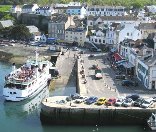
Belle-Île-en-Mer is an island located off the southern coast of Brittany, in western France. Situated 8 miles (13 km) southwest of the Quiberon Peninsula, it is administratively part of the Morbihan département.1
Historically, the island served as a vital strategic outpost for France between 1572 and the 19th century, largely due to its citadel. It was occupied by the British from 1761 to 1763 before being returned to France in the same treaty that transferred Nova Scotia to Great Britain.1
Today, the island covers an area of 32 square miles (83 square km). Its economy is primarily based on agriculture—specifically the production of grains—along with fishing and tourism. The island features several fishing settlements, the largest of which is Le Palais.1
What is the significance of the citadel in Le Palais?
The citadel located in Le Palais on Belle-Île-en-Mer held significant strategic importance for France from 1572 through the 19th century.1
Serving as a vital outpost for the mainland ports of Saint-Nazaire and Lorient, the citadel functioned as a key defensive fortification during a period of intense maritime competition. Its military value was underscored by its occupation by the British between 1761 and 1763; the site was eventually returned to French control under the same treaty that ceded Nova Scotia to Great Britain.1
How did the British occupation affect the island’s history?
The British occupation of Belle-Île-en-Mer from 1761 to 1763 was a direct consequence of the Seven Years’ War, a global conflict involving major European powers.12
The island’s strategic value as an outpost for the French mainland ports of Saint-Nazaire and Lorient made it a target for British forces. The occupation concluded with the Treaty of Paris in 1763, which formally ended the war. Under the terms of this agreement, Great Britain restored Belle-Île-en-Mer to France. This exchange was part of a broader geopolitical settlement in which France ceded significant territories, including Nova Scotia and other North American lands, to the British in exchange for the return of various colonial and European holdings.12
What are the main geographical features of the Brittany coast?
The Brittany coast is characterized by its deeply indented shoreline, which protrudes westward into the Atlantic Ocean as a peninsula. Its geography is defined by several distinct features:3
- Coastal Indentations: Erosion has carved out sharp gorges known as abers along the northern coast. The shoreline is deeply indented, featuring significant gulfs such as the Gulf of Saint-Malo, which includes the bays of Saint-Brieuc and Mont-Saint-Michel.34
- Tidal Activity: The region experiences dramatic tidal variations. At the port of Saint-Malo, tides typically rise 23 to 26 feet, reaching up to 49 feet during spring and autumn, which uncovers vast tracts of land at low tide.4
- Islands: The coast is fringed by several islands, including Belle-Île-en-Mer off the southern coast and the rocky Ouessant Island located off the western tip of the region.315
- Rivers: Several rivers, including the Vilaine, the Leita, the Rance, the Trieux, the Couesnon, and the Sélune, flow into the coastal waters.34
Sources
- Belle-Île-en-Mer — Encyclopædia Britannica
- Treaty of Paris — Encyclopædia Britannica
- Brittany — Encyclopædia Britannica
- Ouessant Island — Encyclopædia Britannica
- Gulf of Saint-Malo — Encyclopædia Britannica
Published on · 2 min read