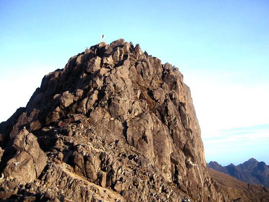
Ben Rinnes
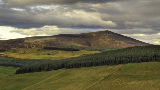
Ben Rinnes is a mountain located in the Moray council area of Scotland.
What is Ben Rinnes?
Ben Rinnes is a mountain located in the Moray council area of Scotland.1
Situated approximately 15 miles (24 km) southwest of Keith and 5 miles (8 km) east of the confluence of the Rivers Avon and Spey, the mountain reaches an elevation of 2,759 feet (841 metres). A notable feature of the landscape is the Linn of Ruthie, a waterfall found on one of the various streams that descend from the mountain’s slopes.1
What is the geography of the Moray council area?
The Moray council area is located in northeastern Scotland, extending inland from the southern shore of the Moray Firth. Its geography is characterized by a diverse landscape that transitions from coastal features to mountainous terrain.2
- Coastal Zone: The northern coastline along the Moray Firth is defined by beaches and sand dunes. This region experiences a relatively dry climate, receiving less than 25 inches (635 mm) of precipitation annually.23
- Interior Plains and Uplands: Moving inland, the area features a fertile coastal plain crossed by the River Spey and the River Findhorn. These rivers originate in the hills and peat moors located to the south.2
- Southern Boundary: The southern portion of the council area is dominated by the Cairngorm Mountains, a massif that rises to nearly 4,000 feet (1,220 metres). This area is part of the broader Grampian Mountains range.24
The region consists primarily of agricultural land and forests, supporting activities such as cattle breeding and sheep grazing.2
How are mountains formed in Scotland?
The formation of mountains in Scotland is primarily the result of ancient tectonic processes followed by extensive glacial erosion.
Tectonic Origins
The foundation of Scotland’s mountainous landscape lies in the Caledonian orogenic belt, which developed between 542 and 416 million years ago. This mountain range was created by the closing of the Iapetus Ocean, which led to the collision of two continental blocks—one representing northwestern Europe and the other North America-Greenland. This collision caused significant crustal deformation, metamorphism, and the creation of magmatic belts, including the granitic masses found in the Highlands.35
Glacial Sculpting
While tectonic forces built the initial mass, the rugged appearance of modern Scottish mountains is largely due to glaciation. During the Pleistocene Epoch, glaciers carved the landscape, transforming plateaus into distinct peaks and deepening valleys.6
- Erosion: Glaciers scoured the terrain, carving out U-shaped valleys, corries (cirques), and steep cliffs.67
- Landscape Variation: In the northwest, severe glaciation wore down ancient rocks to create a hummocky landscape, while the Grampian Mountains were shaped into more rounded, grassy forms with wider plateau areas.6
What are the major rivers in the Scottish Highlands?
Due to an eastward tilting of the Highlands approximately 50 million years ago, a watershed was formed near the west coast, causing most major rivers to flow eastward or northeastward toward the North Sea.13
Key rivers in the region include:
- River Spey: Flowing 107 miles (172 km), it rises in the Corrieyairack Forest and draws tributaries from the Grampian Mountains and the Cairngorm Mountains.14
- River Tay: As Scotland’s longest river (120 miles/193 km), it originates on the slopes of Ben Lui. It drains the largest area in Scotland and flows through Loch Tay before reaching the North Sea.1113
- River Dee: A well-graded river that meanders eastward through the landscape to the North Sea.13
- River Don: Rising in the Grampian Mountains, this 82-mile (132 km) river flows eastward parallel to the Dee, eventually emptying at Aberdeen.10
Sources
- Ben Rinnes — Encyclopædia Britannica
- Moray — Encyclopædia Britannica
- Cairngorm Mountains — Encyclopædia Britannica
- Scotland - Climate of Scotland — Encyclopædia Britannica
- Caledonian orogenic belt — Encyclopædia Britannica
- plate tectonics - Mountains by subduction — Encyclopædia Britannica
- Europe - Caledonian orogenic belt — Encyclopædia Britannica
- Grampian Mountains — Encyclopædia Britannica
- plate tectonics - Mountain building — Encyclopædia Britannica
- Scotland - Relief of Scotland — Encyclopædia Britannica
- Scotland - Drainage — Encyclopædia Britannica
- Pleistocene Epoch - Glaciation — Encyclopædia Britannica
- River Spey — Encyclopædia Britannica
- River Tay — Encyclopædia Britannica
- River Don — Encyclopædia Britannica
Published on · 3 min read