Bucegi Massif
The Bucegi Massif is a mountain group located in south-central Romania, forming one of the four major massifs of the Transylvanian Alps (Southern…
What is Bucegi Massif?
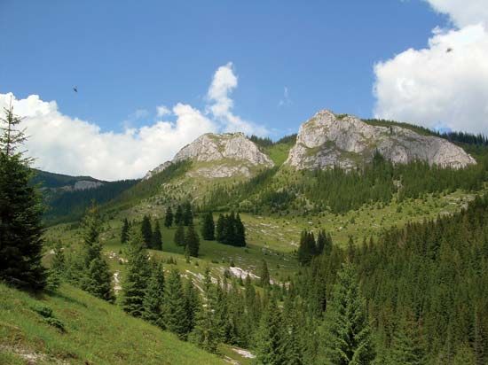
The Bucegi Massif is a mountain group located in south-central Romania, forming one of the four major massifs of the Transylvanian Alps (Southern Carpathians). It reaches its highest elevation of 8,225 feet (2,507 meters) at Mt. Omu.12
Structurally, the massif includes the Leaota Massif and Piatra Craiului, though these are often separated by the Bran Pass and sometimes associated with the Făgăraș Mountains. While the Leaota Massif is characterized by a rounded profile of crystalline rocks, the Bucegi and Piatra Craiului are covered by calcareous conglomerates, resulting in sharper, more rugged landforms. These mountains are well-known for unique rock formations, such as the Sphinx and the Babele (Old Women), the latter of which resemble giant toadstools.1
The region is a popular destination for outdoor activities, including hiking, climbing, and winter sports.1
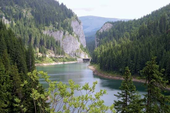
What are the Transylvanian Alps?
The Transylvanian Alps, also known as the Southern Carpathians, are a mountainous region in south-central Romania. Stretching approximately 155 miles (250 km), this range extends from the Prahova River valley in the east to the gap containing the Timiș and Cerna rivers in the west.45
Key characteristics of the region include:
- Geology and Relief: Unlike other Carpathian divisions, the Southern Carpathians are composed primarily of hard crystalline and volcanic rocks, giving them a massive, rugged character. They are higher and more impassable than the eastern and western segments of the Carpathian arc.54
- Elevations: The average elevation ranges between 4,920 and 5,740 feet (1,500–1,750 meters). The region contains the highest peaks in Romania, including Mount Moldoveanu (8,346 feet) and Mount Negoiu (8,317 feet), both located in the Făgăraș Mountains.45
- Subdivisions: Major massifs within this region include the Făgăraș, Bucegi, Parâng, and Retezat-Godeanu.5
How are natural rock formations like the Sphinx and Babele created?
Natural rock formations like the Sphinx and the Babele in the Bucegi Massif are primarily the result of periglacial landform processes. These features are carved into the massif’s characteristic calcareous conglomerates through the mechanical action of weathering.
The primary driver of this erosion is the repeated cycle of freezing and thawing. When water enters cracks in the exposed bedrock, it exerts significant pressure as it crystallizes into ice, exceeding the tensional strength of the rock. Over time, this process breaks down the stone, gradually sculpting the distinct, rugged shapes observed today. While similar processes often reduce bedrock to rubble—creating features like felsenmeers or talus slopes—differential weathering on the conglomerate layers allows for the formation of unique, isolated structures like the toadstool-shaped Babele and the Sphinx.
What are some other major mountain ranges in Romania?
The relief of Romania is dominated by the Carpathian Mountains, which are divided into three primary regions. Beyond the Southern Carpathians (Transylvanian Alps), the country features:
- Eastern Carpathians: Extending from the Ukrainian border to the Prahova River valley, these mountains consist of parallel crests with a central core of crystalline rock. They include the Rodna Massif, which contains the range’s highest peak, Pietrosu (7,556 feet). The western fringe is characterized by a volcanic crescent, including the Călimani and Harghita ranges, which feature preserved volcanic craters and mineral springs.52
- Western Carpathians: Unlike the continuous arcs of the other regions, these form a cluster of massifs separated by structural depressions. This region includes the Apuseni Mountains and the Bihor Massif, known for their rugged karst landscapes and rich mineral deposits.52
- Subcarpathians: This is a fringe of rolling, lower-elevation terrain (1,300–3,300 feet) that accompanies the outer arc of the Carpathians, providing fertile land for agriculture and viticulture.52
Sources
- Bucegi Massif — Encyclopædia Britannica
- Romania - Relief — Encyclopædia Britannica
- Ciucaș — Encyclopædia Britannica
- Transylvanian Alps — Encyclopædia Britannica
- Carpathian Mountains - Physiography of the Carpathian Mountains — Encyclopædia Britannica
- Alps - Tourism — Encyclopædia Britannica
- glacial landform - Felsenmeers, talus, and rock glaciers — Encyclopædia Britannica
Published on · 3 min read