Campaspe River
The Campaspe River is a 105-mile (170-km) river located in central Victoria, Australia. It originates in the Eastern Highlands and flows northward, passing…
What is Campaspe River?
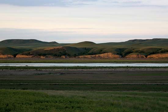
The Campaspe River is a 105-mile (170-km) river located in central Victoria, Australia. It originates in the Eastern Highlands and flows northward, passing through Kyneton before being dammed to create the Eppalock Reservoir. The river continues past Elmore and eventually joins the Murray River near Echuca.1
The river’s drainage basin spans approximately 1,500 square miles (3,900 square km) and is a key component of the Goulburn Irrigation System. The surrounding agricultural land is utilized for sheep, dairy cattle, timber, wheat, and grape production. The river was named in 1836 by Sir Thomas Mitchell after the favorite mistress of Alexander the Great.1
What is the significance of the Murray River in Australia?
The Murray River is the principal river of Australia and the main artery of the Murray-Darling Basin. Spanning approximately 1,570 miles, it is of immense economic and environmental significance to the nation.2
Economic Importance
The Murray-Darling Basin, which occupies about one-seventh of Australia’s landmass, is the country’s most vital agricultural region. It supports over 70 percent of Australia’s irrigated crops and pastures, including grains, cattle, sheep, and fruit, and serves as the nation’s second-largest wine-producing area. While the river was once a major route for shipping, its primary modern role is providing water for large-scale irrigation, supported by major infrastructure like the Snowy Mountains Hydro-Electric Scheme.23
Water Management and Challenges
The river is essential for human consumption, notably serving as the primary water supply for Adelaide. However, intensive irrigation has led to significant salinity issues, occasionally rendering the water unfit for drinking by World Health Organization standards. Consequently, managing the river’s health through sustainable development and basin-wide legislative cooperation has become a matter of national priority.2
How do irrigation systems like the Goulburn support agriculture?
Irrigation systems, such as those utilizing the Goulburn River, are fundamental to supporting agriculture in Australia’s often arid environment. By capturing and distributing water through networks of dams, reservoirs, and canals, these systems allow for the cultivation of crops and the maintenance of pastures in regions that would otherwise be unsuitable for intensive farming.452
Specifically, irrigation enables the following agricultural activities:
- Diversified Production: The introduction of irrigation in the 1880s transformed the Goulburn Valley, shifting the focus from simple pastoralism to more intensive practices, including fruit and vegetable farming, dairying, and sheep raising.4
- Reliability: Irrigation provides a consistent water supply, which is essential for maximizing the use of modern agricultural technology, such as fertilizers and optimized crop rotations.5
- Large-Scale Infrastructure: Major projects like the Snowy Mountains Hydro-Electric Scheme divert river systems to convert vast, arid plains into productive land, supporting over 70 percent of Australia’s irrigated crops and pastures.52
However, these systems face significant environmental challenges. Intensive irrigation has led to rising water tables and increased soil salinity, which can degrade farmland and affect water quality. To address these issues, government initiatives like Landcare work with farmers to implement sustainable practices, such as improved drainage and better water management, to ensure the long-term viability of these agricultural regions.4267
Who was Sir Thomas Mitchell and what were his explorations?
Sir Thomas Livingstone Mitchell (1792–1855) was a Scottish-born soldier and the surveyor general of New South Wales, renowned for his extensive mapping and exploration of Australia. After serving in the Peninsular War, he arrived in Sydney in 1827, eventually taking sole charge of the surveyor general’s department in 1830.
His major explorations included:
- 1831–1832: Explored the region between the Castlereagh and Gwydir rivers.
- 1835: Traced the Darling River from where Charles Sturt had previously stopped to its junction with the Murray River.
- 1836: Explored the area around the Murray River, naming it Australia Felix—a region that later became the state of Victoria.
- 1845–1846: Led a fourth expedition attempting to find an overland route to Port Essington.
Mitchell documented his findings in works such as Three Expeditions into Eastern Australia and Journal of an Expedition into the Interior of Tropical Australia.
Sources
- Campaspe River — Encyclopædia Britannica
- Murray River — Encyclopædia Britannica
- New South Wales - Drainage — Encyclopædia Britannica
- Goulburn River — Encyclopædia Britannica
- Origins of agriculture - Irrigation — Encyclopædia Britannica
- Darling River — Encyclopædia Britannica
- Victoria - Settlement patterns and demographic trends — Encyclopædia Britannica
- Victoria - Drainage and soils — Encyclopædia Britannica
- Australia - Agriculture, forestry, and fishing — Encyclopædia Britannica
- Sir Thomas Livingstone Mitchell — Encyclopædia Britannica
Published on · 3 min read