Caroní River
The Caroní River is a 430-mile (690-km) river located in the state of Bolívar in southeastern Venezuela. Its headwaters originate in the Sierra Pacaraima…
What is Caroní River?
The Caroní River is a 430-mile (690-km) river located in the state of Bolívar in southeastern Venezuela. Its headwaters originate in the Sierra Pacaraima near Mount Roraima, where the borders of Venezuela, Brazil, and Guyana converge.1
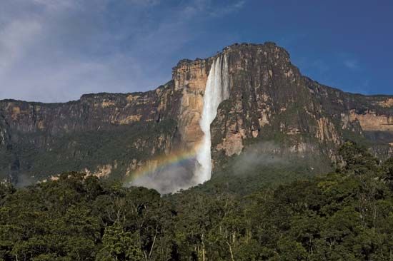
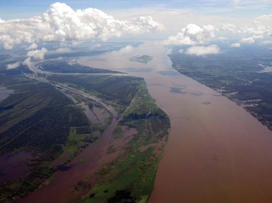
Flowing northward across the Guiana Highlands, the river eventually empties into the Orinoco River near Ciudad Guayana. The river is notable for hosting Angel Falls, the world’s highest waterfall, on one of its headstreams.1
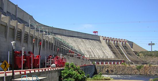
The Caroní is a vital source of energy for the region, with its significant hydroelectric potential harnessed by major projects such as the Guri Dam and the Macagua dam. While rapids make navigation difficult near its mouth, the lower course remains accessible by launch.12
How are Angel Falls connected to the Caroní River?
Angel Falls is connected to the Caroní River through a tributary relationship. Specifically, the falls are located on the Churún River, which serves as a headstream and tributary of the Caroní.341
As the world’s highest waterfall, Angel Falls drops 3,212 feet (979 meters) from the Auyán-Tepuí plateau within the Guiana Highlands3. The waters from this cataract eventually flow into the Caroní, which continues its northward course across southeastern Venezuela before emptying into the Orinoco River near Ciudad Guayana.541
What are the Guiana Highlands like?
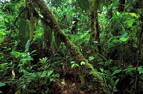
The Guiana Highlands are a vast, heavily forested plateau and low-mountain region in South America. Situated between the Amazon and Orinoco rivers, the region spans parts of Venezuela, Brazil, Colombia, and the Guianas.4
The terrain is characterized by three distinct elevations:
- Rolling Upland: A basement area generally under 1,000 feet (300 meters) above sea level.
- Low Mountains: Ranging from 2,000 to 3,000 feet (600 to 900 meters) near stream divides.
- Tabular Plateaus: Resistant sandstone-capped formations, including Mount Roraima, which reach the highest elevations.4
The region experiences abundant rainfall year-round, supporting dense tropical rainforests and pockets of savanna. These lands are rich in natural resources, including gold, diamonds, iron ore, and valuable timber, though the dense vegetation often complicates exploration. The area is also home to Angel Falls, the world’s highest waterfall, located on a tributary of the Caroní River.4
How do hydroelectric dams generate electricity?
Hydroelectric dams generate electricity by converting the potential energy of stored water into mechanical energy and, ultimately, into electricity.7
The process functions through the following steps:
- Collection: Water is impounded in a reservoir at a high elevation, creating a difference in height known as the head.8
- Conveyance: The water is directed downward through large pipes or tunnels called penstocks toward a powerhouse located at a lower elevation. powerhouse located at a lower elevation.7
- Generation: The force of the falling water causes turbines to rotate. These turbines are connected to generators, which convert the mechanical rotation into electrical energy.7
- Transmission: Transformers increase the voltage of the generated electricity to make it suitable for long-distance transmission across the power grid.7
While this process provides a renewable energy source, it is important to acknowledge that dams can have significant negative environmental impacts, such as disrupting fish migration and displacing local ecosystems.87
Sources
- Caroní River — Encyclopædia Britannica
- Guri Dam — Encyclopædia Britannica
- Angel Falls — Encyclopædia Britannica
- Guiana Highlands — Encyclopædia Britannica
- Orinoco River - Physiography of the Orinoco — Encyclopædia Britannica
- Guyana - Early history — Encyclopædia Britannica
- Did you know? — Merriam-Webster
- hydroelectric power — Encyclopædia Britannica
Published on · 2 min read