Caney Fork River
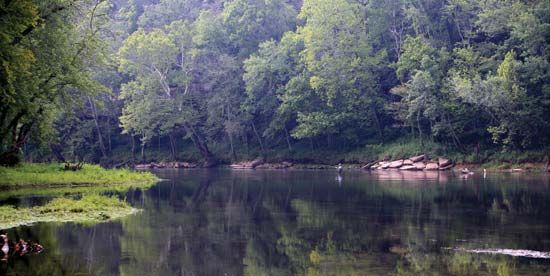
The Caney Fork River is a 144-mile (232 km) waterway located in central Tennessee, U.S. It originates from the confluence of the Collins and Rocky rivers and…
What is Caney Fork River?
The Caney Fork River is a 144-mile (232 km) waterway located in central Tennessee, U.S. It originates from the confluence of the Collins and Rocky rivers and flows northwesterly until it joins the Cumberland River near Carthage.1
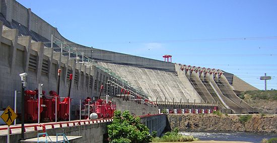
The river is managed by two significant dams:
- Great Falls Dam (1925): This structure creates the Great Falls Reservoir and is part of the Tennessee Valley Authority system.1
- Center Hill Dam (1951): This dam impounds the river to form Center Hill Lake.1
What is the purpose of the Tennessee Valley Authority?
The Tennessee Valley Authority (TVA) was established by the U.S. Congress in 1933 as a public corporation to address the economic and environmental challenges of the Tennessee River drainage basin. Its primary purposes include:
- Flood Control: Managing a unified system of dams to prevent the severe periodic flooding that historically devastated the region.2
- Navigation: Improving the river channel and installing locks to facilitate commercial transport, which significantly increased river traffic.2
- Power Generation: Producing and supplying affordable electricity through hydroelectric stations, coal-fired plants, and nuclear power to spur industrial development.2
- Regional Development: Improving living standards for farmers, promoting land conservation, and managing public health initiatives, such as the eradication of malaria through mosquito control.2
By consolidating various government activities under one agency, the TVA became a prototype for integrated natural-resource planning across seven states.2
How do dams affect the surrounding river ecosystem?
Dams significantly alter river ecosystems by transforming natural landscapes into reservoirs, which can lead to the destruction of local flora and fauna. The environmental impact of these structures is multifaceted:34
- Disruption of Migratory Species: Dams often block or impede the movement of fish, such as salmon, that must travel upstream to spawn. While technologies like fish passes (ladders and locks) have been developed to mitigate this, they are not always successful, leading to population declines or even the threat of extinction for some species.35
- Sedimentation and Erosion: When water flow velocity decreases in a reservoir, sediment is deposited, which can reduce the reservoir’s capacity over time. Conversely, the water released downstream is often sediment-starved, which increases its capacity to erode the stream channel below the dam.4
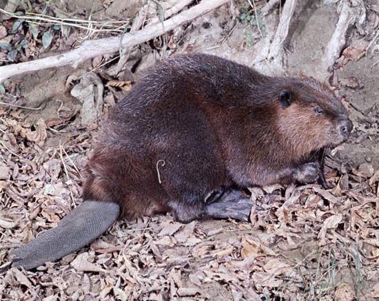
- Habitat Transformation: Large-scale dams inundate vast areas, displacing human populations and destroying terrestrial habitats. In contrast, smaller dams built by beavers can act as “ecosystem engineers,” creating wetlands and ponds that support diverse aquatic life.346
We could dive deeper into the specific technologies used to help fish bypass dams, or explore the long-term ecological consequences of reservoir sedimentation.
What are the main features of the Cumberland River?
The Cumberland River is a 687-mile (1,106 km) waterway that originates on the Cumberland Plateau in southern Kentucky and flows into the Ohio River at Smithland, Kentucky.7
Key features of the river include:
- Course and Geography: It begins as a mountain stream formed by the confluence of Poor and Clover forks. It flows through a deep gorge with cliffs reaching 300–400 feet before entering the central limestone basin of Tennessee.7
- Hydrology: The river drains an area of 18,080 square miles. It is characterized by low volume in late summer and significant flooding during winter and spring.7
- Development: As part of the Tennessee Valley Authority system, the river features several dams, such as the Wolf Creek Dam, which created Lake Cumberland. These structures provide flood control, power generation, and navigation.7
- Urban Centers: Nashville is the largest city along its banks, with other notable centers including Clarksville and Williamsburg.7
Sources
- Caney Fork River — Encyclopædia Britannica
- Tennessee Valley Authority — Encyclopædia Britannica
- dam - Rise of environmental and economic concerns — Encyclopædia Britannica
- dam - Fish passes — Encyclopædia Britannica
- Why do beavers build dams? — Encyclopædia Britannica
- reservoir — Encyclopædia Britannica
- Cumberland River — Encyclopædia Britannica
Published on · 3 min read