Cape Roca
Cape Roca, also known as Cabo da Roca, is a prominent headland located in Portugal. It serves as the westernmost point of continental Europe, situated on the…
What is Cape Roca?
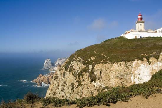
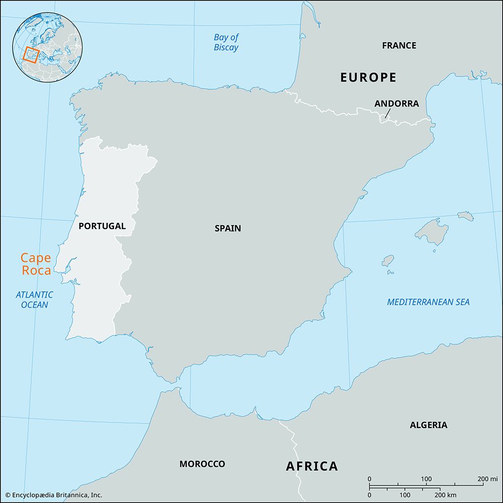
Cape Roca, also known as Cabo da Roca, is a prominent headland located in Portugal. It serves as the westernmost point of continental Europe, situated on the Atlantic coast within the Lisboa district.12
The cape is characterized by a narrow granite cliff that rises 472 feet (144 meters) above the sea, marking the western terminus of the Sintra Mountains. Historically referred to by the Romans as Promontorium Magnum, it is located approximately 25 miles (40 km) west-northwest of Lisbon.2
What are the Sintra Mountains known for?
The Sintra Mountains are primarily known for their lush, diverse vegetation and mild climate, which have long established the range as a popular tourist retreat for the population of Lisbon.3
The area is celebrated for its unique natural beauty and historical significance, featuring:
- Botanical Diversity: The mountainsides host a rich mix of Mediterranean and northern European flora.3
- Architectural Landmarks: The peaks are home to notable structures, including the 19th-century Pena Palace and the 8th-century Castle dos Mouros.4
- Cultural Heritage: The region, particularly the town of Sintra, was a former royal summer residence and is recognized as a UNESCO World Heritage site.4
- Landscape Gardening: The area contains some of the finest examples of landscape gardening on the Iberian Peninsula, notably within the Parque da Pena.4
How did the Romans use the name Promontorium Magnum?
The Romans used the name Promontorium Magnum to identify the geographic feature now known as Cape Roca. In Latin, the name translates to “Great Promontory,” reflecting the site’s status as a significant landmark on the Atlantic coast of the Iberian Peninsula.1
While historical records confirm this designation, the name served primarily as a descriptive geographical label for the westernmost point of continental Europe, which forms the dramatic granite terminus of the Sintra Mountains.1
What other geographical landmarks are found in Portugal?
Portugal features a diverse array of geographical landmarks shaped by its varied geology, ranging from rugged mountain ranges to extensive river systems and coastal formations.
Mountain Ranges
- Estrela Mountains: The highest range in continental Portugal, reaching 6,539 feet (1,993 metres) at its peak, Torre.5
- Monchique Mountains: A dissected massif of igneous rock in the south, rising to 2,959 feet (902 metres) at Mount Foia.6
- Nogueira Mountains: A singular monadnock in the northern interior that rises to 4,330 feet (1,320 metres).7
- Other Ranges: The landscape also includes the schistose Caldeirão Mountains in the south, the Caramulo and Montemuro mountains in the north-central region, and the Larouco Mountains in the northwest.678
Rivers and Waterways
- Douro River: A major river that flows through deep gorges and has been made navigable via a series of dams.9
- Mondego River: The longest river located entirely within Portugal, rising in the Estrela Mountains.9
- Other Rivers: The Tagus, Guadiana, Minho, Vouga, Sado, and Zêzere rivers are significant features that define the country’s drainage patterns.69
Coastal and Island Landmarks
Sources
- Cape Roca — Encyclopædia Britannica
- Roca, Cape — Merriam-Webster
- Sintra Mountains — Encyclopædia Britannica
- Sintra — Encyclopædia Britannica
- Portugal - South — Encyclopædia Britannica
- Portugal - Drainage — Encyclopædia Britannica
- Portugal - Northern interior — Encyclopædia Britannica
- Estrela Mountains — Encyclopædia Britannica
- Portugal - Vegetation — Encyclopædia Britannica
- Portugal - North — Encyclopædia Britannica
- Portugal - Wildlife of Portugal — Encyclopædia Britannica
Published on · 2 min read