Ceboruco
Ceboruco is a volcano located in the southeastern part of the Nayarit state in west-central Mexico. Situated approximately 50 miles (80 km) southwest of the…
What is Ceboruco?
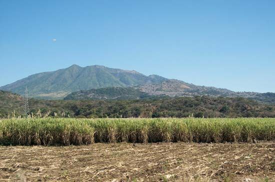
Ceboruco is a volcano located in the southeastern part of the Nayarit state in west-central Mexico. Situated approximately 50 miles (80 km) southwest of the state capital, Tepic, the volcano features three principal craters, with the highest reaching an elevation of 7,100 feet (2,164 meters) above sea level.1
Geologically, the volcano is characterized by three distinct periods of eruption, which are evidenced by various lava flows of differing compositions. While currently considered dormant, its most recent period of activity occurred between 1870 and 1875. Additionally, several smaller cones are situated on the volcano’s northern, southern, and eastern flanks.1
What is the difference between a dormant and an active volcano?
The distinction between active and dormant volcanoes is often blurred by human perception, as many explosive volcanoes have such long periods of inactivity that nearby populations may mistakenly consider them extinct rather than dormant.2
Active Volcanoes
An active volcano is one that is currently erupting or has erupted in recent history and is expected to erupt again. These volcanoes are characterized by ongoing geological processes, such as the discharge of molten rock, pyroclastic fragments, or steam. Scientists monitor these sites by tracking earthquake activity and surface deformation to forecast potential eruptions.342
Dormant Volcanoes
A dormant volcano is one that is not currently erupting but is still considered capable of future activity. The primary challenge in managing volcanic risk is that dormant volcanoes often have very long “repose periods”—the time between eruptions—which can lead to public complacency. Because these intervals can span centuries or longer, people living near these mountains may incorrectly assume they are extinct.32
Ultimately, the classification depends on the volcano’s eruptive history and current monitoring data, though the science of volcano forecasting remains complex and carries inherent uncertainty.2
How do volcanic eruptions change the surrounding landscape?
Volcanic eruptions profoundly reshape the Earth’s surface through both destructive and constructive processes. The resulting landforms are determined by factors such as the volume and composition of erupted material, the geometry of the vent, and the environment—whether subaerial, submarine, or subglacial—in which the eruption occurs.6
Landscape Transformation
- Lava Flows: Effusive eruptions can bury vast areas under layers of basalt, andesite, dacite, or rhyolite. These flows can create expansive plateaus or build up massive structures like shield volcanoes. In some cases, such as in Hawaii, lava flows can extend landmasses by pouring into the ocean.67
- Explosive Deposits: Large-scale explosive eruptions often result in the formation of a caldera, a massive depression created when the ground collapses over an emptied magma chamber. These events can blanket thousands of square kilometers with ash and pyroclastic flows, which incinerate and sweep away existing terrain.68
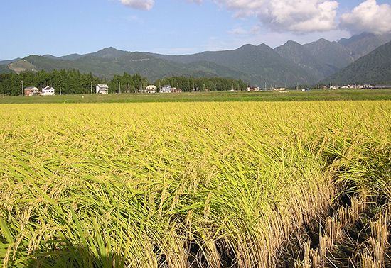
- Soil Enrichment: While eruptions are initially destructive, volcanic ash weathers over time to form highly fertile, loamy soils. This process can transform barren landscapes into productive agricultural regions, such as the terraced rice paddies found on Java.9
Environmental and Climatic Impact
Beyond local topography, volcanic activity can influence the global environment. High ash clouds and sulfur dioxide emissions can inject aerosols into the stratosphere. These particles can create haze layers that blanket the Earth, potentially lowering global temperatures for several years, as observed following the 1815 eruption of Mount Tambora.9
What are the other major volcanoes located in Mexico?
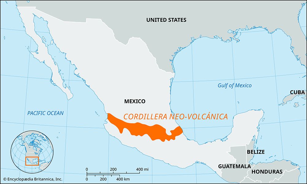
Mexico is home to a significant number of volcanoes, many of which are located along the Cordillera Neo-Volcánica, a geologically active range that traverses the central part of the country from the west coast to the east coast.1011
Some of the most notable volcanoes in Mexico include:
- Pico de Orizaba: Also known as Citlaltépetl, this is the highest point in Mexico, reaching an elevation of 18,406 feet (5,610 meters).1012
- Popocatépetl: An active volcano located southeast of Mexico City. It is one of the country’s most prominent peaks and has experienced several eruptions in recent decades.1312
- Iztaccíhuatl: A dormant volcano located near Popocatépetl. Known as the “sleeping woman,” it features three summits and last erupted in 1868.1014
- Colima: A notable volcanic peak situated within the Cordillera Neo-Volcánica.10
- Parícutin: Located in Michoacán, this is one of the world’s youngest volcanoes, having emerged violently from a field between 1943 and 1952.11
- El Chichón: Situated in the Chiapas Highlands, this volcano is known for its 1982 eruption, which destroyed several surrounding villages.11
Sources
- Ceboruco — Encyclopædia Britannica
- volcano - Volcano forecasting and warning — Encyclopædia Britannica
- volcano - Six types of eruptions — Encyclopædia Britannica
- volcano - List of the world’s major volcanoes — Encyclopædia Britannica
- volcanism — Encyclopædia Britannica
- volcano - Determinants of size and shape — Encyclopædia Britannica
- volcano - Long-term environmental effects — Encyclopædia Britannica
- volcano - Pyroclastic flows — Encyclopædia Britannica
- volcano - Lava flows — Encyclopædia Britannica
- Cordillera Neo-Volcánica — Encyclopædia Britannica
- Popocatépetl — Encyclopædia Britannica
- Mexico - Physiographic regions — Encyclopædia Britannica
- Iztaccíhuatl — Encyclopædia Britannica
- Mexico - Geologic origins — Encyclopædia Britannica
- Are Volcanoes Dangerous When They’re Not Erupting? — Encyclopædia Britannica
Published on · 3 min read