Cordillera Real
The Cordillera Real acts as a critical climatic and topographic barrier in Bolivia, separating the high-altitude Altiplano to the west from the low-lying…
How do the Cordillera Real mountains impact the climate and ecosystems of Bolivia?
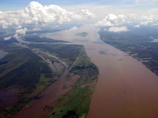
The Cordillera Real acts as a critical climatic and topographic barrier in Bolivia, separating the high-altitude Altiplano to the west from the low-lying Amazon River basin to the east.1
This mountain system profoundly influences regional ecosystems through its dramatic elevation changes:
- Climatic Barrier: The range forces air to rise and cool, creating distinct climatic zones. The eastern slopes, known as the Yungas, experience heavy, seasonal rainfall and support lush, tropical forests. In contrast, the western side and the Altiplano are significantly drier, as the mountains create a rain shadow effect.234
- Vertical Zonation: Ecosystems are organized by altitude. The high, snow-covered peaks support minimal life, while the lower slopes and intermontane valleys (Valles) provide more temperate conditions suitable for agriculture and diverse fauna.23
- Biodiversity: The transition from high-altitude, cold-adapted species—such as camelids like llamas and alpacas—to the rich, jungle-dwelling wildlife of the eastern plains is a direct result of the varied habitats created by the range’s extreme relief.23
What is the geological history of the Cordillera Real mountain range?
The geological history of the Cordillera Real is fundamentally tied to the broader evolution of the Andes Mountains, a system shaped by plate tectonics over hundreds of millions of years.1
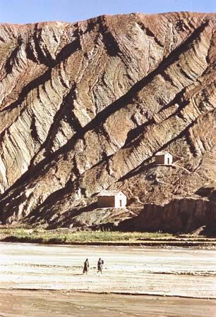
The foundation of these mountains began between 450 and 250 million years ago, when sediments eroded from the Amazonia craton were deposited on its western flank. The weight of these deposits caused the crust to subside, and subsequent heat and pressure metamorphosed these sediments into resistant rocks like quartzite, shale, and marble.1
The modern mountain system emerged through the Andean orogeny, driven by the subduction of the oceanic Nazca Plate beneath the continental South American Plate. This process, which began approximately 170 million years ago, involved significant crustal uplift and the intrusion of magma from the mantle. This volcanic and intrusive activity created the complex geological matrix of the cordilleras, including mineral-rich veins that have been historically significant to the region. While earlier estimates suggested the primary uplift occurred between 15 and 6 million years ago, recent research indicates that this significant mountain-building process began as early as 25 million years ago.1
How does the Cordillera Real compare to other mountain ranges in South America in terms of size and elevation?
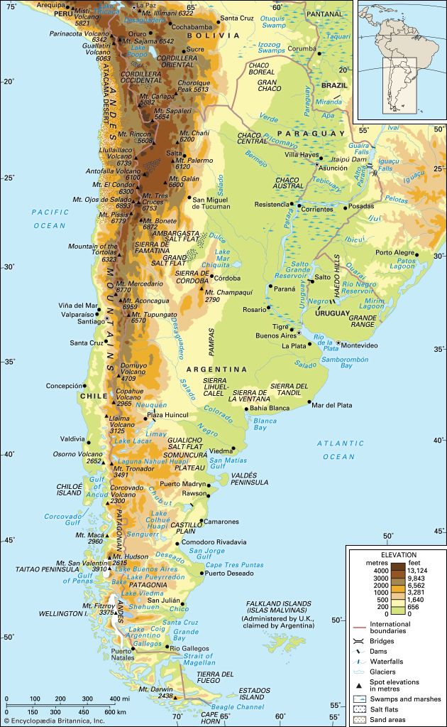
The Cordillera Real is a major mountain system in Bolivia, extending approximately 750 miles (1,200 km) in a north-south direction. It is characterized by its narrow width and high, glaciated peaks, with significant summits such as Mount Illimani and Illampu exceeding 21,000 feet (6,400 meters).112
When compared to other segments of the Andes Mountains, the Cordillera Real stands out for its extreme elevation relative to its northern counterparts in the Ecuadorian Andes or the Colombian Andes, where average elevations are generally lower. While the Cordillera Central in Colombia is the highest of that country’s three ranges, its peaks—such as Mount Huila—typically reach around 18,865 feet, which is lower than the highest points of the Cordillera Real.121314
Furthermore, the Cordillera Real is part of the widest segment of the Andes, where it forms the eastern boundary of the Altiplano, one of the world’s largest interior basins. Unlike the volcanic chains found in the Cordillera Occidental or the northern Andes, the Cordillera Real is primarily a fold and thrust belt, contributing to its distinct geological profile and rugged, high-altitude character.124
Where is the Cordillera Real located in Bolivia, and what are its main geographical features?
The Cordillera Real is a major mountain system located in Bolivia, serving as the easternmost of the country’s two primary ranges. It extends approximately 750 miles (1,200 km) in a north-south direction, acting as a geographic barrier that separates the Altiplano high plateaus to the west from the Amazon River basin lowlands to the east.1
Key geographical features include:
- Physiographic Regions: The range encompasses two distinct zones: the Valles, which are high intermontane valleys (8,200 to 11,500 feet), and the Yungas, which are lower-lying valleys (3,300 to 6,600 feet).1
- Composition: It is composed of six lesser ranges, including the Cordillera de La Paz—the highest portion of the system—as well as the Cordillera Tres Cruces, the Azanaques, the Frailes, the Chichas, and the Lípez.1
- Elevation: The range is characterized by narrow, rugged terrain and high, glaciated peaks. Notable summits such as Illampu and Mount Illimani exceed 21,000 feet (6,400 meters) in elevation.112
Sources
- Cordillera Real — Encyclopædia Britannica
- Bolivia - Relief — Encyclopædia Britannica
- Andes Mountains - Plant and animal life — Encyclopædia Britannica
- Andes Mountains - Physiography of the Northern Andes — Encyclopædia Britannica
- Andes Mountains - Climate — Encyclopædia Britannica
- Sierra Madre - Climate — Encyclopædia Britannica
- Andes Mountains - Geology — Encyclopædia Britannica
- United States - The Western Intermontane Region — Encyclopædia Britannica
- Western Cordillera — Encyclopædia Britannica
- South America - The Southern Andes — Encyclopædia Britannica
- South America - The Andean orogeny — Encyclopædia Britannica
- Andes Mountains - Physiography of the Central Andes — Encyclopædia Britannica
- Colombia - Relief — Encyclopædia Britannica
- mountain - The Andes — Encyclopædia Britannica
Published on · 3 min read