Ch’ŏngch’ŏn River
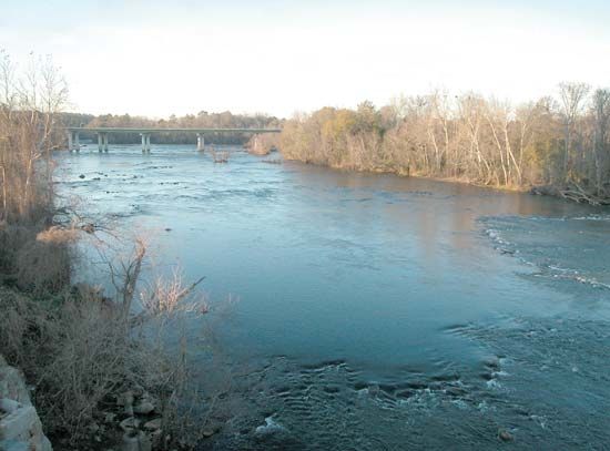
The Ch’ŏngch’ŏn River is a waterway located in central North Korea. It originates in the Ch’ŏgyu Mountains, approximately 75 miles (120 km) northwest of…
What is Ch’ŏngch’ŏn River?
The Ch’ŏngch’ŏn River is a waterway located in central North Korea. It originates in the Ch’ŏgyu Mountains, approximately 75 miles (120 km) northwest of Hamhŭng. The river flows in a generally southwestern direction for about 125 miles (200 km), passing through the cities of Hŭich’ŏn, Kujang, and Anju. It drains a region characterized by fertile agricultural plains before emptying into Korea Bay west of Sinanju.1
The river is also historically significant for its role during the Korean War. In late 1950, it served as a major site of conflict, including the battle of Onjŏng-Unsan, where Chinese forces engaged United Nations Command (UNC) troops. Following these engagements, the Eighth Army retreated to the south bank of the river to regroup. The area between the Ch’ŏngch’ŏn and P’yŏngyang later became a focal point for military maneuvers during the Chinese offensives.2
What role did the Yalu River play in the Korean War?
The Yalu River played a critical role in the Korean War (1950–53), serving as both a strategic boundary and a focal point of military tension.
- Strategic Importance: The river’s hydroelectric plants, particularly the Sup’ung Dam, were vital to the region. The protection of these facilities and the desire to maintain a buffer zone were primary motivations for China’s entry into the war when United Nations Command (UNC) forces advanced northward toward the river in 1950.3
- Air Warfare: The area near the Yalu became the site of intense air combat. A corridor in northwestern Korea, known as “MiG Alley,” saw fierce battles between U.S. F-86 Sabre jets and Soviet-piloted MiG-15 fighters. These aircraft operated from bases in Manchuria to defend bridges and dams along the river.2
- Political Buffer: The Soviet Union promised to extend air defenses to a corridor above the Yalu to protect Chinese air bases and hydroelectric plants, facilitating China’s military intervention.2
How did the geography of North Korea affect military strategies during the war?
The rugged geography of North Korea significantly dictated the flow and tactics of the Korean War. The country’s terrain, dominated by mountains and deep river valleys, created formidable obstacles that influenced military movement, logistics, and defensive strategies.43
Topographic Constraints
- Mountainous Terrain: The Nangnim Mountains run north-to-south, acting as a natural divide that restricted east-west movement. This forced military forces to rely on limited corridors, such as the narrow coastal plains and specific river valleys, for major advances.4
- Transportation Bottlenecks: Because of the high mountains, the country’s infrastructure was limited. The railway network primarily ran north-south, parallel to the coasts, with few east-west connections. This lack of lateral mobility hampered the ability of armies to shift forces quickly across the peninsula.5
- River Barriers: Rivers like the Yalu, Ch’ŏngch’ŏn, and Nakdong served as both strategic boundaries and defensive lines. During the war, the Nakdong River became the site of the “Pusan Perimeter,” where United Nations Command (UNC) forces established a final defensive line in the southeast.67
Strategic Implications
- Amphibious Operations: Due to the difficulty of navigating the mountainous interior, military planners like General Douglas MacArthur turned to amphibious landings to bypass enemy lines. The Incheon landing was a direct response to the need to overcome the constraints of the peninsula’s geography.8
- Guerrilla Warfare: The mountainous interior provided natural cover for retreating forces and partisans. After the KPA disintegrated as an organized field force in 1950, thousands of troops retreated into the mountains to continue fighting as guerrillas, utilizing the rugged terrain to evade detection.8
Who was General Peng Dehuai and what was his impact on the conflict?
General Peng Dehuai was a prominent Chinese military leader who served as the commander of the Chinese People’s Volunteers Force (CPVF) during the Korean War. A veteran commander under Mao Zedong, Peng was tasked with leading Chinese forces into Korea to support Kim Il-sung after United Nations Command (UNC) troops crossed the 38th parallel.112
Impact on the Conflict
Peng’s leadership was characterized by tactical innovation and the ability to command massive forces under difficult conditions:
- Tactical Strategy: Peng developed a formula for engaging UNC forces that emphasized night attacks, cutting off supply and withdrawal routes, and utilizing the rugged terrain for concealment and ambush.2
- Major Offensives: He orchestrated several major offensives, most notably the trap set for Douglas MacArthur’s forces in late 1950, which successfully drove UNC troops back into South Korea.2
- Armistice: Despite the heavy casualties suffered by his forces, Peng remained a central figure throughout the war and ultimately signed the armistice at P’anmunjŏm on July 27, 1953.11
Sources
- Ch’ŏngch’ŏn River — Encyclopædia Britannica
- Korean War - Back to the 38th parallel — Encyclopædia Britannica
- Yalu River — Encyclopædia Britannica
- North Korea - Relief — Encyclopædia Britannica
- Korea Bay — Encyclopædia Britannica
- 38th parallel — Encyclopædia Britannica
- North Korea - Transportation — Encyclopædia Britannica
- Nakdong River — Encyclopædia Britannica
- Korean War - South to Pusan — Encyclopædia Britannica
- Korean War - North to the Yalu — Encyclopædia Britannica
- Peng Dehuai — Encyclopædia Britannica
Published on · 3 min read