Congo River
The Congo River rises in the highlands of northeastern Zambia as the Chambeshi River, situated between Lake Tanganyika and Lake Nyasa at an elevation of…
What is the source of the Congo River and where does it empty?
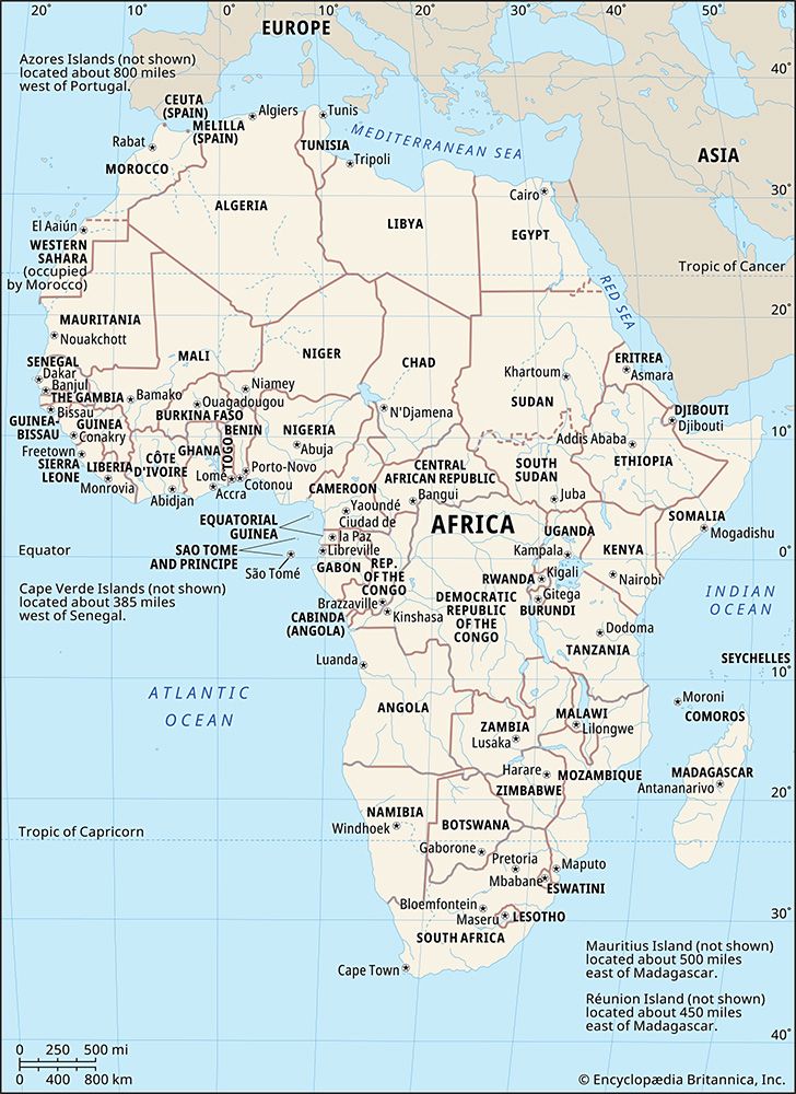
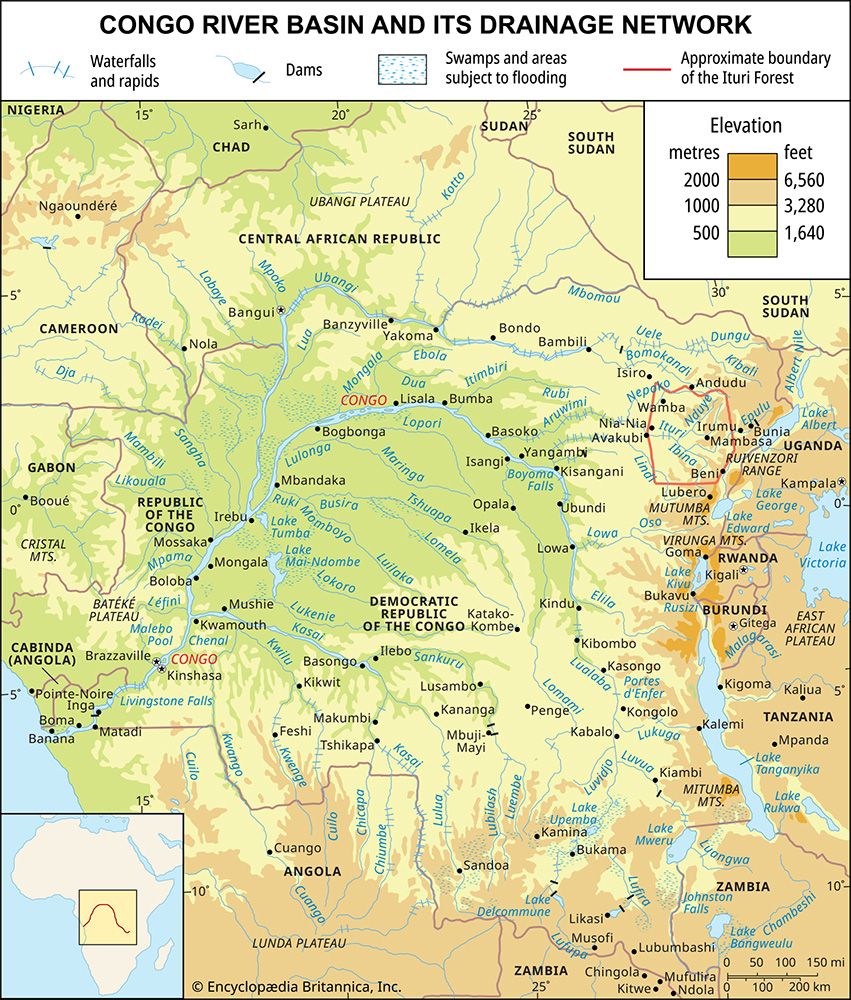
The Congo River rises in the highlands of northeastern Zambia as the Chambeshi River, situated between Lake Tanganyika and Lake Nyasa at an elevation of 5,760 feet (1,760 meters) above sea level. While the Chambeshi is considered the remotest source, the Lualaba River, which rises in the southeastern Democratic Republic of the Congo, is often regarded as the original main stream in terms of water volume.12
After flowing in a giant counterclockwise arc through west-central Africa, the river drains into the Atlantic Ocean at Banana (Banane) in the Democratic Republic of the Congo. The river enters the sea through a swampy estuary that is approximately 6 miles wide at its mouth.123
What major tributaries feed into the Congo River?
The Congo River is fed by a vast, fan-shaped network of tributaries that drain the surrounding Congo basin. These rivers contribute to the Congo’s status as one of the world’s most significant hydrological systems.12
Key tributaries include:
- Ubangi River: A major tributary that joins the Congo from the right bank.42
- Kasai River: A significant tributary entering from the left bank, which rivals the Ubangi in the size of its drainage basin.4
- Sangha River: Another important tributary that flows into the Congo from the right bank.2
- Kwa River: A notable tributary that joins the main river from the left bank.2
- Lomami River: Enters the Congo upstream of the middle course, where the river begins to widen significantly.2
- Upper Congo tributaries: The upper reaches are formed by the union of several streams, including the Lualaba River, the Luvua River, and the Lukuga River.2
How does the Congo River compare to other major rivers in Africa in terms of length, discharge, and importance?
The Congo River holds a unique position among African rivers, distinguished by its immense volume and its role as a vital economic artery for the continent’s interior.15
Length and Drainage
At 2,900 miles (4,700 km) long, the Congo is the second-longest river in Africa, surpassed only by the Nile. Its drainage basin covers approximately 1,335,000 square miles (3,457,000 square km), encompassing a vast region of west-central Africa. While this basin is only about half the size of the Amazon River’s basin, it remains the largest in Africa.15
Discharge and Hydrology
The Congo is characterized by a remarkably regular flow, sustained by year-round rainfall across its equatorial basin. Its discharge at the mouth is approximately 1,450,000 cubic feet (41,000 cubic meters) per second. While this is significantly less than the Amazon’s massive discharge, it represents a substantial volume of water that is critical to the region’s hydrology.35
Economic and Navigational Importance
The Congo forms the largest network of navigable waterways in Africa, providing essential communication links for regions otherwise inaccessible by road. Although its navigability is interrupted by 32 cataracts in its lower course—including the Inga Falls—the river remains a key component of the economic development of the central African interior, facilitating the transport of agricultural produce, wood, minerals, and fuel.156
How has the Congo River influenced the distribution of human populations in Central Africa?
The Congo River has been a fundamental influence on human settlement and population distribution in Central Africa for millennia, serving as both a conduit for movement and a center for economic activity.76
Historical Settlement and Trade
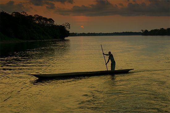
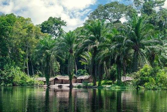
Historically, the river system facilitated the mobility of individuals, goods, and ideas, fostering a common social environment among diverse groups. Early inhabitants, including farmer-trappers and fishing peoples, established communities along the riverbanks, where they adapted to the environment through specialized activities like fishing and agriculture. The introduction of New World crops such as cassava and maize, often transported via trade networks, allowed for higher population densities in the region.678
Urbanization and Economic Centers
The river has been a primary driver of modern urbanization. Major cities, including Kinshasa and Brazzaville, developed at key points along the river, particularly near the Malebo Pool, to serve as administrative and commercial hubs. These urban centers became magnets for rural-to-urban migration, especially following independence, as people sought better opportunities and amenities.79101112
Transportation and Connectivity
Because the Congo basin is often difficult to traverse by road, the river remains a vital transport artery. The river system connects inland regions to the coast, supporting industries such as timber, mining, and agriculture. Consequently, population clusters are frequently found near river ports like Kisangani, Mbandaka, and Matadi, which serve as essential links in the regional economy.91387
Sources
- Congo River: Top Questions — Encyclopædia Britannica
- Africa - Congo basin — Encyclopædia Britannica
- Congo River — Encyclopædia Britannica
- Congo River - Physiography — Encyclopædia Britannica
- Congo River - Hydrology of the Congo River — Encyclopædia Britannica
- Congo River - Transportation — Encyclopædia Britannica
- Democratic Republic of the Congo - Settlement patterns — Encyclopædia Britannica
- Republic of the Congo - Settlement patterns — Encyclopædia Britannica
- Democratic Republic of the Congo - Transportation and telecommunications — Encyclopædia Britannica
- Congo River - Life of the river peoples — Encyclopædia Britannica
- Kinshasa - People — Encyclopædia Britannica
- Congo River - Animal life — Encyclopædia Britannica
- Republic of the Congo - Demographic trends — Encyclopædia Britannica
- Republic of the Congo - Early history — Encyclopædia Britannica
Published on · 4 min read