Chu River
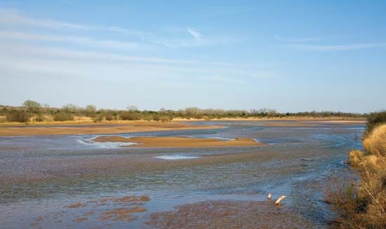
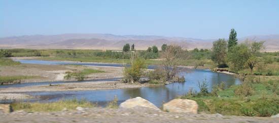
The Chu River is a 663-mile (1,067-km) river located in Kyrgyzstan and Kazakhstan.
What is Chu River?
The Chu River is a 663-mile (1,067-km) river located in Kyrgyzstan and Kazakhstan.1
It originates in the Tien Shan mountains at the confluence of the Kochkor and Dzhuvanaryk rivers. From there, the river flows north through the Boam Gorge, receives the Chon-Kyomin, and continues northwest through the fertile Chu Valley. Much of the river’s water is utilized for irrigation in this valley before the river eventually terminates in the sands of the Moyynqum Desert. The river drains a total basin area of 24,150 square miles (62,500 square km).1
What are the Tien Shan mountains?
The Tien Shan, a name meaning “Celestial Mountains,” is a vast mountain system in Central Asia stretching approximately 1,500 miles (2,500 km). It primarily straddles the border between China and Kyrgyzstan, covering a total area of about 386,000 square miles (1,000,000 square km).2
Physical Features
The system is characterized by alpine-type ranges, deep basins, and intervening valleys. Elevations are extreme, ranging from the Turfan Depression—the lowest point in Central Asia—to the system’s highest peak, Victory Peak, which reaches 24,406 feet (7,439 meters). The mountains are divided into several regions, including the northern, central, inner, western, and southern Tien Shan, each with distinct geological and climatic characteristics.32
Climate and Ecology
The region experiences a sharply continental climate with significant temperature extremes. Because of the varying elevations, the Tien Shan hosts diverse ecosystems:4
- Foothills: Characterized by semidesert and desert vegetation.5
- Steppe: The most common landscape, found between 3,500 and 11,000 feet.5
- Forests: Primarily deciduous and coniferous forests, including unique nut-bearing stands.5
- Alpine Zones: High-altitude meadows and “cold deserts” give way to glaciers at the highest summits.35
How is the Chu Valley used for farming?
The Chu Valley is a vital agricultural region in Central Asia, primarily supported by the Chu River. Because the region relies on the river’s flow for its productivity, much of the water is diverted for irrigation to sustain farming activities within the valley.1
The valley’s fertility is a key economic asset for Kyrgyzstan, as the river serves as a major source of water for the country’s agricultural needs. By channeling the river’s flow, farmers are able to cultivate crops in an area that would otherwise be limited by the arid climate of the surrounding landscape.16
What is the climate of the Moyynqum Desert?
The Moyynqum Desert is located in southern Kazakhstan, a region characterized by a sharply continental climate. This environment experiences extreme seasonal fluctuations, with hot summers and cold winters.7
In the southern regions of Kazakhstan, average January temperatures typically range from 23 to 29 °F (−5 to −1.4 °C), while average July temperatures rise to approximately 84 °F (29 °C). The area is subject to significant temperature extremes, with recorded highs reaching 113 °F (45 °C) and lows dropping to −49 °F (−45 °C). Precipitation in these arid zones is generally light, with annual totals typically ranging between 8 and 12 inches (200 to 300 millimeters).7
Sources
- Chu River — Encyclopædia Britannica
- Tien Shan — Encyclopædia Britannica
- Tien Shan - Physiography — Encyclopædia Britannica
- Tien Shan - Climate — Encyclopædia Britannica
- Tien Shan - Plant life — Encyclopædia Britannica
- Kyrgyzstan - Drainage — Encyclopædia Britannica
- Kazakhstan - Climate — Encyclopædia Britannica
Published on · 2 min read