Clarence River
The name "Clarence River" refers to two distinct geographical features in Oceania:
What is Clarence River?
The name “Clarence River” refers to two distinct geographical features in Oceania:
Clarence River, Australia
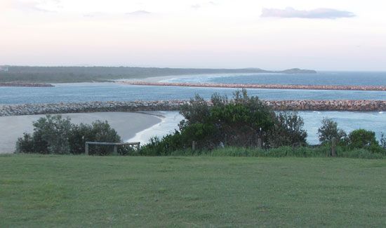
Located in northeastern New South Wales, this river rises in the McPherson Range near the Queensland border. It flows for 245 miles (394 km) before emptying into the Pacific Ocean near Grafton. Historically known as the “Big River,” it was named for the Duke of Clarence and is navigable by small steamers as far as Grafton.1
Clarence River, New Zealand
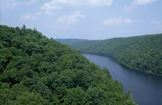
This river is situated in the eastern South Island. It originates on the slopes of the Spenser Mountains and flows 130 miles between the Inland and Seaward Kaikōura ranges. Due to its steep gradient and series of gorges, the river possesses significant hydroelectric potential.2
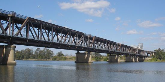
How do rivers like the Clarence support local agriculture?
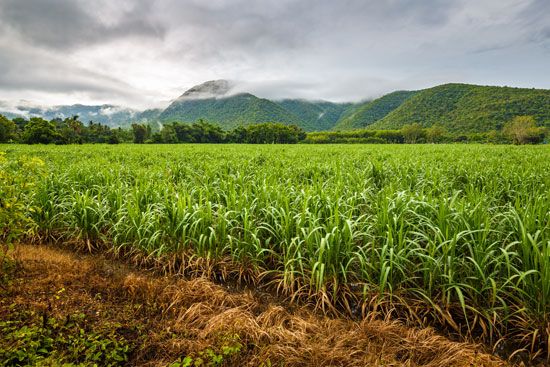
Rivers like the Clarence River support local agriculture primarily by creating fertile alluvial plains, which provide highly productive land for farming. In the region surrounding the city of Grafton, these conditions allow for the cultivation of a diverse range of agricultural products, including sugarcane, corn (maize), fruits, vegetables, and dairy products.14
Beyond providing rich soil, rivers serve as vital water sources for agricultural development. While the Clarence is noted for its role in shaping the landscape, the broader practice of river-based irrigation—seen in other systems like the Indus River or the Canterbury Plains—demonstrates how water management through canals, dams, and irrigation systems can transform land into productive acreage. These systems enable farmers to overcome rainfall variability, support intensive farming, and sustain both food and cash crops. However, such management requires careful oversight to prevent issues like soil salinity and waterlogging, which can occur if drainage is not properly controlled.567
What are the main differences between the Australian and New Zealand Clarence Rivers?
The Clarence Rivers in Australia and New Zealand differ significantly in their geography, scale, and utility.
Feature
Clarence River (Australia)
Clarence River (New Zealand)
Location
Northeastern
New South Wales
Eastern
South Island
Length
245 miles (394 km)
130 miles (209 km)
Topography
Flows through coastal plains with many islands
Flows through steep mountain ranges and gorges
Navigability
Navigable by small steamers to
Grafton
Noted for steep gradient and hydroelectric potential
Key Tributaries
Timbarra, Mitchell, and Orara
Acheron River
While the Australian Clarence is a coastal river characterized by its navigability and flood-prone islands, the New Zealand Clarence is defined by its rugged mountain path between the Kaikōura ranges and its potential for power generation.12
We could dive deeper into the specific hydroelectric projects or the historical exploration of these regions if you are interested.
Why are river floodplains often important for human settlement?
River floodplains have been central to human settlement for millennia, primarily because they provide highly fertile land for agriculture. These areas are formed by alluvial deposits—a mixture of silt, sand, clay, and organic matter left behind when rivers overflow their banks. This nutrient-rich soil has historically supported the development of “hydraulic civilizations” in regions like the Tigris-Euphrates, the Nile, and the Indus valleys, where the ability to cultivate food crops allowed populations to grow and transition into permanent urban centers.101112
Beyond agriculture, floodplains and their associated river systems have historically provided:
- Transportation and Communication: Rivers served as the primary routes for trade, exploration, and conquest, often dictating the location of major cities and capitals.1213
- Water Access: As populations grew, rivers became essential for drinking water, cooling industrial facilities, and supporting hydroelectric power generation.13
- Engineering and Infrastructure: The need to manage annual flooding led to the development of early engineering practices, including irrigation systems and flood defenses, which fostered strong community structures.12
While these sites offered significant advantages, they also presented challenges, such as the risk of salinization from irrigation and the spread of waterborne diseases, which sometimes contributed to the decline of early settlements.12
Sources
- Clarence River — Encyclopædia Britannica
- Clarence River — Encyclopædia Britannica
- Richmond River — Encyclopædia Britannica
- Origins of agriculture - Irrigation — Encyclopædia Britannica
- Indus River - Irrigation of the Indus River — Encyclopædia Britannica
- Rakaia River — Encyclopædia Britannica
- Canterbury Plains — Encyclopædia Britannica
- Grafton — Encyclopædia Britannica
- New South Wales - Drainage — Encyclopædia Britannica
- river - Significance in early human settlements — Encyclopædia Britannica
- river - Floodplain deposits, origins, and features — Encyclopædia Britannica
- river - Significance to trade , agriculture, and industry — Encyclopædia Britannica
- alluvial deposit — Encyclopædia Britannica
- Laos - Soils — Encyclopædia Britannica
- alluvium — Encyclopædia Britannica
Published on · 3 min read