Chuna River
The Chuna River is a river located in east-central Russia. It originates in the Eastern Sayan Mountains within the Irkutsk oblast (region) and flows for…
What is Chuna River?
The Chuna River is a river located in east-central Russia. It originates in the Eastern Sayan Mountains within the Irkutsk oblast (region) and flows for approximately 746 miles (1,203 km) in a northwesterly direction through the Krasnoyarsk kray (territory) before joining the Taseyeva River. Notably, the upper portion of the river is referred to as the Uda.1
What is the Taseyeva River system?
The Taseyeva River is a significant waterway in east-central Russia, located within the Krasnoyarsk kray (territory). It is formed by the confluence of two major rivers: the Chuna River—whose upper course is known as the Uda—and the Biryusa River. The Taseyeva serves as a major tributary of the Angara River, which eventually flows into the Yenisey system.1
Where are the Eastern Sayan Mountains located?
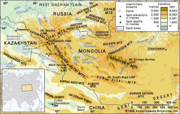
The Sayan Mountains are a large upland region situated along the frontiers of east-central Russia and Mongolia.2
Within Russia, the mountains are located in the following areas:
- The southern parts of the Krasnoyarsk kray (territory) and Irkutsk oblast (region).2
- The northern part of Tyva (Tuva).2
- The western part of Buryatiya.2
The range forms a rough arc, stretching from the Altai Mountains in the west to Lake Baikal in the east. The system is divided into western and eastern ranges, which meet at a central mountain knot where elevations exceed 10,000 feet (3,000 meters). The Eastern Sayan range is notably higher than the western portion and includes Mount Munku-Sardyk, which reaches an elevation of 11,453 feet (3,491 meters).23
How do rivers change names as they flow?
Rivers generally maintain consistent names throughout their courses, but they can undergo renaming due to historical, political, or cultural factors rather than natural processes. While a river system may be formed by the confluence of multiple tributaries, the resulting main stem typically retains a single name.67
Instances where a river’s name changes often stem from human intervention:
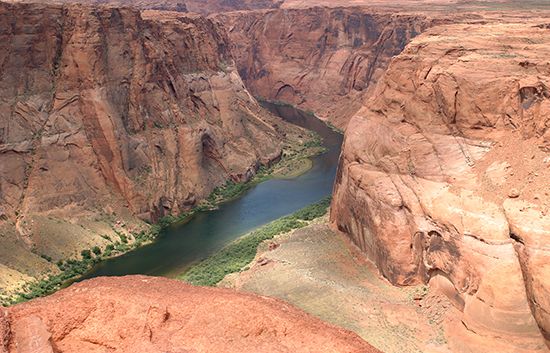
- Political and Regional Identity: Names may be altered to reflect regional pride or political shifts. For example, the western Colorado River was known as the Grand River until 1921, when it was officially renamed by the U.S. Congress to align with the state of Colorado.7
- Exploration and Mapping Errors: Early explorers and mapmakers sometimes applied the same name to different bodies of water due to confusion, leading to multiple rivers sharing names, such as the two distinct Colorado Rivers in the United States.7
- Historical Layers: Because river names are highly conservative, they often persist through different populations, serving as historical markers of past cultures even when political boundaries or languages change.6
Sources
- Chuna River — Encyclopædia Britannica
- Sayan Mountains — Encyclopædia Britannica
- Yenisey River - Physical features — Encyclopædia Britannica
- Yenisey River - Physiography — Encyclopædia Britannica
- Sayan Mountains — Merriam-Webster
- Name - Place-names reflecting historical influences — Encyclopædia Britannica
- Why are there two Colorado Rivers? — Encyclopædia Britannica
- Did you know? — Merriam-Webster
- confluents — Merriam-Webster
Published on · 2 min read