Deseado River
The Deseado River is a river located in southern Argentina that spans approximately 380 miles (610 km) in length. It originates in the Andes near Lake Buenos…
What is Deseado River?
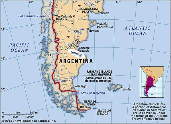
The Deseado River is a river located in southern Argentina that spans approximately 380 miles (610 km) in length. It originates in the Andes near Lake Buenos Aires and flows eastward and southeastward through the Santa Cruz province.1
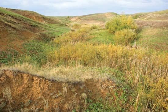
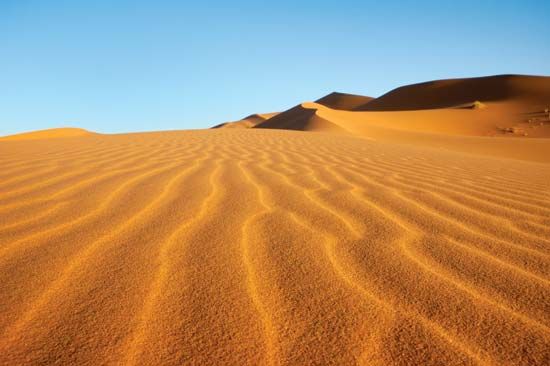
The river is notable for its intermittent nature; it often disappears into the dry soils of Patagonia before reemerging to empty into the Atlantic at Puerto Deseado. Because it can dry up along parts of its course, it is significantly altered by wind and sand, leaving little surface evidence of its flow in certain areas. Despite these characteristics, the river is utilized for irrigation along its lower course.12
What is the geography of the Patagonia region?
Patagonia is a vast, semiarid region covering approximately 260,000 square miles (673,000 square kilometers) across the southern portion of mainland Argentina and parts of Chile. Its geography is defined by a dramatic transition from the rugged Patagonian Andes in the west to a sprawling steppe and desert plateau that extends to the Atlantic Ocean.34
Physical Features and Climate
The region’s climate is heavily influenced by the Andes, which block humid winds from the Pacific, leaving the eastern plains dry and cold. Patagonia is generally divided into two climatic zones:5
- Northern Zone: Semiarid with mean temperatures between 54 and 68 °F (12 and 20 °C) and strong, dry southwest winds.5
- Southern Zone: A colder, harsher environment with heavy winter snows, frequent frosts, and mean temperatures ranging from 40 to 55 °F (4 to 13 °C).5
Drainage and Landscape
The landscape is characterized by deep, wide valleys that once carried water from the Andes to the Atlantic. Today, many of these are dry or contain only intermittent streams, such as the Deseado River, due to the effects of wind and sand. The contact zone between the tablelands and the Andes features numerous lakes formed in glacial troughs.6
Biodiversity
Vegetation varies from deciduous Andean forests to xerophytic shrubs and wiry grasses on the steppe. The region supports unique wildlife, including guanacos, rheas, and pumas, while the Valdés Peninsula is a critical habitat for marine mammals like whales and elephant seals.4
How do rivers in arid climates disappear into the ground?
In arid and semiarid climates, rivers often appear to disappear into the ground because they are ephemeral streams, frequently referred to as arroyos, wadis, or dry washes. These watercourses are typically dry for most of the year and only flow during seasonal or irregular rainstorms.
As these streams move downstream, they often become shallower, and a significant portion of their water is absorbed directly into the dry streambed. This process is a form of groundwater recharge, where water drains through the soil to replenish aquifers—underground rock layers that store and transmit water. In these arid environments, the lack of continuous vegetation cover and the porous nature of the soil facilitate this rapid absorption. Additionally, high rates of evaporation and the diversion of water for irrigation and other human uses can further contribute to the reduction or total loss of surface flow before a river reaches its final destination.789
What are some other major rivers in Argentina?
Argentina features a diverse network of rivers, ranging from the massive systems in the north to the glacial-fed streams of the south.
The Paraguay–Paraná–Río de la Plata System
This is the largest river basin in the country, draining northern Argentina and neighboring nations.11
- Paraná River: The principal river of the system, it flows through Argentine territory and serves as a vital transport route for agriculture and industry.1112
- Uruguay River: Another major system that flows into the Río de la Plata estuary, forming part of the border between Argentina, Brazil, and Uruguay.1113
- Tributaries: Key tributaries include the Iguazú, Pilcomayo, Bermejo, Salado, and Carcarañá rivers.11
Other Notable Rivers
- Patagonian Rivers: These rivers flow from the Andes toward the Atlantic, often diminishing in volume as they cross arid lands. Major examples include the Colorado, Negro, Santa Cruz, and Chubut rivers.1114
- Northwestern Rivers: The Desaguadero River and its tributaries, such as the San Juan, Mendoza, and Diamante, provide essential water to the deserts of Mendoza province.11
Sources
- Deseado River — Encyclopædia Britannica
- Patagonia - Drainage and soils — Encyclopædia Britannica
- Patagonia - Climate — Encyclopædia Britannica
- Andes Mountains - Physiography of the Southern Andes — Encyclopædia Britannica
- Patagonia — Encyclopædia Britannica
- Argentina - Patagonia and Tierra del Fuego — Encyclopædia Britannica
- arroyo — Encyclopædia Britannica
- aquifer — Encyclopædia Britannica
- valley - Paleovalleys — Encyclopædia Britannica
- conservation - In fresh water — Encyclopædia Britannica
- Argentina - Drainage — Encyclopædia Britannica
- Paraná River — Encyclopædia Britannica
- Río de la Plata - Physiography of the Uruguay basin — Encyclopædia Britannica
- Chubut River — Encyclopædia Britannica
Published on · 3 min read