Camú River
The Camú River is a river located in the north-central and northeastern regions of the Dominican Republic.
What is Camú River?
The Camú River is a river located in the north-central and northeastern regions of the Dominican Republic.1
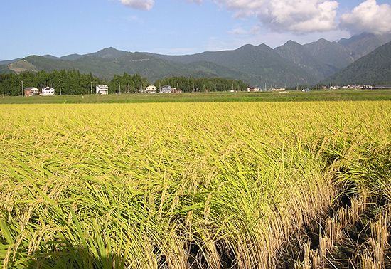
Spanning approximately 50 miles (80 km) in length, the river originates from headstreams in the Cordillera Central near La Vega, with additional tributaries flowing from the Cordillera Septentrional near Moca. The river follows a generally eastward course across the fertile La Vega Real region before merging with the Yuna River southeast of Pimentel. A significant portion of the river’s utility comes from a network of canals that branch out from the Camú and its tributaries, which are primarily used for the irrigation of rice crops.1
What is the significance of the Cordillera Central mountain range?
The Cordillera Central is the most rugged and imposing mountain range in the Dominican Republic, serving as a vital geographical and hydrological feature of the nation.23
Its significance includes:
- Hydrological Source: The range acts as the primary watershed for the country. It is the source of the headstreams for three of the nation’s most important river systems: the Yuna River, the Yaque del Norte, and the Yaque del Sur.23
- Highest Elevation: It contains Duarte Peak, which, at 10,417 feet (3,175 meters), is the highest mountain in the West Indies.23
- Climate Regulation: The range significantly influences local climate patterns. Its high elevation results in cooler temperatures—averaging 69 °F (21 °C)—compared to the coastal plains, and its slopes capture moisture from trade winds, affecting rainfall distribution across the island.4
- Economic and Natural Resources: While settlement is sparse due to the rugged terrain, the range supports limited forestry, specifically in its pine forests.25
How does the Yuna River impact the Dominican Republic’s geography?
The Yuna River is one of the three most significant river systems in the Dominican Republic, playing a crucial role in shaping the nation’s geography and economy.8
Originating from headstreams in the Cordillera Central, the river flows northeast into the Cibao Valley, where it waters the humid and fertile La Vega Real region. By traversing this valley, the Yuna supports a diverse agricultural output, including coffee, tobacco, cacao, corn, and rice. Its lower course, which eventually empties into Samaná Bay, crosses marshy lowlands and provides essential irrigation for rice cultivation.89
Geographically, the Yuna system—often referred to as the Camú-Yuna system—is a primary contributor to the fertile alluvial soils that characterize the country’s most productive agricultural landscapes. While the river spans approximately 100 miles, only its lower reaches are navigable, serving as a vital drainage artery for the eastern portion of the Cibao Valley.38
Why is the La Vega Real region important for agriculture?
The La Vega Real region is a cornerstone of the Dominican Republic’s agricultural economy due to its exceptionally fertile soil and humid climate. Named by Christopher Columbus during his second voyage, the region is watered by the Yuna River, which provides the necessary irrigation to sustain a diverse range of crops.9
Key agricultural products from the region include:
- Cacao and Coffee: Major export crops that thrive in the area’s humid conditions.910
- Tobacco: A long-standing staple of the region’s agricultural output.910
- Rice and Corn: Essential food crops supported by the fertile alluvial plains.910
- Fruits and Cattle: The region also supports fruit production and livestock farming.10
Beyond its natural fertility, the region serves as a vital commercial and transportation hub, with cities like La Vega acting as centers for manufacturing and the distribution of these agricultural goods to the rest of the country.10
Sources
- Camú River — Encyclopædia Britannica
- Cordillera Central — Encyclopædia Britannica
- Dominican Republic - Relief, drainage, and soils — Encyclopædia Britannica
- Andes Mountains - Geology — Encyclopædia Britannica
- Andes Mountains - Plant and animal life — Encyclopædia Britannica
- Dominican Republic - Climate — Encyclopædia Britannica
- Dominican Republic - Agriculture, fisheries, and forestry — Encyclopædia Britannica
- Yuna River — Encyclopædia Britannica
- Cibao Valley — Encyclopædia Britannica
- La Vega — Encyclopædia Britannica
Published on · 3 min read