Chambeshi River
The Chambeshi River is a river located in northeastern Zambia. It originates in the hills near the Tanzanian border at an elevation of 5,760 feet (1,760…
What is Chambeshi River?
The Chambeshi River is a river located in northeastern Zambia. It originates in the hills near the Tanzanian border at an elevation of 5,760 feet (1,760 meters) above sea level,760 meters) above sea level.1
The river flows for approximately 300 miles (480 km) southwest into the Bangweulu swamps. These swamps regulate annual flooding by slowly releasing water through various channels and lagoons, eventually emerging as the Luapula River.2
The Chambeshi is recognized as the remotest source of the Congo River, making it the river’s original main stream in terms of total length. While it holds this distinction, the Lualaba River is often considered the Congo’s main stream in terms of water volume.1
What role do the Bangweulu swamps play in the river’s ecosystem?
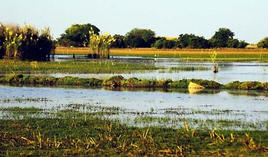
The Bangweulu swamps play a critical role in the Chambeshi River ecosystem by acting as a natural regulator for the river’s flow. Because the region features a low gradient, the swamps—formed by extensive vegetation growth—serve as a check against annual flooding.13
Instead of allowing floodwaters to surge downstream rapidly, the swamps capture and release the water slowly through a complex network of lagoons and channels. This process allows the water to eventually emerge as the Luapula River once the slope increases again.13
The ecosystem is defined by distinct vegetation zones that support this hydrological function, including:
- Phragmites communis (common water reed) growing just above the mean water level.3
- A zone of papyrus at the water level.3
- Floating grass, known as hippo-grass, in deeper water.3
Additionally, these wetlands provide a habitat for diverse wildlife, including various bird species and aquatic life, and are a significant source of fish for the surrounding region.34
How does the Lualaba River compare to the Chambeshi in terms of water volume?
While the Chambeshi River is recognized as the remotest source of the Congo River, making it the original main stream in terms of total length, it does not carry the most water.
The Lualaba River is considered the Congo’s main stream in terms of water volume because it carries a greater quantity of water than the Chambeshi.5
What are some of the major geographical features of the Congo River basin?
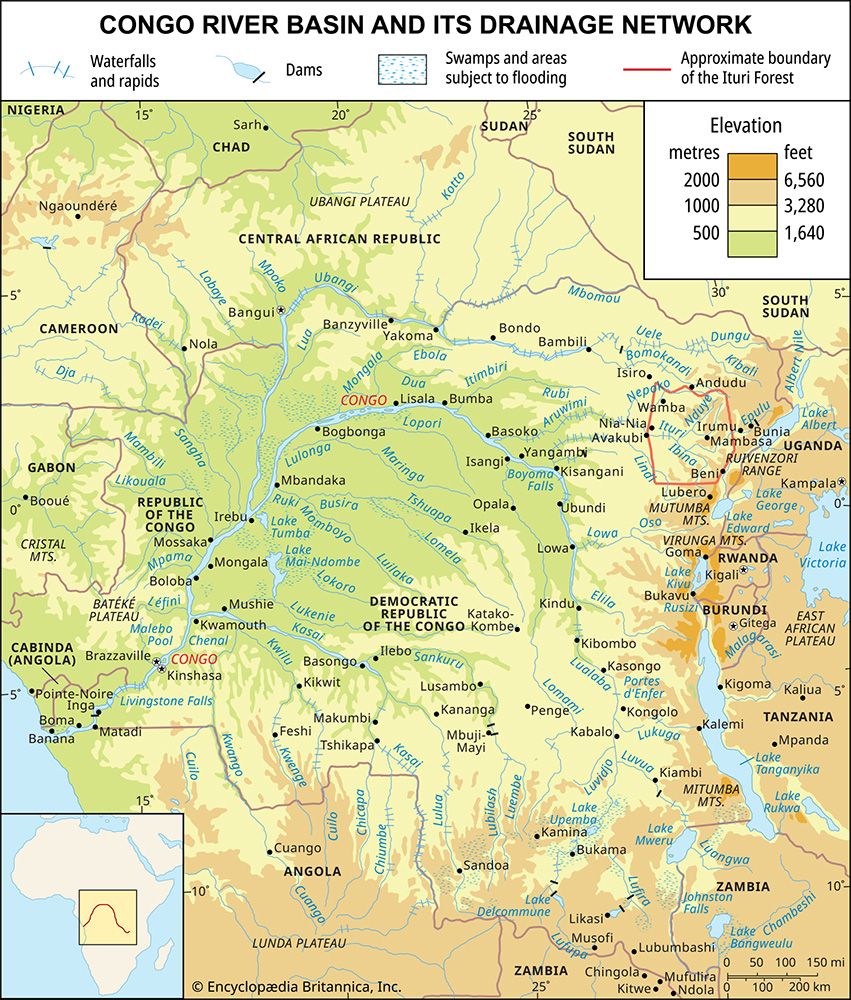
The Congo basin is a vast, hydrographic depression in west-central Africa, covering over 1.3 million square miles. It is characterized by several distinct geographical features:
- The Central Depression (Cuvette): At the heart of the basin lies an immense, saucer-shaped depression known as the cuvette. It contains thick layers of Quaternary alluvial deposits, including sands and sandstones, which have accumulated over millions of years due to a persistent tendency toward subsidence in the region.95
- Surrounding Highlands: The basin is enclosed by an almost circular rim of highlands. Concentric slopes, ranging from 900 to 1,500 feet in elevation, channel a fan-shaped web of tributaries toward the central depression.9105
- River System and Navigation: The Congo River system is defined by three contrasting sections:
- Upper Congo: Characterized by confluences, lakes (such as Lake Upemba), and numerous waterfalls and rapids that limit navigation.5
- Middle Congo: A navigable, steady stretch flowing through an alluvial plain, often widening significantly and containing many islands.5
- Lower Congo: Marked by cataracts, rapids, and a deep gorge that cuts through the Cristal Mountains before reaching the Atlantic Ocean via a swampy estuary.105
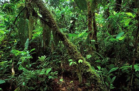
- Vegetation Zones: The basin hosts the world’s second-largest rainforest, which covers the central depression. This forest is bordered by belts of savanna that transition into wooded savanna farther from the Equator.9
Sources
- Chambeshi River — Encyclopædia Britannica
- Congo River — Encyclopædia Britannica
- Bangweulu — Encyclopædia Britannica
- Zambia - Plant and animal life — Encyclopædia Britannica
- Lualaba River — Encyclopædia Britannica
- river - Hydraulic geometry — Encyclopædia Britannica
- hydrologic sciences - Runoff and stream discharge — Encyclopædia Britannica
- Congo River - Physiography — Encyclopædia Britannica
- Congo basin — Encyclopædia Britannica
- Africa - Congo basin — Encyclopædia Britannica
Published on · 3 min read