Coutchiching Series
The Coutchiching Series is a geological division of rocks located in northern Minnesota and Ontario, dating back approximately 2.6 billion years to the…
What is Coutchiching Series?
The Coutchiching Series is a geological division of rocks located in northern Minnesota and Ontario, dating back approximately 2.6 billion years to the Precambrian Time.1
These rocks are primarily sedimentary in origin and have undergone varying degrees of metamorphism. While some geologists have historically argued that the Coutchiching Series is older than the neighboring Keewatin Series, this remains a subject of debate. Current evidence suggests that the two series are likely interbedded with volcanic lava flows and are, at least in part, equivalent in age. Further stratigraphic study is required to fully resolve their relationship.1
What is the Keewatin Series?
The Keewatin Series is a division of Precambrian rocks found in northern Minnesota and Ontario. These strata are closely associated with the Coutchiching Series, which appears to underlie the Keewatin in some locations.12
Key characteristics and relationships include:
- Composition: The Keewatin Series is noted for containing lava flows that are likely interbedded with the sedimentary rocks of the Coutchiching Series.1
- Age and Correlation: While some geologists have historically classified the Keewatin as younger than the Coutchiching, current evidence suggests they are at least partially equivalent in age.1
- Stratigraphic Position: The Keewatin Series is overlain by the Seine Series, from which it is separated by an unconformity—a surface representing a significant period of erosion. This erosion exposed the granitic cores of mountains formed during the Keewatin period, which were subsequently incorporated as boulders into the conglomerate base of the overlying Seine Series.2
How do geologists determine the age of ancient rocks?
Geologists determine the age of ancient rocks using two primary approaches: relative dating and absolute dating.5
Relative Dating
Relative dating establishes the chronological order of events without providing a specific numerical age. This method relies on principles such as the law of superposition, which states that in an undisturbed sequence of sedimentary rock layers, the oldest strata are at the bottom and the youngest are at the top. Geologists also analyze crosscutting relationships—such as faults or igneous intrusions—to determine if a feature is younger or older than the surrounding rock. By integrating data from widely spaced outcrops and using fossil records, scientists can correlate rock units across different regions.567
Absolute Dating
Absolute dating provides a numerical age by measuring the decay of radioactive isotopes trapped within minerals8. As radioactive parent atoms decay into stable daughter elements at a known rate, geochronologists can calculate the time elapsed since the rock or mineral formed. Common techniques include:57
- Uranium-Lead Dating: Highly precise and effective for dating rocks billions of years old.87
- Potassium-Argon Dating: Used for potassium-bearing minerals.9
- Other Methods: Techniques involving rubidium-strontium, samarium-neodymium, and rhenium-osmium are also employed depending on the rock’s composition.9
These methods allow scientists to calibrate the geologic time scale and date Earth’s oldest rocks, some of which exceed 4 billion years in age.75
What are the main features of the Canadian Shield?
The Canadian Shield is a vast geologic continental shield that serves as the craton, or continental interior, of North America. Covering approximately 8 million square kilometers, it occupies about half of Canada and extends into the United States and Greenland.1213
Geological Composition
The shield is the largest mass of exposed Precambrian rock on Earth. It is composed of ancient crystalline rocks that have undergone a complex history of orogeny (mountain building), uplift, and erosion.1213
Landscape and Glacial Impact
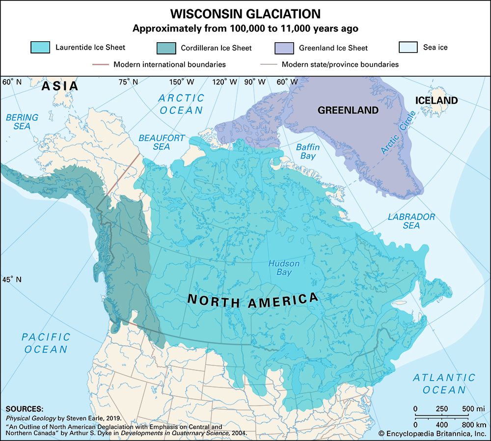
While the region was once mountainous, long-term erosion reduced it to a relatively low-relief plain. Its current appearance is largely defined by Pleistocene Epoch glaciation, which stripped away weathered soil and created a “rock-knob” landscape. This process left behind:
- Abundant Water: Hundreds of thousands of lakes and swamps occupying basins carved by ice.1413
- Glacial Deposits: Features such as eskers (long ridges of sediment) and fields of erratics.14
- Varied Relief: Most of the shield lies below 600 meters, though it rises significantly in the northeast, reaching over 1,500 meters in Labrador and Baffin Island.1413
Economic and Human Significance
The shield is rich in minerals, including gold, copper, nickel, and uranium, which have driven industrial development. However, the region’s thin, acidic soil makes agriculture difficult, resulting in low population density and few large cities.141513
Sources
- Coutchiching Series — Encyclopædia Britannica
- North America - 2.6 to 2.0 billion years ago — Encyclopædia Britannica
- Seine Series — Encyclopædia Britannica
- North America - 3.0 to 2.6 billion years ago — Encyclopædia Britannica
- dating: Top Questions — Encyclopædia Britannica
- dating - Origin of radioactive elements used — Encyclopædia Britannica
- stratigraphy — Encyclopædia Britannica
- dating - Distinctions between relative-age and absolute-age measurements — Encyclopædia Britannica
- geology - Historical geology and stratigraphy — Encyclopædia Britannica
- Precambrian - Age and correlation of granulite-gneiss belts — Encyclopædia Britannica
- Precambrian - Precambrian life — Encyclopædia Britannica
- Canadian Shield: Top Questions — Encyclopædia Britannica
- Canada - The Canadian Shield — Encyclopædia Britannica
- Canada - Minerals — Encyclopædia Britannica
- Canadian Shield — Encyclopædia Britannica
Published on · 3 min read