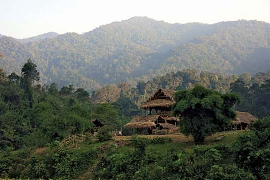
Dângrêk Mountains
The Dângrêk Mountains are a forested range of hills that serve as a natural border between Thailand and Cambodia. Extending approximately 200 miles (320 km)…
What is Dângrêk Mountains?
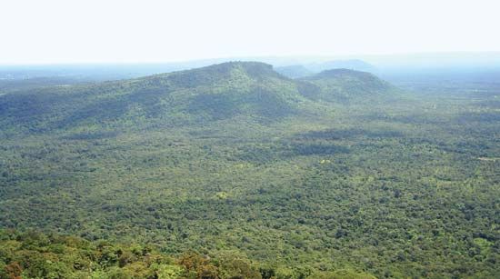
The Dângrêk Mountains are a forested range of hills that serve as a natural border between Thailand and Cambodia. Extending approximately 200 miles (320 km) from the Mekong River in the east, the range acts as the southern escarpment of the Khorat Plateau.1
The topography of the range is asymmetrical: it slopes gradually to the north toward the Mun River in Thailand, while it drops abruptly to the south, forming a steep, southward-facing cliff above the Cambodian plain. The mountains average between 1,500 and 2,000 feet (450–600 m) in elevation, with the highest point reaching 2,497 feet (761 m). Composed largely of sandstone, the range represents a significant geological feature defining the northern boundary of the Cambodian lowlands.12
What is the significance of the Preah Vihear Temple in this region?
The Temple of Preah Vihear is a significant historical and cultural site located in the Dângrêk Mountains, dedicated to the worship of Shiva. Its importance is defined by both its architectural heritage and its role as a focal point of long-standing territorial disputes between Thailand and Cambodia.34
Historically, the temple was returned to Cambodia under the 1907 Franco-Siamese treaty, a decision that has remained a source of resentment in Thailand. Following decades of regional instability, the site gained international prominence when it was designated a UNESCO World Heritage site in 2008. This recognition triggered renewed border clashes between 2008 and 2011, leading to casualties and displacement.34
The International Court of Justice (ICJ) has intervened multiple times to resolve the conflict. In 1962, the court ruled the temple belonged to Cambodia, and in 2013, it further clarified that both the temple and its immediate vicinity fall within Cambodian territory.3
How does the Khorat Plateau influence the climate of northeastern Thailand?
The Khorat Plateau influences the climate of northeastern Thailand primarily through its topography, which creates a rain-shadow effect along its western margins. This phenomenon occurs as the plateau’s surrounding ranges, such as the Phetchabun and Phang Hoei mountains, intercept moisture-laden winds, leading to less-pronounced precipitation patterns compared to other regions.56
The plateau experiences a distinct seasonal climate driven by the tropical monsoon cycle. During the rainy season (April–November), the region’s impermeable soils often become flooded. Conversely, the dry season is characterized by parched conditions. The northeast monsoon, which occurs between November and February, brings cooler, drier air to the area, often resulting in frequent morning fogs that typically dissipate by midday. Overall, the plateau’s saucer-shaped tableland structure and elevation contribute to these localized weather variations within the broader climate of mainland Southeast Asia.56
What are the main geographical features of the Mekong River?
The Mekong River is a massive waterway stretching from the Plateau of Tibet to the South China Sea, draining over 313,000 square miles. Its geography is typically divided into two major sections based on its descent from the Yunnan highlands.7
Upper and Lower Mekong
- Upper Mekong: Flows 1,215 miles through a long, narrow, and rugged valley in southwestern China, originating at over 16,000 feet in the Tanggula Mountains.78
- Lower Mekong: Spanning 1,485 miles, this section drains the Khorat Plateau, the Annamese Cordillera, and most of Cambodia.7
Physiographic Regions
The lower basin is categorized into six distinct sections:
- Northern Highlands: Characterized by highly folded, steep ranges reaching 9,000 feet.8
- Khorat Plateau: A region of gently rolling hills and flat alluvial plains.8
- Eastern Highlands: Part of the Annamese Cordillera, featuring rapid streams in narrow valleys.8
- Southern Lowlands: Includes the Khone Falls and the Tonle Sap, a vital lake that expands significantly during flood seasons.8
- Southern Highlands: Comprised of the Dâmrei and Krâvanh mountains Krâvanh mountains.9
- Delta: A 25,000-square-mile area in southern Vietnam featuring distributary channels, levees, and swampy terrain.78
Sources
- Dângrêk Mountains — Encyclopædia Britannica
- Cambodia - Relief — Encyclopædia Britannica
- Thailand-Cambodia Conflict - French-era borders and the Temple of Preah Vihear — Encyclopædia Britannica
- Cambodia - Cultural institutions — Encyclopædia Britannica
- Khorat Plateau — Encyclopædia Britannica
- Thailand - Climate — Encyclopædia Britannica
- Mekong River - Physical features — Encyclopædia Britannica
- Mekong River - Climate and hydrology — Encyclopædia Britannica
- Mekong River - Physiography — Encyclopædia Britannica
Published on · 3 min read