Discovery Bay
Discovery Bay is a wide, curved bay located on the southern coast of Australia. As an inlet of the Indian Ocean, it spans 50 miles (80 km) and is defined by…
What is Discovery Bay?
Discovery Bay is a wide, curved bay located on the southern coast of Australia. As an inlet of the Indian Ocean, it spans 50 miles (80 km) and is defined by Cape Bridgewater in Victoria to the east and Cape Northumberland in South Australia to the west.1
The bay was visited in 1800 by James Augustus Grant of the Royal Navy and was later named in 1836 by Thomas Livingstone Mitchell, who reached the area while descending the Glenelg River. While settlement remains sparse along the eastern shore, the area around Port Macdonell in the west is more densely populated.1
Who was Thomas Livingstone Mitchell?
Sir Thomas Livingstone Mitchell (1792–1855) was a prominent Scottish-born surveyor and explorer who served as the surveyor general of New South Wales, Australia.3
Before his work in Australia, Mitchell served as a soldier during the Peninsular War, where he specialized in topographical intelligence. He arrived in New South Wales in 1827 and succeeded John Oxley as surveyor general in 1828, eventually overseeing all colonial roads, bridges, and surveying operations.3
Mitchell led several significant expeditions:
- 1831–1836: He explored the region between the Castlereagh and Gwydir rivers, traced the Darling River, and surveyed the Murray River basin, naming the region “Australia Felix” (modern-day Victoria). During this time, he also named Discovery Bay while descending the Glenelg River Glenelg River.31
- 1845–1846: He conducted a fourth expedition attempting to find an overland route to Port Essington.3
Mitchell was knighted in 1839 and authored several influential works, including Three Expeditions into Eastern Australia and The Australian Geography.3
What is the significance of the Glenelg River?
The Glenelg River is a significant waterway in southwestern Victoria, Australia, spanning over 280 miles (450 km). Its importance is defined by both its historical exploration and its role in regional infrastructure:
- Water Management: Although the river is prone to drying up, it is dammed to create the Rocklands Reservoir. This reservoir holds 272,000 acre-feet (336,000,000 cubic meters) of water and serves as a vital component of the Wimmera-Mallee Stock and Domestic Supply System.4
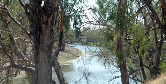
- Historical Exploration: Originally known as the Nangeela, the river was surveyed in 1836 by Thomas Mitchell, the surveyor general of New South Wales. Mitchell renamed the river to honor Lord Glenelg, who served as the British secretary of state for the colonies at that time.4
- Geography: The river flows from the Grampians to Discovery Bay, where its mouth is notably deflected by coastal sand dunes near the South Australian border.4
How do coastal bays form in geography?
Coastal bays are concavities in a coastline formed primarily through the differential erosion of rock formations.
The process typically occurs where softer, more easily eroded rocks—such as clays, silts, or certain sandstones—are situated between harder, more resistant formations like granite or massive limestone. As waves approach the shore, they are refracted by the shallower seabed, causing them to concentrate their energy on the softer materials. This leads to more rapid erosion of the softer rock, creating a semicircular or nearly circular indentation, while the harder rocks remain as projecting promontories.5
In addition to wave-driven erosion, some larger bays are formed by:
- Vertical earth movements: Shifts in the Earth’s crust that create depressions.5
- Glacial erosion: The carving of land by massive ice sheets, as seen in the formation of Hudson Bay.5
- Tidal action: The rise and fall of tides can contribute to the erosion of coastlines and the transport of sediment, further shaping these features.67
Sources
- Discovery Bay — Encyclopædia Britannica
- Lantao Island — Encyclopædia Britannica
- Sir Thomas Livingstone Mitchell — Encyclopædia Britannica
- Glenelg River — Encyclopædia Britannica
- bay — Encyclopædia Britannica
- list of bays and gulfs — Encyclopædia Britannica
- coastal landforms - Tides — Encyclopædia Britannica
Published on · 3 min read