Dunajec River
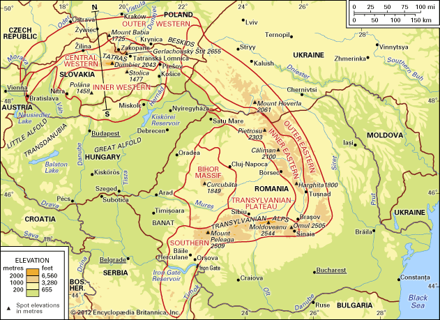
The Dunajec River is a 156-mile (251-km) waterway located in southern Poland. It originates in the Tatra Mountains near the border with Slovakia and flows…
What is Dunajec River?
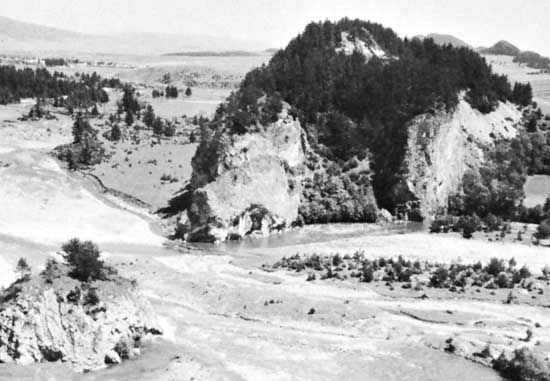
The Dunajec River is a 156-mile (251-km) waterway located in southern Poland. It originates in the Tatra Mountains near the border with Slovakia and flows northeast until it joins the Vistula River.1
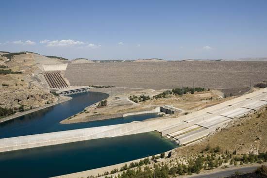
The river serves as a source of hydropower, with dams constructed at Rożnów, Czchów, and Czorsztyn. The latter project required a border modification between Poland and Czechoslovakia in 1975. Historically, the river was the site of significant combat during World War I, specifically during a German breakthrough of Russian defensive lines. Today, the river is well-known for recreational activities, particularly canoeing through the scenic Pieniny gorge.1
What are the Tatra Mountains?
The Tatra Mountains are the highest range within the Central Carpathians. Stretching approximately 40 miles (64 km) along the border between Poland and Slovakia, the range varies in width from 9 to 15 miles (14 to 24 km).2
Geography and Climate
The range is characterized by steep rises from high plateaus and features roughly 300 named peaks. The highest point is Gerlachovský Peak, reaching 8,711 feet (2,655 meters). While the Tatras lack glaciers, their rugged terrain is often compared to the Alps. The region includes high-lying lakes, hanging valleys, and distinct ecological zones, ranging from spruce woodlands up to 6,300 feet (1,900 meters) to alpine zones above. The climate is continental, with mean annual temperatures dropping to about 25 °F (−4 °C) in the High Tatras.234
Conservation and Recreation
The area is protected by two national parks:
- Tatra National Park (Poland): 82 square miles (212 square km)2
- Tatry National Park (Slovakia): 286 square miles (741 square km)2
The mountains are a popular destination for summer and winter sports and are home to diverse fauna, including bears, chamois, marmots, and eagles.2
How does the Vistula River impact Poland?
The Vistula River is central to Poland’s geography, economy, and history. As the nation’s largest river, it drains more than 85 percent of its basin within Polish territory, serving as a vital artery that connects southern industrial centers to the Baltic Sea via the port of Gdańsk.
Economic and Industrial Impact
The river has long been a major trade route, historically transporting salt, timber, and grain. Today, it supports large industrial projects attracted by water access and cost-effective bulk transport. To maximize its potential, the river has been integrated into a broader waterway system, including links to the Oder River via the Bydgoszcz Canal. Post-World War II efforts focused on developing the river’s hydroelectric potential and improving navigation for freight barges.567
Environmental and Urban Influence
The Vistula flows through major cities, including Warsaw and Kraków, and its valley is a hub for tourism and health resorts. However, the river also presents challenges; its low gradient and sandbanks can make navigation difficult, and spring ice dams frequently threaten surrounding areas with flooding. The fertile soils of the delta, known as Żuławy, remain a significant agricultural asset.87
What is the significance of the Pieniny gorge?
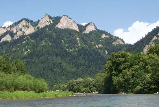
The Pieniny gorge, carved by the Dunajec River, is a significant natural landmark located along the border between Poland and Slovakia. Its primary significance lies in its role as a premier destination for outdoor recreation, particularly for canoeing and white-water activities, which draw large numbers of tourists to the region.19
Beyond its recreational value, the area is ecologically important. The gorge is protected within the Pieniny National Park, which is managed through a cooperative administrative agreement between Polish and Slovak authorities. This park, along with others in the region, preserves unique wilderness areas that feature diverse alpine flora and fauna, including relict species that date back to the Pleistocene Epoch.9
Sources
- Dunajec River — Encyclopædia Britannica
- Tatra Mountains — Encyclopædia Britannica
- Slovakia - Climate — Encyclopædia Britannica
- Slovakia - Relief — Encyclopædia Britannica
- Vistula River — Encyclopædia Britannica
- Vistula River - History — Encyclopædia Britannica
- Vistula River - The economy — Encyclopædia Britannica
- Vistula River - Physiography — Encyclopædia Britannica
- Slovakia - Sports and recreation — Encyclopædia Britannica
Published on · 3 min read