Fergana Valley
The Fergana Valley has historically served as a vital crossroads in Central Asia due to its unique geography and position along major trade routes. Nestled…
How has the Fergana Valley’s strategic location influenced its historical importance?
The Fergana Valley has historically served as a vital crossroads in Central Asia due to its unique geography and position along major trade routes. Nestled between the Tien Shan and the Gissar and Alay mountain systems, the valley provided fertile, irrigated land that supported sedentary agriculture for centuries.1
Its strategic importance was cemented by its role on the Silk Road, the ancient network connecting China to the West. Near the city of Osh, a stone tower historically marked the symbolic watershed between East and West, making the valley a critical transit point for merchants and travelers.2
This location made the region a frequent target for conquest. Throughout history, it was controlled by various powers, including the Arabs, Genghis Khan, and Timur, before the Khanate of Kokand ruled until the Russian conquest in 1876. Its position as a gateway between mountain ranges and the western steppes ensured its status as a densely populated and economically significant hub.1
What are the main geographical features of the Fergana Valley?
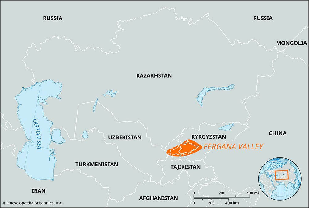
The Fergana Valley is a vast, roughly triangular depression covering 8,500 square miles (22,000 square km) across Uzbekistan, Tajikistan, and Kyrgyzstan. Its primary geographical features include:
- Mountain Borders: It is enclosed by the Tien Shan system, specifically the Chatkal and Kurama mountains (northwest), the Fergana Mountains (northeast), and the Alay and Turkistan ranges (south), which rise above 16,500 feet (5,000 meters).
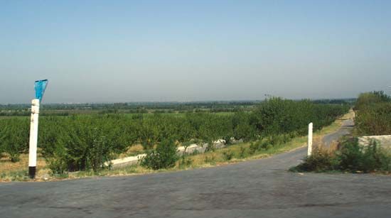
- Topography: The valley floor slopes from over 3,300 feet (1,000 meters) in the east to 1,050 feet (320 meters) at Khujand. A belt of barren hills known as adyr separates the mountains from the fertile central plains, which contain salt marshes and sand dunes.
- Hydrology: The Syr Darya flows along the northern edge, formed by the confluence of the Naryn and Qoradaryo rivers. Numerous other rivers descend from the mountains, though most are diverted for extensive irrigation systems.
- Climate: The region experiences a continental climate characterized by hot summers, moderately cold winters, and low precipitation.
Where is the Fergana Valley located, and which countries does it span?
The Fergana Valley is an enormous depression located in Central Asia, situated between the Tien Shan and the Gissar and Alay mountain systems.1
The valley spans three countries:
- Uzbekistan (the majority of the valley lies in the eastern part of the country)1
- Tajikistan1
- Kyrgyzstan1
What is the climate like in the Fergana Valley, and how does it affect agriculture?
The Fergana Valley experiences a continental climate characterized by hot summers and moderately cold winters, with low overall precipitation, particularly in the western regions. In the summer, mean temperatures in July can reach approximately 81 °F (27 °C), while January mean temperatures hover around 25 °F (−4 °C).168
This climate significantly shapes the region’s agricultural practices:
- Irrigation Dependency: Because precipitation is low, sedentary agriculture relies heavily on water diverted from the numerous rivers descending from the surrounding mountains.1
- Infrastructure: Extensive irrigation networks, such as the Great Fergana Canal, the Southern Fergana Canal, and the Northern Fergana Canal, are essential for sustaining the fertile oases that surround the valley’s central salt marshes and sand dunes.16
- Primary Crops: These conditions support a highly productive agricultural economy, making the valley a major producer of cotton, fruit, and raw silk through sericulture1.6
Sources
- Fergana Valley — Encyclopædia Britannica
- road - The Silk Road — Encyclopædia Britannica
- Fergana — Encyclopædia Britannica
- Syr Darya — Encyclopædia Britannica
- list of valleys — Encyclopædia Britannica
- Fergana — Encyclopædia Britannica
- Uzbekistan - Relief — Encyclopædia Britannica
- Tien Shan - Climate — Encyclopædia Britannica
Published on · 3 min read