Fouta Djallon
The Fouta Djallon is a mountainous region located in west-central Guinea. It serves as one of the country's four primary geographic regions, situated inland…
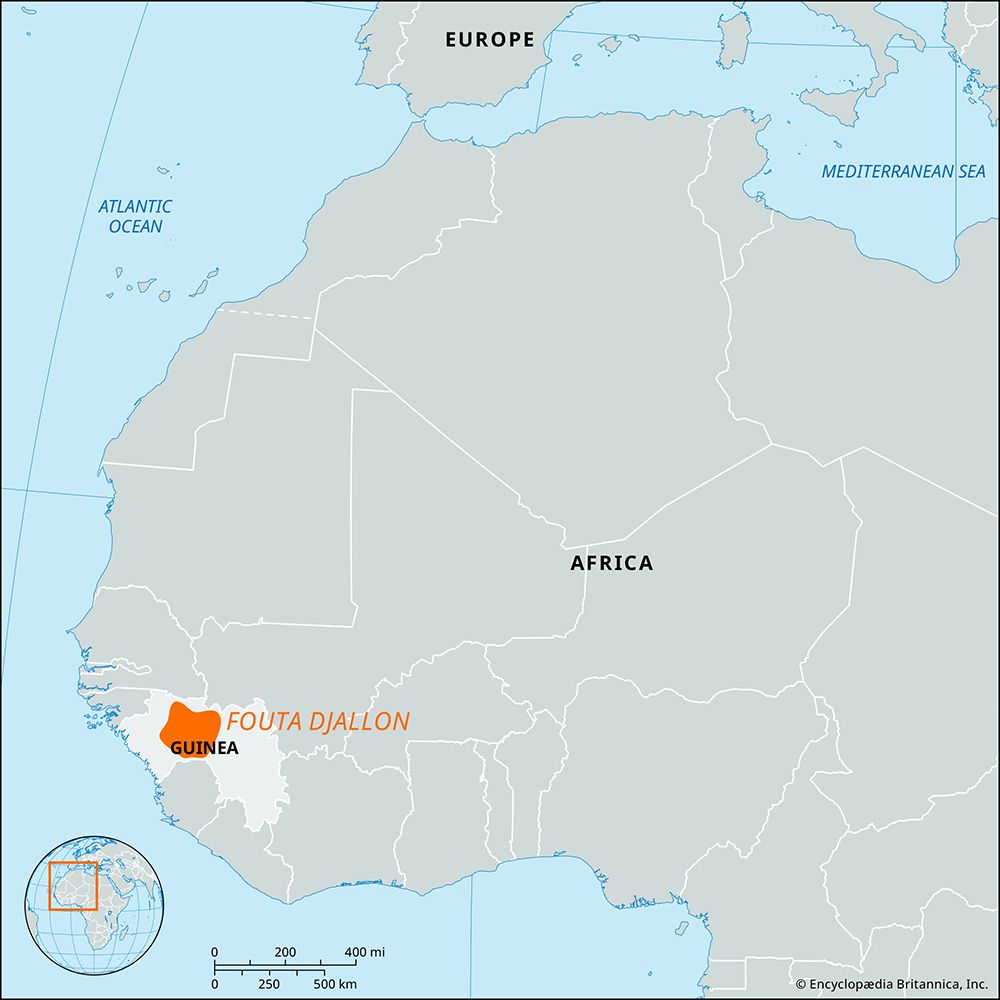
Where exactly is the Fouta Djallon region located in Guinea?
The Fouta Djallon is a mountainous region located in west-central Guinea. It serves as one of the country’s four primary geographic regions, situated inland from the coastal plain of Lower Guinea.12
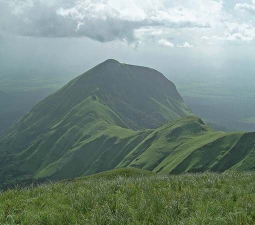
The region is characterized by an enormous sandstone block that rises sharply from the coastal plain in a series of abrupt faults. It covers an area of approximately 30,000 square miles (77,000–78,000 square km) and features a landscape of stepped plateaus, deep trenches, and gorges. Its highest point, Mount Loura (also known as Mount Tamgué), reaches 5,046 feet (1,538 meters) near the northern town of Mali. To the east, the plateau transitions toward the Niger Plains, with towns like Dabola situated at its eastern edge.123
What are the main economic activities in the Fouta Djallon region?
The economy of the Fouta Djallon region is primarily driven by agriculture and livestock, supported by its unique geography.
Agriculture and Livestock
- Pasture and Crops: The high plateaus serve as grazing land for Ndama cattle, a breed valued for being tsetse-resistant. Farmers also raise sheep, goats, horses, donkeys, chickens, and Muscovy ducks.14
- Cultivation: Hillsides are utilized for growing peanuts (groundnuts) and fonio, a sorghumlike grain. Along the region’s numerous streams and rivers, commercial production includes rice, bananas, tomatoes, strawberries, and citrus fruits.4
- Market Gardening: Many families maintain truck gardens to supply vegetables to distant markets.4
Resources and Energy
- Hydroelectric Power: The region’s deep gorges and high rainfall provide significant hydroelectric power potential. A major station on the Konkouré River currently generates nearly one-third of Guinea’s electricity, primarily to support the alumina sector.5
Trade
- Commercial Hubs: The town of Labé serves as the chief trade center for the region.1
What are the main ethnic groups living in the Fouta Djallon region?
The Fouta Djallon region is home to several distinct ethnic groups, with a history shaped by migration and political shifts:
- Fulani (Fulbe): The modern population is primarily composed of Muslim Fulani peoples. They are the dominant group in the region, and their language, Pulaar (a dialect of Fula), serves as the primary language of the area.16
- Dialonke (Djallonke): The region derives its name from these early inhabitants, who were the original people of the area before the arrival of other groups.1
- Malinke: Historically, the Malinke played a significant role in the region’s political development, particularly during the jihad of the 1720s that established the Fouta Djallon as a theocratic state.17
- Basari: This ancient people is also found residing within the rocky highlands of the Fouta Djallon.8
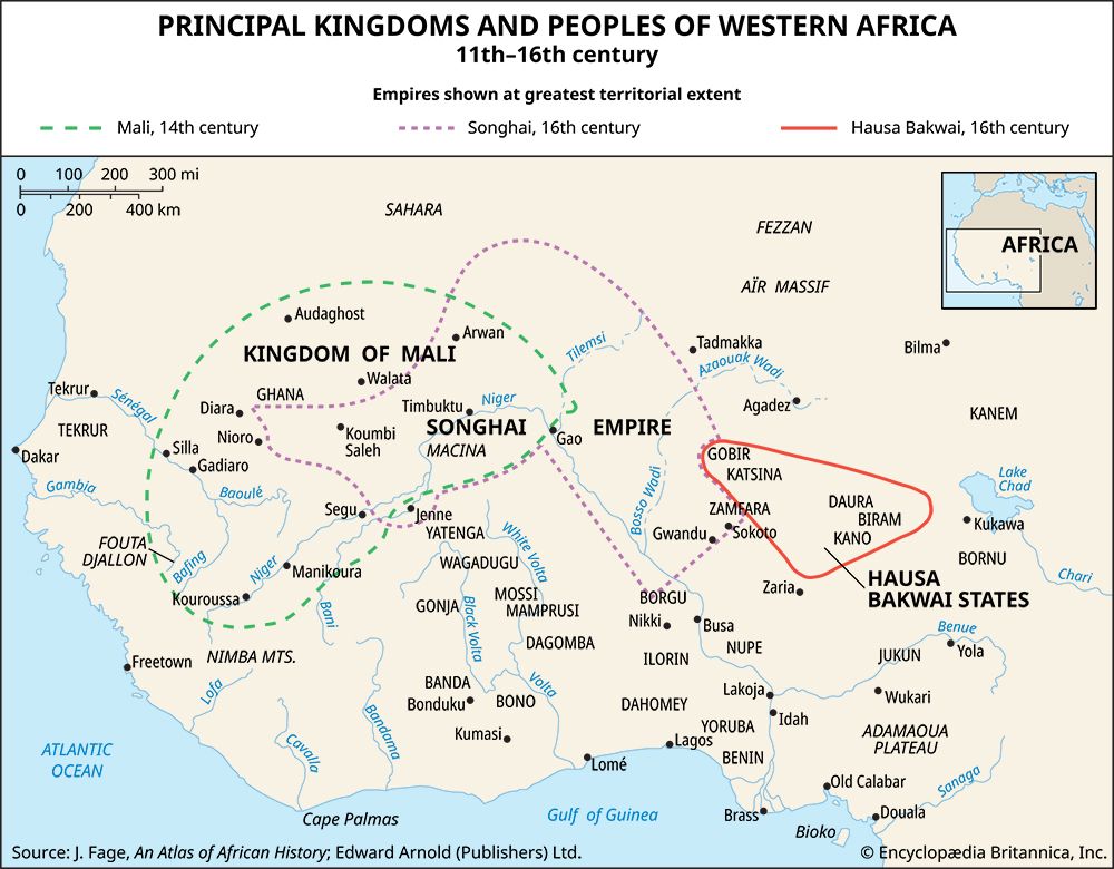
The region’s demographic landscape has evolved significantly since the 13th century, when various groups began to encroach upon earlier populations, eventually leading to the long-standing dominance of the Fulani.7
How has the landscape of Fouta Djallon been shaped over time?
The landscape of the Fouta Djallon is defined by its geological composition and its critical role as a major watershed. The region consists of a series of stepped sandstone plateaus that average 3,000 feet (914 metres) in elevation, punctuated by picturesque trenches and gorges carved over time.1
The central plateau serves as the primary source for several of western Africa’s major rivers, including the Gambia, Bafing (Sénégal), Koliba, Kolenté, Kaba, and Konkouré. Furthermore, the eastern slopes contribute to the Niger River system, while the region’s southeastern extension, the Guinea Highlands, contains the source of the Niger itself. The highest point in this rugged terrain is Mount Loura, which reaches an elevation of 5,046 feet (1,538 metres).1
Sources
- Fouta Djallon — Encyclopædia Britannica
- Guinea - Relief — Encyclopædia Britannica
- Dabola — Encyclopædia Britannica
- Guinea - Agriculture, forestry, and fishing — Encyclopædia Britannica
- Guinea - Resources and power — Encyclopædia Britannica
- Guinea - Ethnic groups and languages — Encyclopædia Britannica
- Senegal - Ethnic groups — Encyclopædia Britannica
- history of Guinea - Early history of Guinea — Encyclopædia Britannica
- Fouta — Encyclopædia Britannica
Published on · 3 min read