Koulountou River
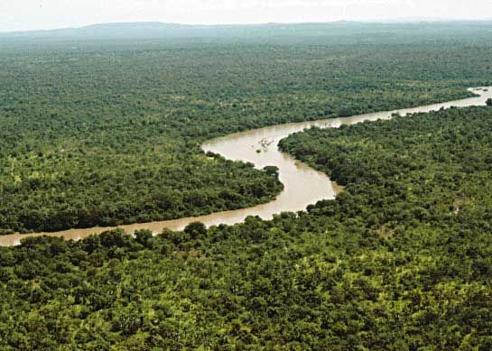
The Koulountou River is the primary tributary of the Gambia River. It originates in the Fouta Djallon highlands of Guinea and flows northward for…
What is Koulountou River?
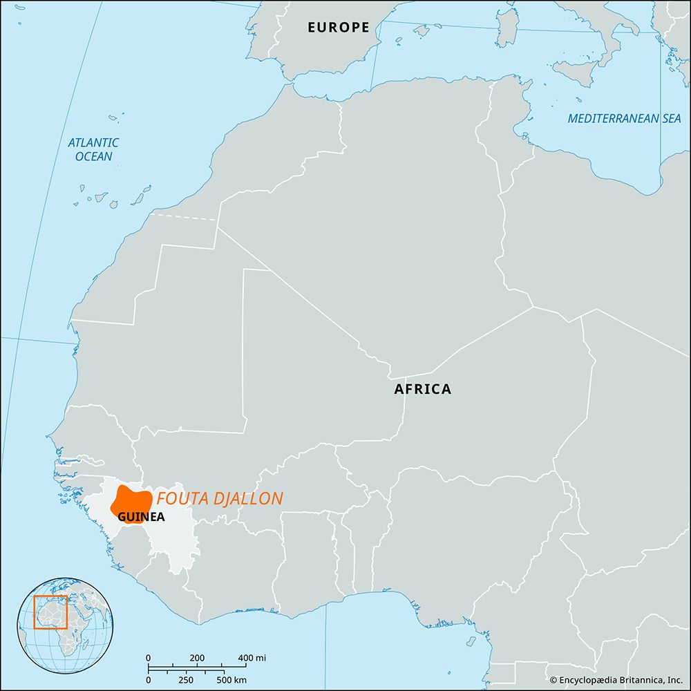
The Koulountou River is the primary tributary of the Gambia River. It originates in the Fouta Djallon highlands of Guinea and flows northward for approximately 140 miles (225 km). The river eventually joins the Gambia River upstream from the Barra Kunda Falls and the border of The Gambia.1
What is the Fouta Djallon region known for?
The Fouta Djallon is a mountainous region in west-central Guinea characterized by a series of stepped sandstone plateaus, picturesque gorges, and trenches. It is primarily known for the following:2
- Major Watershed: The region serves as the vital source for many of western Africa’s greatest rivers, including the Gambia, Bafing (Sénégal), Koliba, Kolenté, Kaba, and Konkouré rivers.2
- Historical Significance: Originally inhabited by the Dialonke people, the region became a powerful Muslim theocratic state in the 1720s following a jihad led by Karamoko Alfa and Ibrahima Sori. It remained a significant political entity until it was occupied by French troops in 1896.2
- Cultural and Economic Life: Today, the area is primarily inhabited by Fulani peoples who are known for herding tsetse-resistant Ndama cattle. The town of Labé serves as the region’s chief trade center.2
- Climate: The region features a tropical climate with distinct wet and dry seasons, experiencing significant temperature fluctuations between day and night.3
How does the Gambia River shape the landscape of West Africa?
The Gambia River significantly shapes the landscape of West Africa by carving a distinct valley into a plateau of sandstone dating back to the Paleogene and Neogene periods.6
The river’s physical influence varies along its course:
- Lower Course: The river terminates in a drowned estuary fringed by dense mangrove swamps. The low-lying banto faros—grass-covered flats—are often inundated by salt water, limiting their agricultural utility.6
- Middle and Upper Course: Braiding of the river channels has created several islands, such as MacCarthy Island. The fertile alluvial loams here are ideal for rice cultivation, while the well-drained, light sandy soils of the higher slopes support peanut farming.6
Human settlement patterns are directly dictated by these features; villages are typically situated between the river flats and the plateau to avoid both seasonal flooding and the aridity of higher terrain.6
What are the main characteristics of the Gambia River?
The Gambia River is a prominent 700-mile (1,120 km) waterway in western Africa with several defining characteristics:
- Navigability: It is one of the finest waterways in Africa and the only one in the region easily accessible to oceangoing shipping, serving as a vital artery for transportation, passengers, and freight.6
- Geography and Course: Rising in the Fouta Djallon highlands of Guinea, the river flows westward into the Atlantic Ocean. Its mouth is a drowned estuary, and its middle course features braided channels and islands, such as MacCarthy Island.6
- Vegetation and Wildlife: The lower river is fringed by dense mangrove swamps, while inland areas feature freshwater swamps, salt flats, and parkland. The river supports diverse wildlife, including hippopotamuses, crocodiles, and hundreds of bird species.67
- Agricultural Utility: While lower river flats (banto faros) are often inundated by salt water, the middle and upper flats provide fertile alluvial loams for rice cultivation, and higher slopes support peanut farming.6
Sources
- Koulountou River — Encyclopædia Britannica
- Fouta Djallon — Encyclopædia Britannica
- Fouta — Encyclopædia Britannica
- Guinea - Climate — Encyclopædia Britannica
- Guinea Highlands — Encyclopædia Britannica
- Gambia River — Encyclopædia Britannica
- The Gambia - Plant and animal life — Encyclopædia Britannica
Published on · 2 min read