Georgian Bay
The shores of Georgian Bay, a large northeastern arm of Lake Huron in Ontario, Canada, host several significant towns and communities that serve as important…
What are some of the major towns and communities along the shores of Georgian Bay?
The shores of Georgian Bay, a large northeastern arm of Lake Huron in Ontario, Canada, host several significant towns and communities that serve as important hubs for commerce, shipping, and tourism.
Key settlements and ports along the bay include:
- Parry Sound: A notable port located along the eastern shore.1
- Midland: An important commercial shipping port.1
- Owen Sound: A major port situated on the bay’s sound of the same name.1
- Collingwood: A significant port and settlement located along the southern coast.12
- Port McNicoll: Another key commercial shipping port.1
- Wasaga Beach: A popular summer-resort community located along the shores of Nottawasaga Bay.2
- Meaford and Thornbury: Important settlements situated around the Nottawasaga Bay area.2
The region is well-known for its diverse landscape, ranging from the glacier-scraped rocks of the Georgian Bay Islands National Park to the agricultural, apple-growing districts found along the southern shores.12
What are some of the unique geological formations found in Georgian Bay, such as the Niagara Escarpment?
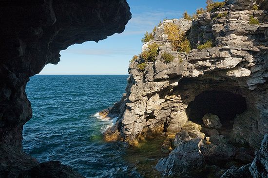
The geology of Georgian Bay is defined by a dramatic contrast between the ancient, rugged terrain of the north and the sedimentary formations of the south.
The Niagara Escarpment
The Niagara Escarpment is perhaps the most prominent geological feature in the region. This massive ridge of Silurian-aged dolomite extends through the Bruce Peninsula, forming the western boundary of the bay. Because the dolomite is highly resistant to weathering and glaciation, it stands as a steep, forested headland rising 200 to 500 feet above the water along the bay’s eastern coast.56
Glacial and Coastal Formations
The landscape has been profoundly shaped by the Pleistocene Epoch glaciers, which scoured the basins and left behind distinct features:
- Glacier-scraped rocks: Much of the shoreline, particularly in the Georgian Bay Islands National Park, is characterized by exposed, glacier-scraped bedrock.14
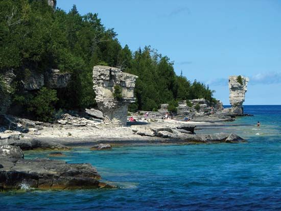
- Flowerpot pillars: Located at Flowerpot Island, these unique, giant flowerpot-shaped pillars were sculpted from limestone cliffs by wave action over time.14
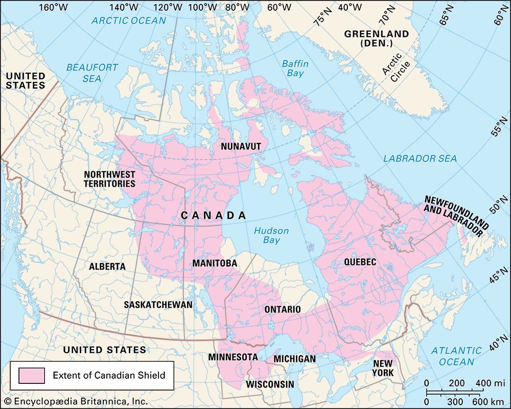
- The Canadian Shield: The northern shores of the bay are part of the Canadian Shield, an ancient geological formation known for its rugged, rocky terrain and dense forests.7
What recreational activities and attractions are popular in the Georgian Bay area?
The Georgian Bay area is a premier destination for outdoor recreation, offering a variety of activities centered around its unique landscape and waterways.
Popular Recreational Activities and Attractions
- National Park Exploration: The Georgian Bay Islands National Park is a major draw, featuring approximately 40 islands that provide opportunities for hiking, wildlife viewing, and experiencing diverse ecosystems, including dense forests and glacier-scraped rock formations.14
- Summer Resort Areas: The Thirty Thousand Islands, located along the bay’s eastern shore, serve as a highly popular summer resort destination for vacationers.1
- Sightseeing and Nature: Visitors frequently travel to see natural landmarks such as the unique, wave-sculpted limestone pillars on Flowerpot Island.14
- Water-Based Activities: The bay’s extensive network of navigable waters, including connections to the Trent Canal, makes the region ideal for boating and exploring the various bays and sounds, such as Nottawasaga Bay and Parry Sound.1
What is Georgian Bay and where is it located in Ontario, Canada?
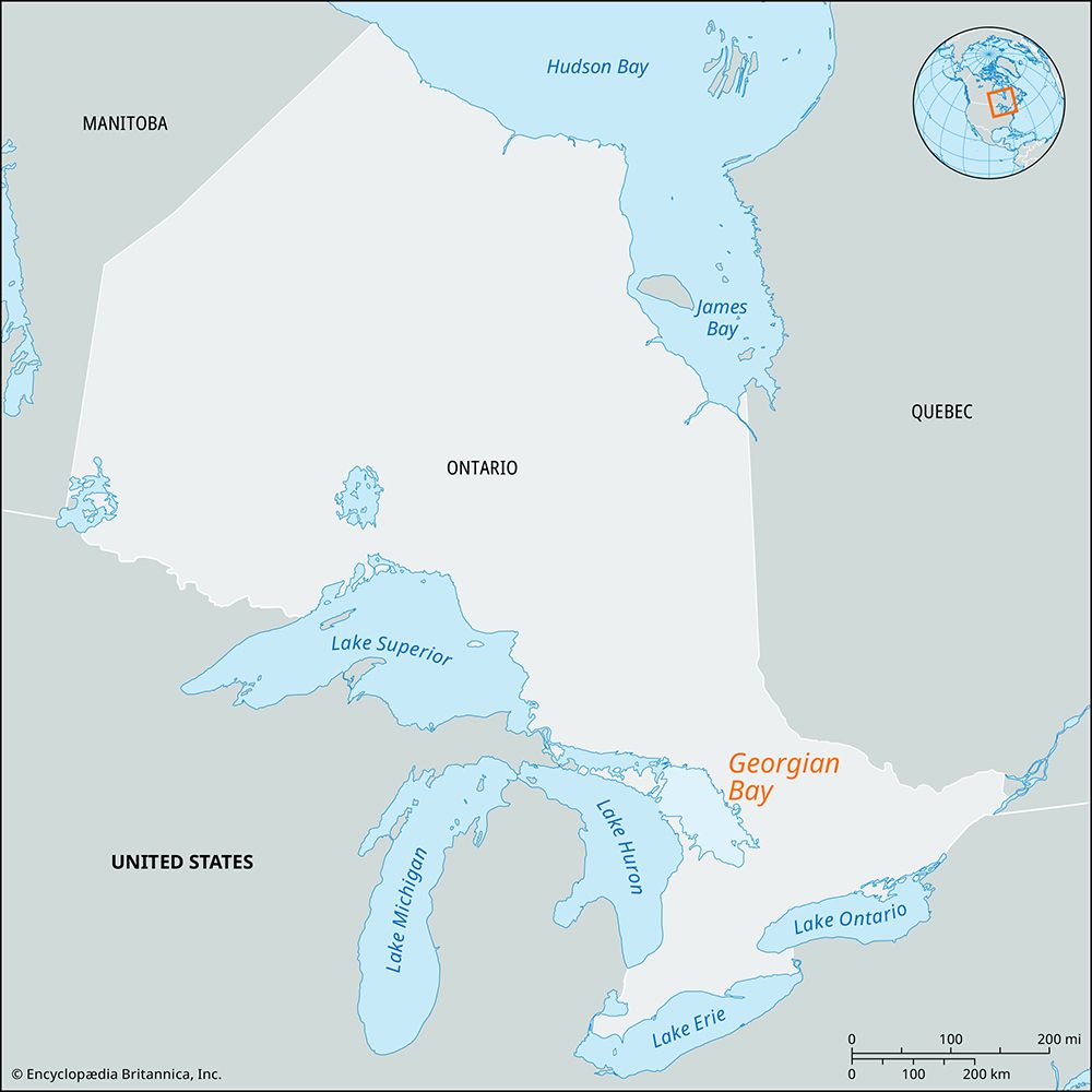
Georgian Bay is a large bay that serves as the northeastern arm of Lake Huron, located in south-central Ontario, Canada.
The bay is sheltered from the main body of Lake Huron by Manitoulin Island and the Bruce Peninsula. It spans approximately 120 miles (190 km) in length and 50 miles (80 km) in width, with depths reaching up to 540 feet (165 meters) near the Main Channel. The region is characterized by a diverse landscape, including the glacier-scraped rocks of the Georgian Bay Islands National Park and the famous Thirty Thousand Islands along its eastern shore. Historically, it was the first part of the Great Lakes recorded by the French explorer Samuel de Champlain in 1615 and was later named in honor of King George IV.12
Sources
- Georgian Bay — Encyclopædia Britannica
- Georgian Bay — Merriam-Webster
- Nottawasaga Bay — Encyclopædia Britannica
- Georgian Bay Islands National Park — Encyclopædia Britannica
- Bruce Peninsula — Encyclopædia Britannica
- Niagara Escarpment — Encyclopædia Britannica
- Great Lakes - Geology — Encyclopædia Britannica
- Ontario - Relief — Encyclopædia Britannica
Published on · 3 min read