Gilgit River
The Gilgit River is a 150-mile (240-km) long river located in the Gilgit-Baltistan area of the Pakistani-administered portion of Kashmir in the northwestern…
What is Gilgit River?
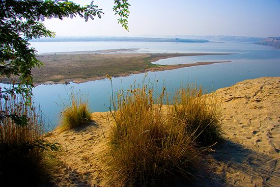
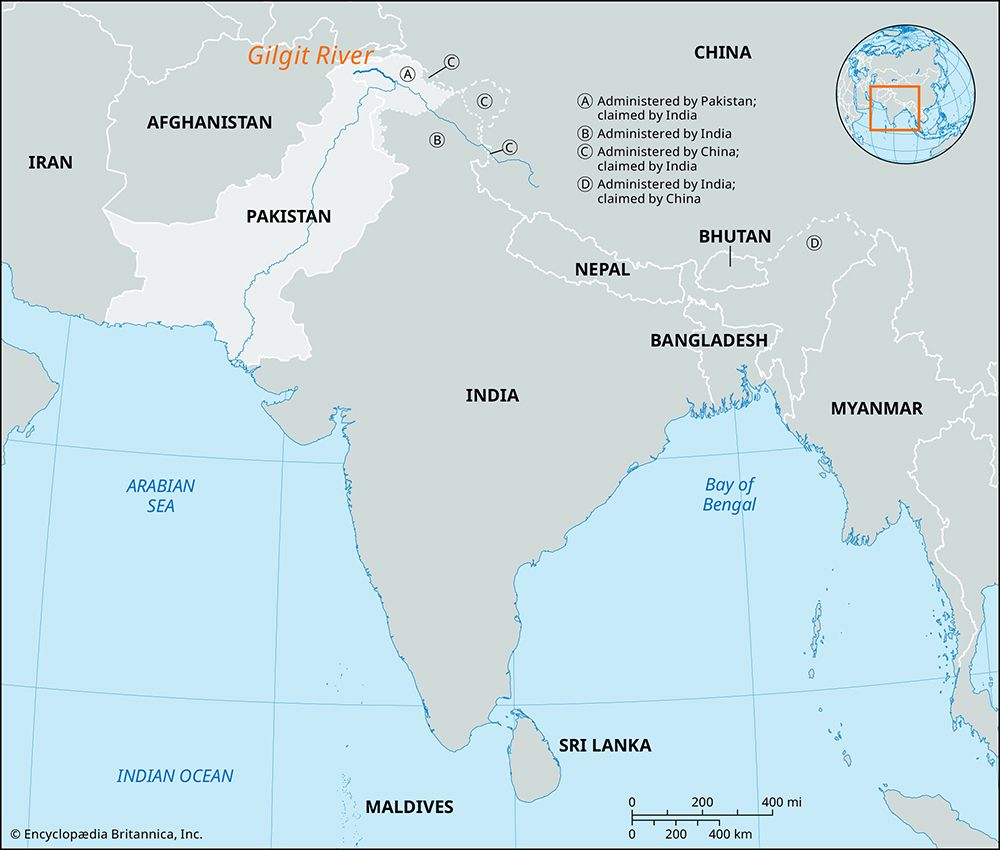
The Gilgit River is a 150-mile (240-km) long river located in the Gilgit-Baltistan area of the Pakistani-administered portion of Kashmir in the northwestern Indian subcontinent.1
The river originates from a high alpine glacier at the meeting point of the Hindu Kush, Karakoram Range, and western Himalayas1. It flows through a deep valley, passing the town of Gilgit, where it is joined by the Hunza River. Continuing southeast, the Gilgit River eventually serves as a right-bank tributary to the Indus River, joining it just north of Bunji. As a glacial-fed stream, it plays a role in carrying meltwater into the Indus system.123
What is the significance of the Karakoram Highway to the Gilgit region?
The Karakoram Highway is vital to the Gilgit region, serving as its primary transportation link to the rest of Pakistan and China.43
Completed in 1978, this 500-mile (800-km) road traverses some of the world’s most rugged terrain, connecting Gilgit to Islamabad in the south and Kashgar in the north via the Khunjerab Pass. Its significance includes:43
- Economic Connectivity: The highway provides a crucial artery for trade and movement, supporting the local economy which relies on agriculture and, increasingly, tourism related to trekking and mountaineering in the Karakoram Range.43
- Accessibility: As the only town of significant size in the region, Gilgit relies on the highway to overcome the isolation imposed by the surrounding mountainous landscape, supplementing the town’s limited airport facilities.3
- Strategic Infrastructure: The road represents a major engineering achievement that facilitates regional integration, despite the constant challenges of maintaining the route against natural hazards like landslides and glacial movement.4
How do glaciers in the Karakoram Range influence the Indus River system?
Glaciers in the Karakoram Range are fundamental to the Indus River system, serving as a primary source of its water flow. The high-elevation zones of these mountains act as a watershed where the melting of perpetual snows and glaciers feeds the river channels.56
The influence of these glaciers on the Indus is characterized by several key factors:
- Water Supply: A significant portion of the Indus River’s volume is derived from glacial meltwater and snowmelt from the Karakoram, Hindu Kush, and Himalayan ranges. This supply is vital for the river’s flow, particularly in the mountainous sections of the basin.5
- Sediment Transport: Glacial meltwater is often opaque due to the presence of rock flour—pulverized stone created by glacial movement. This material, combined with eroded debris from mountain channels, gives the Indus the highest suspended sediment load of any major river.6
- Hydrological Dynamics: Glaciers often combine to form complex systems that occupy entire watersheds. While seasonal thawing contributes to the river’s flow, it can also lead to serious flooding on the southern slopes of the range.6
- Environmental Sensitivity: Recent climate change has led to glacial decline and unpredictable weather patterns, which directly impact the stability of the water supply for the Indus region.5
What are some other major tributaries that feed into the Indus River?
The Indus River is fed by a diverse network of tributaries that vary based on the river’s progression from the high mountains to the plains.
Highland Tributaries
In its upper reaches, the Indus is joined by several streams that carry significant glacial meltwater from the Karakoram Range and surrounding highlands:
- Zanskar River: The first major tributary, joining on the left bank near Leh.2
- Shyok River: A notable right-bank tributary.2
- Shigar River: Joins the Indus on the right bank near Skardu.2
- Gilgit River: A right-bank tributary that meets the Indus at Bunji.2
- Astor River: A left-bank tributary originating from the Nanga Parbat massif.2
- Kabul River: Joins the Indus just above Attock.2
The Punjab Tributaries
The most famous tributaries, which define the Punjab (“Five Rivers”) region, enter the Indus from the eastern plains:
These five rivers eventually converge into the Panjnad before flowing into the Indus.8
Sources
- Gilgit River — Encyclopædia Britannica
- Indus River - Physical features — Encyclopædia Britannica
- Gilgit — Encyclopædia Britannica
- Karakoram Highway — Encyclopædia Britannica
- Karakoram Range - Glaciation and drainage — Encyclopædia Britannica
- Indus River - Climate — Encyclopædia Britannica
- Himalayas - Drainage of the Himalayas — Encyclopædia Britannica
- Sutlej River — Encyclopædia Britannica
Published on · 3 min read