Great Stour
The Great Stour is a 40-mile (64 km) river located in the county of Kent, England. It flows through The Weald, passing through the towns of Ashford…
What is Great Stour?
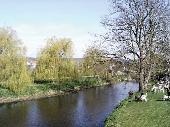
The Great Stour is a 40-mile (64 km) river located in the county of Kent, England. It flows through The Weald, passing through the towns of Ashford, Canterbury, and Sandwich before emptying into the North Sea.12
The river is notable for its floodplain, which was once a silted marine inlet known as the Wantsum Channel; this channel historically separated the Isle of Thanet from the mainland until the 14th century. The Great Stour is fed by tributaries including the East Stour and the Little Stour, and it is navigable for vessels below Canterbury.1
What was the Wantsum Channel?
The Wantsum Channel was a significant marine water route that historically separated the Isle of Thanet from the mainland of Kent, England.31
During the Roman period, the channel served as a vital waterway guarded by two strategic forts: Regulbium (Reculver) in the north and Rutupiae (Richborough) in the south. The area also holds historical significance as the reputed landing site of the Anglo-Saxon leader Hengist at Ebbs Fleet during the 5th century.3
While the channel remained navigable for small vessels until the 16th century, its status as a distinct separator of the island diminished over time as the inlet silted up. By the 14th century, the channel had largely transformed into the floodplain that characterizes the modern Great Stour river system.31
How did the Isle of Thanet become connected to the mainland?
The Isle of Thanet became connected to the mainland of Kent through the natural process of silting. Historically, the island was separated from the mainland by the Wantsum Channel, a significant marine water route that remained navigable for small vessels until the 16th century.34
Over time, the channel gradually filled with sediment, transforming the waterway into the floodplain that now characterizes the Great Stour river system. This process of silting effectively closed the channel by the 14th century, integrating the former island into the mainland landscape.4
What are some other major rivers in England?
England features a diverse network of rivers that serve as vital drainage systems, flowing either westward toward the Atlantic Ocean and Irish Sea or eastward toward the North Sea and the English Channel.56
Major Rivers of England
- River Severn: Britain’s longest river, it flows southward for approximately 180 miles before reaching the Bristol Channel.7
- River Thames: The longest river entirely within England, it dominates the southeast, flowing through Oxford and London before reaching the North Sea.568
- River Trent: Rising in the Pennines, it flows eastward and eventually drains into the Humber estuary.56
- River Mersey: A significant westward-flowing river in northwestern England.56
- River Tyne: A major river in northeastern England that flows independently to the North Sea.56
- River Stour: Located in eastern England, this river forms the boundary between Suffolk and Essex and is famously associated with the artist John Constable.9
- River Ouse: There are multiple rivers by this name, including one that drains into the Wash and another in northern England that flows into the Humber.56
Sources
- Great Stour — Encyclopædia Britannica
- Stour — Merriam-Webster
- Isle of Thanet — Encyclopædia Britannica
- Thanet — Encyclopædia Britannica
- United Kingdom - Drainage — Encyclopædia Britannica
- England - Drainage of England — Encyclopædia Britannica
- River Severn — Encyclopædia Britannica
- River Thames - Touring the Thames — Encyclopædia Britannica
- River Stour — Encyclopædia Britannica
Published on · 2 min read