Gran Chaco
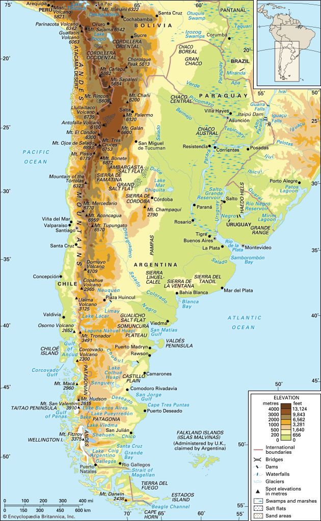
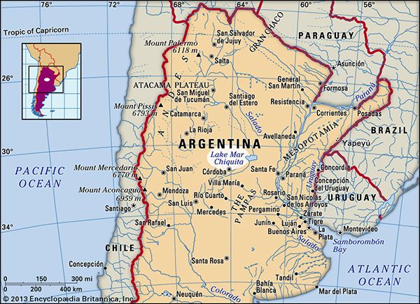
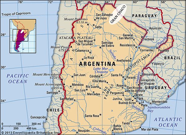
The Gran Chaco is a vast, arid subtropical lowland plain located in interior south-central South America. It spans across three primary countries:
What are the main countries that the Gran Chaco region spans across?
The Gran Chaco is a vast, arid subtropical lowland plain located in interior south-central South America. It spans across three primary countries:
- Argentina: Contains slightly more than half of the region’s total area.1
- Paraguay: Accounts for approximately one-third of the region.1
- Bolivia: Comprises the remainder of the territory, often referred to as the Bolivian Chaco.1
The region is bounded by the Andes mountains to the west and the Paraguay and Paraná rivers to the east, covering roughly 280,000 square miles (725,000 square kilometers).1
How has agriculture and ranching impacted the Gran Chaco ecosystem?
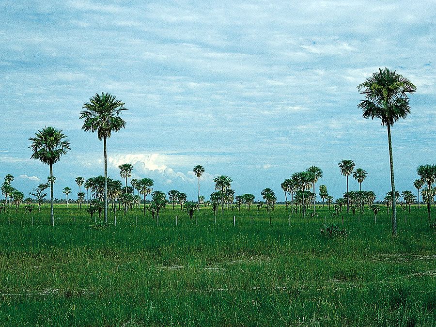
Agriculture and ranching have significantly altered the Gran Chaco ecosystem, primarily through land clearing and the introduction of non-native species.
Ranching Impacts
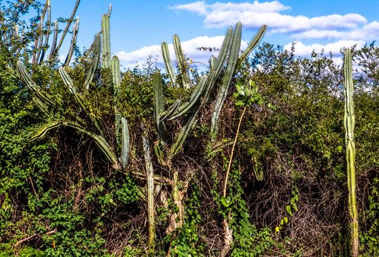
Cattle grazing has been the most extensive use of the land since the late 19th century. The introduction of criollo cattle led to large-scale ranching operations (estancias), which often required clearing native vegetation. A major ecological consequence of this expansion is the invasion of thorny species, such as the vinal (Prosopis ruscifolia). This plant was declared a national plague in Argentina because its long, sharp thorns created significant hazards for livestock in areas where native forests had been cleared for pasture.345
Agricultural and Logging Impacts
- Deforestation: The expansion of agriculture and the timber industry has led to the clearing of vast thorn forests and quebracho woodlands.54
- Habitat Alteration: Savannas in the region are often induced by fire or deforestation to make way for human activity.5
- Resource Depletion: The systematic harvesting of quebracho trees for tannin and lumber has often outpaced natural reforestation, threatening the sustainability of these hardwood forests.3
- Crop Introduction: The introduction of crops like cotton, which can withstand the region’s long droughts, has further transformed the landscape, particularly in the eastern Chaco.4
How have indigenous peoples historically inhabited and used the Gran Chaco, and what is their current situation?
Historically, the indigenous peoples of the Gran Chaco were diverse groups adapted to the region’s challenging, arid environment. They are broadly categorized into “foot Indians,” such as the Wichí and Zamuco, and “horsemen,” including the Abipón, Mocoví, and Caduveo.
Historical Use and Adaptation
- Subsistence: Traditionally, these groups relied on gathering wild plant foods, such as the pods of the algarrobo tree, and fishing in the region’s river systems. In the west, groups shifted camps frequently to follow water sources, while those in the wetter east practiced limited cultivation.78
- Impact of the Horse: The introduction of the horse by the Spanish transformed many tribes into mobile, predatory nomads. These groups raided Spanish settlements and other tribes, leading to increased warfare and the development of social stratification, particularly among the Caduveo, who maintained systems of nobility, serfdom, and slavery.8
- Resistance: Indigenous groups successfully resisted European colonization for centuries, maintaining a state of “siege” that limited effective foreign occupancy until the late 19th century.9
Current Situation
The provided search results do not contain information regarding the contemporary status or current living conditions of indigenous peoples in the Gran Chaco.
What is the geographical location and extent of the Gran Chaco plain in South America?
The Gran Chaco is a vast alluvial plain located in the interior of south-central South America. It covers approximately 280,000 square miles (725,000 square kilometres), with its territory distributed among Argentina (slightly more than half), Paraguay (one-third), and Bolivia.1
The region’s boundaries are defined as follows:
- West: The Andes mountain ranges.1
- East: The Paraguay and Paraná rivers.1
- North: Generally reaches the Izozog Swamps in eastern Bolivia.1
- South: Extends to approximately 30° S latitude, or roughly the Salado River in Argentina.1
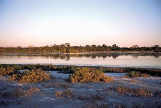
The plain spans about 450 miles (725 km) from east to west and 700 miles (1,100 km) from north to south. It is characterized by its exceptionally level terrain, which often leads to extensive flooding during the rainy season due to poor drainage and impermeable subsoils.110
Sources
- Gran Chaco — Encyclopædia Britannica
- Argentina - Land — Encyclopædia Britannica
- Argentina - The Gran Chaco — Encyclopædia Britannica
- Gran Chaco - Plant life — Encyclopædia Britannica
- Argentina - The Gran Chaco — Encyclopædia Britannica
- Gran Chaco - European colonization and economic activity — Encyclopædia Britannica
- Argentina - The Gran Chaco — Encyclopædia Britannica
- South American nomad - Hunters, gatherers, and fishermen of the Gran Chaco — Encyclopædia Britannica
- South American nomad - Composite bands — Encyclopædia Britannica
- Gran Chaco - Drainage — Encyclopædia Britannica
Published on · 3 min read