Great Alfold
The Great Alfold (also known as the Great Hungarian Plain) is a vast, flat, and fertile lowland covering approximately 40,000 square miles (100,000 square…
What is Great Alfold?
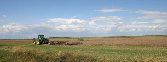
The Great Alfold (also known as the Great Hungarian Plain) is a vast, flat, and fertile lowland covering approximately 40,000 square miles (100,000 square km). While about half of the region lies in Hungary, it also extends into parts of Croatia, Serbia, and Romania.1
Geologically, the area was once a block-faulted mountain range that submerged into the Pannonian Sea during the Pliocene Epoch before eventually drying up and filling with riverine deposits. Today, the region is characterized by its continental climate, which is notably dry in its central and eastern sections, necessitating large-scale irrigation systems along the Tisza River.123
Historically a steppeland, the Great Alfold has been transformed by flood control and drainage projects into a major agricultural hub for cereals, livestock, and produce. Remnants of the original arid grasslands, or puszta, can still be found in the Hortobágy area.1
What is the significance of the Hortobagy puszta?
The Hortobágy region, often referred to as the puszta (a Hungarian term for a treeless, barren steppe), holds significant cultural and ecological importance as a preserved remnant of Hungary’s traditional landscape.567
Historical and Cultural Significance
Once a fertile area with flourishing medieval villages, the region became depopulated under Turkish rule, eventually transforming into a vast grazing land for horses and cattle. Following the regulation of the Tisza River in the 1840s, the area became increasingly arid, earning a reputation as a haunt for betyár (highwaymen). Today, the village of Hortobágy serves as the cultural heart of the region, preserving traditional folk art and heritage, including unique livestock breeds and equestrian traditions showcased at annual fairs.57
Ecological and Global Status
The region is vital for biodiversity, providing a habitat for numerous water birds, such as herons, black storks, and white spoonbills, as well as various birds of prey. To protect this unique flora and fauna, the Hortobágy National Park was established in 1973. In 1999, it was designated a UNESCO World Heritage site, recognizing its value as a protected cultural and natural landscape.587
How did the Pannonian Sea shape the region’s landscape?
The Pannonian Sea played a foundational role in the geomorphology of the Great Alfold. During the Pliocene Epoch, a range of block-faulted mountains that once occupied the region submerged into this inland sea.1
Following this submersion, the margins of the area underwent an uplift, which transformed the region into an inland lake. Over time, this lake either dried up or was filled with riverine deposits carried down from the surrounding highlands. These processes created the flat, fertile lowland that characterizes the region today, with its current drainage patterns derived from the postglacial river systems that shaped the landscape after the water receded.1
What role does the Tisza River play in Hungarian agriculture?
The Tisza River is a vital component of Hungarian agriculture, particularly within the Great Alfold region. Historically, the river’s natural state was characterized by frequent, severe flooding that hindered consistent land use; however, extensive 19th-century regulation projects, including the construction of approximately 2,400 miles of flood-control levees, transformed these floodplains into productive agricultural land.98
The river’s role in modern agriculture is defined by several key infrastructure developments:
- Irrigation: Because the central and eastern areas of the Great Alfold experience a relatively dry climate, the Tisza is essential for large-scale irrigation systems that support the cultivation of cereals, fodder crops, vegetables, and fruit.18
- Water Management: The Tiszalök Dam, completed in 1954, created Hungary’s largest reservoir. This facility, alongside the Eastern Main Canal, provides a reliable, year-round supply of irrigation water to the Hajdúság and Hortobágy plains.9
- Economic Connectivity: As a navigable waterway, the river supports the transport of agricultural goods through river ports such as Szolnok, Csongrád, and Szeged.9
Sources
- Great Alfold — Encyclopædia Britannica
- Hungary - Climate — Encyclopædia Britannica
- Hungary - Drainage and soils — Encyclopædia Britannica
- Pannonia — Encyclopædia Britannica
- Hortobágy — Encyclopædia Britannica
- list of World Heritage sites - Hungary — Encyclopædia Britannica
- puszta — Merriam-Webster
- Hungary - Traditional regions — Encyclopædia Britannica
- Tisza River — Encyclopædia Britannica
Published on · 3 min read