Haedo Range
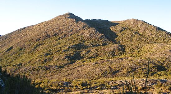
The Haedo Range (Cuchilla de Haedo) is a range of hills located in north-central Uruguay. Extending approximately 125 miles (200 km) southward from the…
What is Haedo Range?
The Haedo Range (Cuchilla de Haedo) is a range of hills located in north-central Uruguay1. Extending approximately 125 miles (200 km) southward from the Brazilian border, the range terminates at the confluence of the Negro and Uruguay rivers.1
Together with the Grande Range, it defines the basin of the Negro River. Geologically distinct from the Grande Range, the Haedo Range acts as a separator between a western basalt upland and the Negro River basin, often appearing as an escarpment of interbedded basalts and red sandstones. The terrain is relatively low, with maximum elevations reaching about 1,300 feet (400 m) at the hills of Lunarejo and Virgen.1
What is the significance of the Negro River in Uruguay?
The Negro River is of vital significance to Uruguay primarily as a major source of hydroelectric power and a central geographic feature of the country.23
Key aspects of its importance include:
- Energy Production: The river is dammed at three locations—Rincón del Bonete, Baygorria, and Palmar—which serve as critical infrastructure for the nation’s electric power generation. Together with plants on the Uruguay River, these facilities provide approximately one-seventh of the country’s electricity.23
- Water Management: The Rincón del Bonete Reservoir, created by the damming of the river near Paso de los Toros, is one of the largest artificial lakes in South America, covering 413 square miles (1,070 square km).2
- Geographic Role: As the largest tributary of the Uruguay River, the Negro defines a major drainage basin alongside the Grande Range and the Haedo Range and the Haedo Range. It flows across central Uruguay before joining the Uruguay River near Soriano, where it significantly broadens the waterway as it approaches the Río de la Plata estuary.3421
How does the geology of the Haedo Range differ from the Grande Range?
The Haedo Range and the Grande Range are both southward extensions of the Brazilian Highlands, but they possess distinct geological characteristics.15
The Haedo Range is primarily defined by its role as a separator between a western basalt upland and the Negro River basin. Its structure frequently appears as an escarpment composed of interbedded basalts and red sandstones. In contrast, while the Grande Range also serves as a major ridge system in the southeast, the Haedo Range is explicitly noted for having a different geologic structure than its eastern counterpart.1
What are the primary geographical features of Uruguay?
The geography of Uruguay is characterized by a gently rolling landscape with an average elevation of approximately 383 feet (117 meters). The country’s primary geographical features include:3
- Relief and Ridges: The terrain consists of broad valleys, plains (pampas), low plateaus, and hills. Two major ridge systems, the Haedo Range in the north and the Grande Range in the southeast, serve as southward extensions of the Brazilian Highlands5. Mount Catedral, located in the southeast, is the nation’s highest point at 1,685 feet (514 meters).3
- River Systems: The Uruguay River forms the western boundary of the country, while the Negro River—the country’s largest internal tributary—flows westward through the central region. These rivers are vital for hydroelectric power generation.567
- Coastline: The southern coast, which faces the Río de la Plata estuary, is marked by tidal lakes and sand dunes.3
- Climate: The country experiences a temperate climate with no distinct dry or rainy season, and precipitation is generally distributed evenly throughout the year.8
Sources
- Haedo Range — Encyclopædia Britannica
- Negro River — Encyclopædia Britannica
- Río de la Plata - Physiography of the Uruguay basin — Encyclopædia Britannica
- Uruguay - Resources and power — Encyclopædia Britannica
- Uruguay - Relief and soils — Encyclopædia Britannica
- Uruguay - Climate — Encyclopædia Britannica
- Grande Range — Encyclopædia Britannica
- Uruguay — Encyclopædia Britannica
- Uruguay - Settlement patterns — Encyclopædia Britannica
Published on · 3 min read