Jura Mountains
The highest peak in the Jura Mountains is Crêt de la Neige, which reaches an elevation of 5,636 feet (1,718 meters).
What is the highest peak in the Jura Mountains and how tall is it?
The highest peak in the Jura Mountains is Crêt de la Neige, which reaches an elevation of 5,636 feet (1,718 meters).1
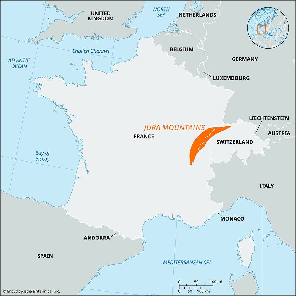
Where are the Jura Mountains located and which countries do they span?
The Jura Mountains are a mountain range that extends for 225 miles (360 km) in an arc between the Rhône River and the Rhine.
The range spans two countries:
- Switzerland: The majority of the mountain system lies within Swiss territory.
- France: A significant portion of the western sector is located in France.
The mountains form a natural border between these two nations, with their highest peaks situated in the south near the Geneva area.1
How do the Jura Mountains affect the climate of the surrounding areas?
The climate of the Jura Mountains is classified as a maritime-continental transitional type, characterized by significant variations based on elevation and topography.
The range influences local weather patterns in several ways:
- Elevation Effects: The climate is notably rawer and harsher on the higher Jura heights compared to the lower elevations.
- Topographical Protection: The valleys and south-facing slopes benefit from milder conditions, as they are shielded from the more extreme elements.
- Temperature Inversions: During the winter, the high valleys can experience the formation of cold air pools, leading to localized temperature drops.
- Precipitation Distribution: Annual precipitation levels vary significantly across the region. Rainfall and snowfall increase toward the south and west, with some areas receiving more than 80 inches (2,030 mm) of precipitation. Conversely, protected areas like the Delsberg Valley and the north-facing corridor of the Ergolz River receive less than 40 inches (1,000 mm) annually.
What are some notable features or landmarks found in the Jura Mountains?
The Jura Mountains are defined by their unique geological composition and distinct natural features. Notable landmarks and characteristics include:
- High Peaks: The highest elevations are found in the south, near the Geneva area. Key summits include Crêt de la Neige and Le Reculet in France, as well as Mount Tendre and La Dôle in Switzerland1.
- Karst Landscapes: Due to the prevalence of limestone, the region features classic karst topography, including numerous caves, sinkholes, and underground drainage systems.13
- Underground Rivers: Many rivers in the region disappear into the ground and reappear elsewhere. For example, Lake Joux has an underground outlet that emerges as the Orbe River, and similar phenomena occur with the Areuse, Schüss, and Birs rivers.1
- Franches Montagnes: This undulating plateau, located between the Saint-Imier Valley and the Doubs River, is a notable tableland known for its mixed agriculture and dairying history.3
- Cluses: These entrenched transverse valleys have been eroded across the mountain ridges, historically serving as vital transportation routes.3
Sources
- Jura Mountains — Encyclopædia Britannica
- France - Pyrenees , Jura, and Alps — Encyclopædia Britannica
- Switzerland - Relief and drainage — Encyclopædia Britannica
Published on · 2 min read