Keppel Bay
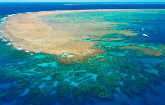
Keppel Bay most commonly refers to an inlet of the Pacific Ocean located in eastern Queensland, Australia. This bay, which measures approximately 30 miles…
What is Keppel Bay?
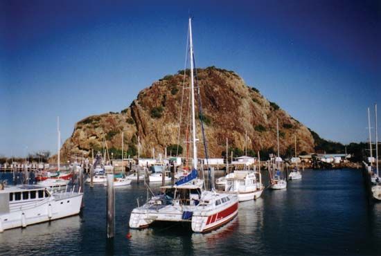
Keppel Bay most commonly refers to an inlet of the Pacific Ocean located in eastern Queensland, Australia1. This bay, which measures approximately 30 miles long and 12 miles wide, was sighted by Captain James Cook in 1770 and named in honor of Rear Admiral Augustus Keppel. The area is known for its coastal resorts, such as Emu Park and Yeppoon, and its productive waters, which yield prawns, scallops, and game fish.1
Additionally, the name “Keppel” is associated with the Keppel wharves in Singapore. These are deepwater facilities located between the islands of Brani and Sentosa. As part of the Port of Singapore, these wharves serve as a major transshipment point for exports including oil, rubber, and lumber.2
Who was Captain James Cook and what were his major voyages?
James Cook (1728–1779) was a renowned British naval captain, navigator, and explorer who fundamentally transformed global cartography through his three major expeditions to the Pacific Ocean.34
Major Voyages
- First Voyage (1768–1771): Commissioned by the Admiralty and the Royal Society, Cook commanded the HMS Endeavour to Tahiti to observe the transit of Venus. He subsequently circumnavigated New Zealand and charted the eastern coast of Australia, successfully navigating the Great Barrier Reef.56
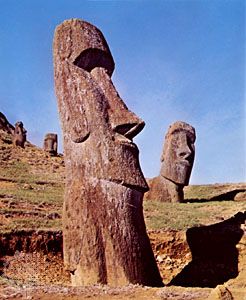
- Second Voyage (1772–1775): Aboard the Resolution and Adventure, Cook conducted the first west-east circumnavigation in high latitudes. He disproved the existence of a habitable southern continent (Terra Australis) and charted numerous islands, including Tonga, Easter Island, and New Caledonia.56
- Third Voyage (1776–1779): Seeking a Northwest Passage, Cook explored the North Pacific. He located the Hawaiian Islands, where he was killed in 1779 during a conflict with local inhabitants.56
Cook is celebrated for his scientific rigor, his humane treatment of indigenous peoples, and his success in preventing scurvy among his crews.56
How does a natural bay like Keppel Bay in Australia differ from a man-made port facility?
A natural bay, such as Keppel Bay, is a coastal feature formed by geological processes, specifically the differential erosion of rock formations by the sea or lake movements. These bays are characterized by their semicircular or nearly circular shapes, where softer rocks are eroded more rapidly than the harder, resistant promontories that flank them. While they may provide natural shelter for ships, they are essentially products of nature, sometimes requiring only minor improvements like dredging to function as harbors.71
In contrast, a man-made port facility is an engineered environment designed specifically for the transfer of goods between transportation forms, such as ships and trucks. When natural harbors are unavailable or insufficient, engineers construct artificial harbors using breakwaters or jetties to create calm water. These facilities require significant civil engineering to provide firm, dry land and specialized infrastructure—such as docks, wharves, and quays—that can support heavy loads while remaining adjacent to deep water.81
What role did the Fitzroy River play in the development of Queensland?
The Fitzroy River in eastern Queensland has been a vital artery for the region’s economic and agricultural development. Serving as a major drainage system for a 55,000-square-mile catchment area, the river facilitates transport and industry, particularly through the city of Rockhampton, which sits at the head of ocean navigation.1112
The river’s role in development includes:
- Commercial and Industrial Hub: Rockhampton grew into a central commercial hub due to its position on the river, which connects the interior to the coast via Port Alma. This connectivity supported the processing of meat, butter, and fruit, as well as the operation of railroad workshops and chemical plants.12
- Resource Support: The river basin supports extensive cattle and sheep grazing lands to the west. Furthermore, the region’s development was historically stimulated by the discovery of gold, tin, and copper in the interior, with the river providing a logistical link for these resources.12
- Agricultural Utility: The lower floodplain of the Fitzroy is utilized for experimental pasturing and rice farming.11
Sources
- Keppel Bay — Encyclopædia Britannica
- Singapore — Encyclopædia Britannica
- James Cook: Top Questions — Encyclopædia Britannica
- James Cook — Encyclopædia Britannica
- Pacific Islands - The 18th century — Encyclopædia Britannica
- James Cook - Voyages and discoveries — Encyclopædia Britannica
- bay — Encyclopædia Britannica
- Harbors and sea works - Natural and artificial harbors — Encyclopædia Britannica
- Harbors and sea works - Docks and quays — Encyclopædia Britannica
- list of bays and gulfs - Australia — Encyclopædia Britannica
- Fitzroy River — Encyclopædia Britannica
- Rockhampton — Encyclopædia Britannica
- Mackenzie River — Encyclopædia Britannica
- Queensland - Relief and drainage — Encyclopædia Britannica
- Fitzroy River — Encyclopædia Britannica
Published on · 3 min read