Khyber Pass
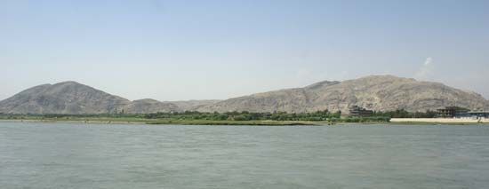
The Khyber Pass is a 33-mile (53-km) mountain passage connecting Kabul, Afghanistan, with Peshawar, Pakistan. Historically, it has served as a vital gateway…
How has the Khyber Pass played a role in historical invasions and trade routes?
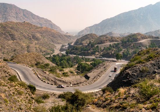
The Khyber Pass is a 33-mile (53-km) mountain passage connecting Kabul, Afghanistan, with Peshawar, Pakistan. Historically, it has served as a vital gateway for invasions of the Indian subcontinent and a significant link in the Silk Road trade network.12
Strategic Importance and Invasions
The pass has been a conduit for numerous empires and military forces, including:
- Ancient Empires: Persians under Darius I, as well as generals of Alexander the Great, utilized the route.1
- Islamic Expansion: Mahmud of Ghazna and Muhammad of Ghur used the pass to launch invasions that established Islamic rule in India.1
- Mughal and Mongol Eras: Genghis Khan and Babur, the founder of the Mughal Empire, both traversed the pass to enter the subcontinent.1
- Modern Era: The British viewed the pass as a critical defensive point against potential Russian expansion. More recently, it served as a primary supply route for NATO during the Afghanistan War.1
What are some of the major cities or towns located near the Khyber Pass?
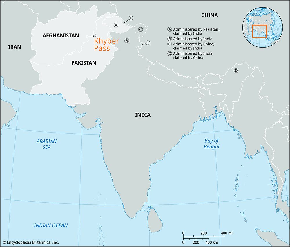
Several significant cities, towns, and strategic locations are situated near or within the Khyber Pass, serving as key points along this historic route:
- Peshawar, Pakistan: Located at the southeastern end of the region, this major city serves as the primary gateway to the pass from the Pakistani side.1
- Jamrud, Pakistan: Situated a few miles east of the pass’s southeastern entrance, it acts as a significant entry point for travelers and trade.1
- Ali Masjid: A historic fort and site of a namesake mosque located within the pass, marking a narrow and strategically vital section of the gorge.1
- Landi Kotal, Pakistan: Positioned at the highest point of the pass (3,518 feet), this town serves as an important market center and cantonment.1
- Landi Khana: A station located further northwest along the route, historically serving as the terminus for the Khyber Pass Railway.1
- Torkham: Located on the border between Pakistan and Afghanistan, this town serves as the critical border post where the pass enters Afghan territory.1
- Kabul, Afghanistan: While not within the pass itself, the capital of Afghanistan is the major western destination connected to the route.1
How has the Khyber Pass been portrayed in literature, media, and popular culture?
The provided search results do not contain information regarding the portrayal of the Khyber Pass in literature, media, or popular culture. The available documentation focuses exclusively on its geographical features, historical military significance, and role in transportation and trade.
Sorry, the Britannica knowledge base does not contain this information.
How has modern technology and infrastructure development impacted the use of the Khyber Pass?
Modern technology and infrastructure development have significantly transformed the Khyber Pass from a rugged caravan track into a vital, albeit vulnerable, artery for regional logistics and military supply.
- Road Infrastructure: The pass is currently traversed by a hard-surface road that facilitates modern vehicular traffic, providing a critical link between Peshawar, Pakistan, and Kabul, Afghanistan. This road serves as the primary conduit for trade and transport in the region.1
- Railway Development: The Khyber Pass Railway, an engineering marvel featuring 34 tunnels and 92 bridges and culverts, revolutionized transportation upon its opening in the 1920s. It provided a broad-gauge connection from Peshawar to Landi Khana. However, this infrastructure has faced significant setbacks; services were suspended in 2007 due to regional civil unrest and severe flood damage that destroyed sections of the track.1
- Strategic Utility: In the 21st century, the pass’s infrastructure proved essential during the Afghanistan War, acting as the primary supply route for 75 percent of NATO coalition logistics. Despite its strategic importance, the flow of goods remains frequently disrupted by extremist activity, highlighting the ongoing challenge of maintaining secure infrastructure in a volatile environment.1
Sources
- Khyber Pass — Encyclopædia Britannica
- Khyber Pass — Merriam-Webster
- Hindu Kush - Physiography — Encyclopædia Britannica
- Gumal Pass — Encyclopædia Britannica
- Karakoram Highway — Encyclopædia Britannica
Published on · 3 min read