Kabul River
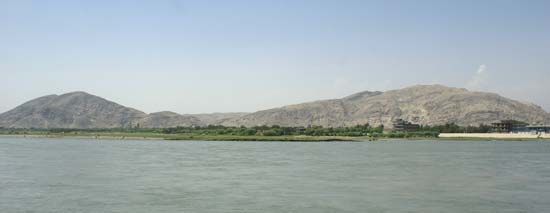
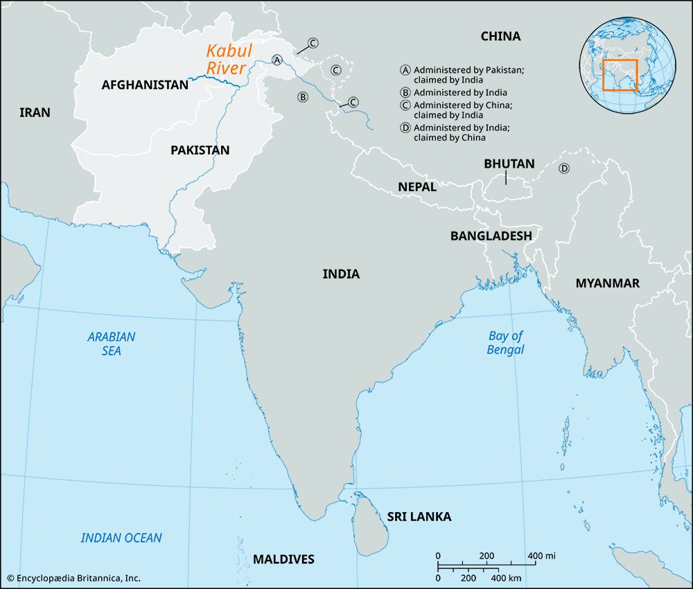
The Kabul River has a total length of 435 miles (700 km), with 350 miles (560 km) of its course located within Afghanistan and the remainder in Pakistan.
What is the total length of the Kabul River, and how does it compare to other rivers in the region?
The Kabul River has a total length of 435 miles (700 km), with 350 miles (560 km) of its course located within Afghanistan and the remainder in Pakistan.1
When compared to other major rivers in the region, the Kabul River is significantly shorter than the Helmand River, which spans approximately 715 miles (1,150 km), and the Amu Darya, which reaches 1,578 miles (2,540 km) in length. Unlike many other important rivers in Afghanistan that terminate in inland lakes or desert basins, the Kabul River is part of a drainage system that reaches the sea by joining the Indus River in Pakistan, which eventually empties into the Arabian Sea.21
How does the Kabul River contribute to the water resources and agriculture of Afghanistan and Pakistan?
The Kabul River serves as a vital water resource for both Afghanistan and Pakistan, supporting extensive agricultural activity along its course.1
Agricultural Impact
- Irrigation: The river is heavily tapped for irrigation throughout its journey. In Afghanistan, it supports farming in the Jalālābād area, while in Pakistan, it is essential for the Peshawar valley.1
- Crop Production: The water provided by the river and its tributaries—such as the Swat River—is critical for cultivating major food crops, including wheat and sugarcane, as well as various fruit orchards.6
- Infrastructure: The Warsak Dam project, located northwest of Peshawar, is a key multipurpose facility on the river that provides irrigation for food crops and orchards while also generating hydroelectric power.6
Resource Management Challenges
The river’s heavy utilization for irrigation is so intensive that segments of the river often dry up during the summer months. Furthermore, as with other major irrigation systems in the region, there is a constant need for careful management to prevent issues such as soil waterlogging and the accumulation of salt, which can render land unsuitable for cultivation.16
Are there any major dams or hydroelectric projects on the Kabul River, and what are their impacts?
The Kabul River features several key infrastructure projects designed to harness its water for agricultural and energy needs.
Major Projects
- Warsak Dam: Located approximately 12 miles (19 km) northwest of Peshawar in Pakistan, this is a significant multipurpose facility. It is designed to generate 240,000 kilowatts of electricity and provides essential irrigation for food crops and fruit orchards throughout the Peshawar valley.1
- Hydroelectric Plant: A hydroelectric plant is situated a few miles downstream from the junction where the Panjshēr River meets the Kabul River.2
Impacts
The development of these projects has had both positive and challenging consequences:
- Agricultural Support: These facilities are vital for sustaining agriculture in the region, particularly for crops like wheat and sugarcane.1
- Resource Management: Because the river is heavily tapped for irrigation, segments of it often dry up during the summer months. Furthermore, as with other large-scale irrigation systems, there is a persistent risk of soil waterlogging and the accumulation of salt, which can render land unproductive if not managed through adequate drainage.21
What is the geographical course of the Kabul River, and which major cities does it flow through?
The Kabul River is a 435-mile (700-km) waterway that flows through eastern Afghanistan and northwestern Pakistan.
Geographical Course
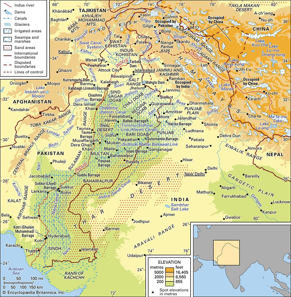
The river rises in the Sanglākh Range, located 45 miles (72 km) west of the city of Kabul. From its headwaters, it flows eastward through Afghanistan, passing through the capital city of Kabul and the city of Jalālābād. It continues its course north of the Khyber Pass into Pakistan, where it flows past Peshawar before eventually joining the Indus River northwest of Islamabad.1
Major Cities
The river is a significant geographical feature for several major urban centers:
Sources
- Kabul River — Encyclopædia Britannica
- Afghanistan - Drainage of Afghanistan — Encyclopædia Britannica
- Hindu Kush - Drainage — Encyclopædia Britannica
- Indus River - Physical features — Encyclopædia Britannica
- Hindu Kush - Physiography — Encyclopædia Britannica
- Pakistan - Agriculture, forestry, and fishing — Encyclopædia Britannica
- Indus River - Irrigation of the Indus River — Encyclopædia Britannica
- Afghanistan - Resources and power — Encyclopædia Britannica
- Kabul - City site and layout — Encyclopædia Britannica
Published on · 3 min read