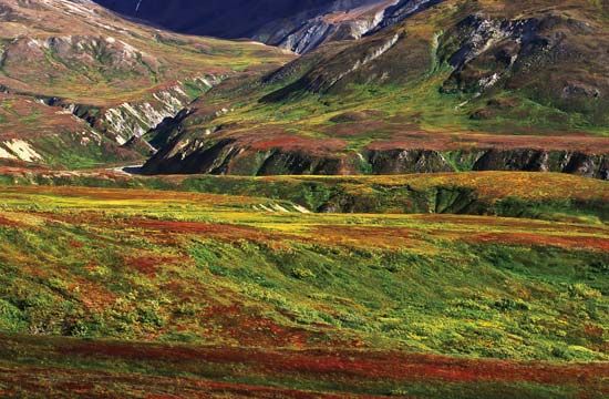
Kolyma River
The Kolyma River region is characterized by its sparse population and remote, rugged terrain, and there are no large cities located along its banks. The area…
Are there any significant towns or cities located along the Kolyma River?
The Kolyma River region is characterized by its sparse population and remote, rugged terrain, and there are no large cities located along its banks. The area is primarily inhabited by the Sakha and Even peoples, who live in a landscape dominated by tundra and stunted forests.1
While there are no major urban centers, the settlement of Zyryanka is mentioned in relation to the river’s geography, marking the transition point where the river leaves its upper course and enters the Kolyma Lowland. Historically, the upper basin of the Kolyma River became infamous for the presence of forced-labour camps during the Soviet era, established to support gold mining operations in the region. Today, gold mining remains the only significant economic activity in the upper basin, contributing to the area’s limited development.12
What are the main economic activities associated with the Kolyma River and its surrounding areas?
The primary economic activity associated with the Kolyma River and its surrounding region is gold mining, which is concentrated specifically in the river’s upper basin.12
Beyond this extraction industry, the region remains largely undeveloped due to its harsh climate and remote geography. The area is characterized by tundra and thin, stunted forests, supporting only a sparse population primarily composed of Sakha and Even peoples. Historically, the upper Kolyma valley was also the site of a vast complex of forced-labour camps during the Soviet era, which were established to facilitate these mining operations.12
While the river is navigable upstream to the Bakhapcha confluence, its economic utility for transport is significantly limited by a short ice-free season, with freeze-up lasting from late September until early June.1
What is the historical significance of the Kolyma River region, particularly during the Soviet era?
The historical significance of the Kolyma River region is defined by its dark role during the Soviet era. Under the leadership of Joseph Stalin, the gold-rich upper valley of the river became the site of a vast and brutal complex of forced-labour camps.1
These camps were established to exploit the region’s mineral wealth, specifically to support gold mining operations in the harsh, remote terrain of northeastern Siberia. The conditions within this system were catastrophic; it is estimated that more than one million prisoners perished in these camps between 1932 and 1954. This period remains a somber testament to the human cost of Soviet industrialization efforts in the region’s desolate tundra and mountain landscapes.12
Where is the Kolyma River located in Russia, and what are its major geographical features?
The Kolyma River is located in northeastern Siberia, in the far eastern region of Russia. It originates in the Kolyma Mountains and flows for 1,323 miles (2,129 km) before discharging into the East Siberian Sea.1
Geographical Features
- Upper Course: The river begins in narrow, rapid-filled gorges within the mountainous terrain.1
- Lower Course: Below the town of Zyryanka, the river enters the expansive, swampy Kolyma Lowland. This section is characterized by a meandering, braided path with multiple channels across a wide floodplain.1
- Hydrology: The river experiences significant seasonal changes. Because the southern upper reaches thaw before the lower course, the spring breakup frequently causes massive ice jams and widespread flooding. Nearly half of the annual water flow occurs during late spring and early summer.1
- Landscape: The entire basin is dominated by tundra and thin, stunted forests.1
Sources
- Kolyma River — Encyclopædia Britannica
- Kolyma Upland — Encyclopædia Britannica
- Chersky Range — Encyclopædia Britannica
Published on · 3 min read