Kuroshio
The Kuroshio, also known as the "Black Current," is a powerful surface oceanic current in the Pacific Ocean. It flows northeasterly between Luzon in the…
What are the main characteristics of the Kuroshio Current, such as its speed, temperature, and salinity?
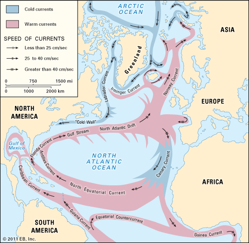
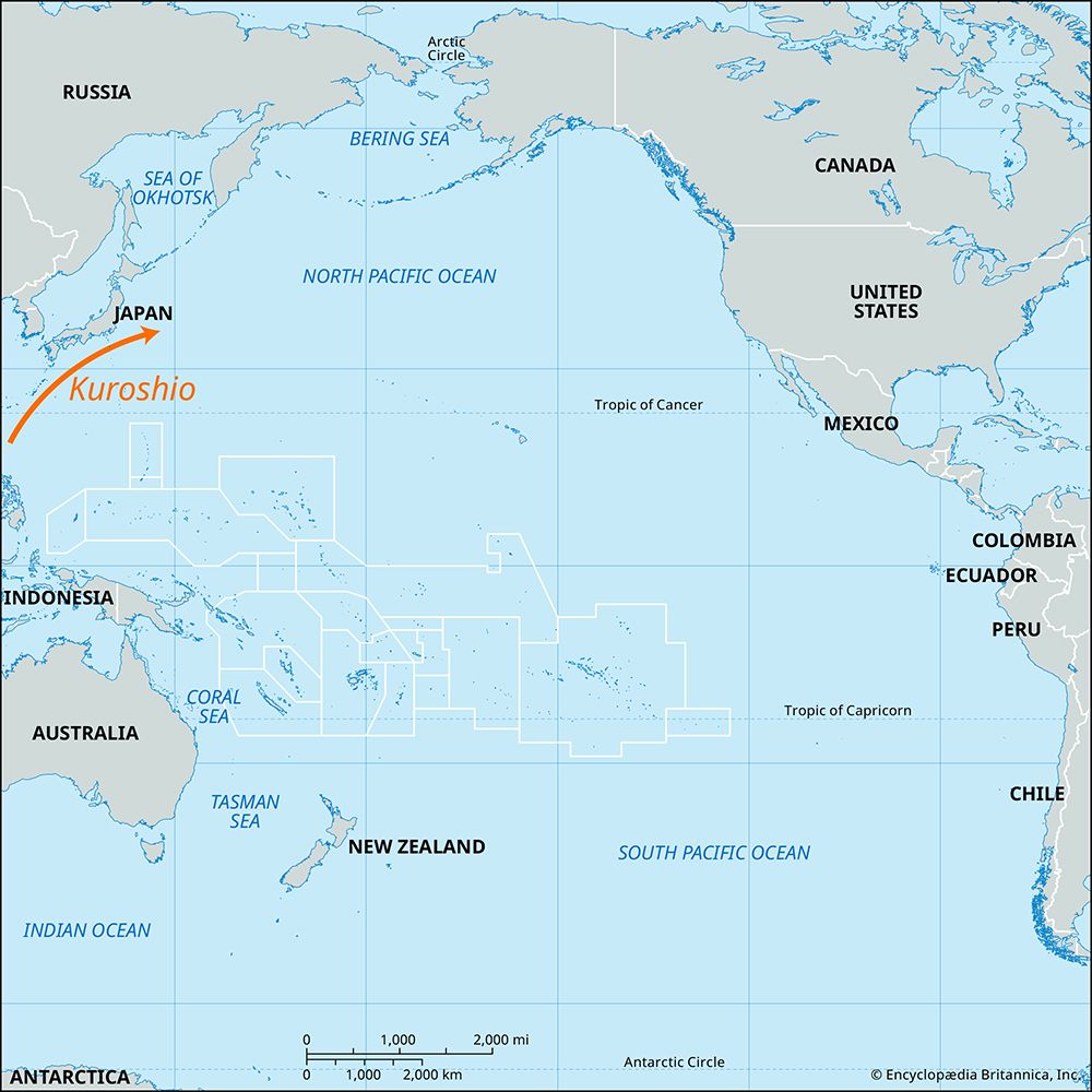
The Kuroshio, also known as the “Black Current,” is a powerful surface oceanic current in the Pacific Ocean. It flows northeasterly between Luzon in the Philippines and the east coast of Japan1.
Key characteristics of the current include:
- Temperature: The water is relatively warm for the region, averaging about 68 °F (20 °C).1
- Salinity: The salinity is approximately 34.5 parts per thousand.1
- Speed: The current travels at rates ranging between 20 and 120 inches (50 and 300 cm) per second.1
- Depth: It reaches a depth of approximately 1,300 feet (400 meters).1
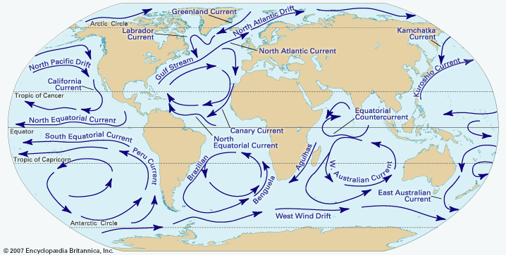
The Kuroshio is strongest from May to August and exerts a significant warming influence on the southern and southeastern coastal regions of Japan. Its flow patterns are often compared to the Gulf Stream in the Atlantic.12
How does the Kuroshio Current affect shipping routes and maritime transportation in the Pacific?
Sorry, the Britannica knowledge base does not contain specific information regarding the impact of the Kuroshio current on shipping routes or maritime transportation logistics. The available data focuses on the current’s physical characteristics, such as its temperature, salinity, speed, and its role in the broader Pacific Ocean circulation system.15
How was the Kuroshio Current first discovered and studied by oceanographers?
The Kuroshio (or “Black Current”) has been recognized by Western observers for centuries. European geographers were aware of its existence as early as 1650, as evidenced by a map created by Bernhardus Varenius.1
Additionally, the current was noted by Captain J. King, who served as a member of the British expedition led by Captain James Cook between 1776 and 1780. The name “Kuroshio” is derived from its appearance; the water looks like a deeper blue than the surrounding sea, leading to its translation as “Black Current.”1
While early records established its presence, modern oceanographic study has further characterized the current by its warm and cold rings, which are similar to those found in the Gulf Stream.6
How do seasonal variations impact the strength and path of the Kuroshio Current?
The Kuroshio current exhibits distinct seasonal fluctuations that impact its overall strength and flow patterns. The current is at its strongest from May to August. Following this peak, it recedes during late summer and autumn. It begins to increase in intensity again from January to February, before weakening once more in early spring.1
While these seasonal variations primarily affect the current’s force, its path is also influenced by regional geography and interactions with other currents. For instance, during the summer, the Kuroshio branches west and then northeast through the Korea Strait to parallel the west coast of Honshu as the Tsushima Current. Near latitude 35° N, the bulk of the current turns east to meet the southward-flowing Oya Current, forming the Kuroshio Extension.12
These dynamics are critical to the climate of the region, as the warm waters of the Kuroshio provide a significant warming effect on the south and southeast coastal regions of Japan.1
Sources
- Kuroshio — Encyclopædia Britannica
- Japan - Climate — Encyclopædia Britannica
- Tsushima Current — Encyclopædia Britannica
- Sea of Japan / East Sea - Hydrology — Encyclopædia Britannica
- Pacific Ocean - Surface currents — Encyclopædia Britannica
- Climate - The Kuroshio — Encyclopædia Britannica
Published on · 2 min read